Snippet Detail
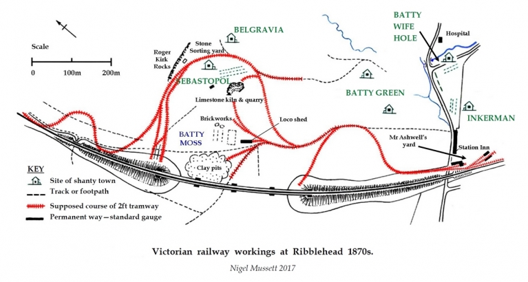
The map below shows the approximate location of key sites associated with the construction of the Settle-Carlisle Railway in the Ribblehead area during the first half of the 1870s. The map is protected copyright (all rights reserved) and it is displayed here with the prior permission of Nigel J. Mussett.
Tip: To view a larger version (JPG format, 620Kb), click / tap on the map.

Location Link(s)
