Conservation Areas are areas "of special architectural or historic interest, the character or appearance of which it is desirable to preserve or enhance". [1]
There is a legal requirement:
- to preserve or enhance the character or appearance of Conservation Areas,
- to exercise control over the demolition of unlisted buildings located within those areas, and
- a restriction on the types of development that may be carried out without the need for planning permission (permitted development rights).
Conservation Area Appraisals
Section 71 of the Planning (Listed Buildings and Conservation Areas) Act 1990 states that:
(1) It shall be the duty of a local planning authority from time to time to formulate and publish proposals for the preservation and enhancement of any parts of their area which are conservation areas.
(2) Proposals under this section shall be submitted for consideration to a public meeting in the area to which they relate.
(3) The local planning authority shall have regard to any views concerning the proposals expressed by persons attending the meeting.
In the most recent version of its advice notes, Historic England recommends that local authorities approach the task in four stages, namely 'Appraise', 'Designate', 'Management' and 'Review'.[2] Key extracts from these notes are reproduced below:
The appraisal is the vehicle for understanding both the significance of an area and the effect of those impacts bearing negatively on its significance ... the purpose being to consider whether an area has:
a) sufficient architectural or historic interest for the area to be considered ‘special’?
b) whether this is experienced through its character or appearance? and
c) whether it is desirable for that character or appearance to be preserved or enhanced, and what problems designation could help to solve.... Conservation area designation is undertaken to recognise the historic character of an area and/or in answer to the impact of development, neglect and other threats, on areas which are considered to have special architectural or historic interest.
... The management plan is a vehicle for reinforcing the positive character of a historic area as well as for avoiding, minimising and mitigating negative impacts identified as affecting the area.
... Finally, it is a statutory requirement for local planning authorities from time to time to review their conservation areas; this will need to refer back to the appraisal and the management plan.
The SCRCA passes through the areas of responsibility of four separate Local Authorities and the nature of each Authority's response has been markedly different.[3]
- North Yorkshire Council (NYC) and its predecessor Craven District Council (CDC):
In 2008, CDC reviewed the Settle Town Conservation Area. However, this review specifically excluded the SCRCA. In 2010, the YDNPA conducted a “Conservation Area Review And Character Appraisal” for Long Preston village, but this too excluded the SCRCA. In 2012, a member of the CDC's planning staff kindly provided the SCRCA Project Team with a scan of an area plan showing the boundary of the SCRCA between Hellifield and Langcliffe (the latter being the CDC's northern boundary). At this time, CDC was without a full-time Conservation Officer and we were advised that a formal appraisal / review of the SCRCA was unlikely to be carried out in the near future. In 2016, as part of the Craven Conservation Areas Project, draft appraisals for 16 existing conservation areas (including the SCRCA) and 3 potential new conservation areas in Craven were produced by CDC, Historic England and Alan Baxter Ltd. In October 2020, CDC launched a public consultation exercise on planning policy and invited public comments on the 'Draft Conservation Area Appraisals' produced in 2016 (including the one produced for the SCRCA). The consultation period ran from 19th October 2020 to Monday 14th December 2020 and the SCRCA Project Team submitted a formal response. The final version of the resulting adopted appraisal (issued in March 2023) can be downloaded (in pdf format) from the "Conservation areas" page on the NYC website:
https://www.northyorks.gov.uk/planning-and-conservation/heritage-conservation-areas-and-listed-buildings/heritage-conservation-areas-and-listed-buildings-craven/conservation-areas - The Yorkshire Dales National Park Authority (YDNPA):
In 2010, the YDNPA published a comprehensive appraisal of its section of the SCRCA. This 80-page publication entitled: "Conservation Area Appraisals in the Yorkshire Dales National Park - Settle-Carlisle Railway - Adopted Document" is available as a 4Mb pdf-file download from:
https://www.yorkshiredales.org.uk/wp-content/uploads/sites/13/2019/10/careview-settlecarlislerailway-full-final.pdf.
When last checked on 5 August 2025, this document was still included in the list of current appraisal documents on the "Conservation areas" page of the NYC website:
https://www.northyorks.gov.uk/planning-and-conservation/heritage-conservation-areas-and-listed-buildings/heritage-conservation-areas-and-listed-buildings-craven/conservation-areas. - Westmorland & Furness Council (W&FC) and its predecessor Eden District Council (EDC):
In 2012, an internet search for Conservation Area appraisals / reviews relating to the EDC section of the SCRCA produced no results. A follow-up e-mail sent to EDC received no response. As EDC had no full-time Conservation Officer at that time, we did not pursue the matter any further. Also in 2012, the EDC website provided links to a series of fourteen plans showing the boundaries of the conservation area within Eden district. However, when checked on 7 November 2020, the relevant webpage stated that these documents are now only 'available on request'. On 16 June 2020, the EDC Executive approved revised Conservation Area Appraisals and associated Management Plans for seven conservation areas within the district. However, the SCRCA was not one of them. When last checked on 5 August 2025, there was no mention of a Conservation Area Appraisal covering the W&FC's portion of the SCRCA on the "Find a conservation area" page on the W&FC website:
https://www.westmorlandandfurness.gov.uk/planning-and-building-control/conservation/find-conservation-area - Cumberland Council (CC) and its predecessor Carlisle City Council (CCC):
The “Conservation areas” page of the former CCC website provides links to a series of five plans showing the boundaries of some parts of the SCRCA within the district and these are available for download in pdf-file format from:
https://www.carlisle.gov.uk/Residents/Planning-Building-Control/Heritage-and-Conservation/Conservation-Areas
In 2012, CCC's Heritage Officer advised us that CCC might conduct a formal appraisal of its portion of the SCRCA at some point, but that it would only be able to do so if and when it has the resources to do so. Occasional checks of the relevant page on the CCC website suggest that the matter remains outstanding (last checked on 5 August 2025).
Conservation Area Management Plans
On pages 8-9 of its ‘Conservation Area Appraisal’ (op. cit.), the YDNPA proposes that:
"The Settle-Carlisle Railway is not a relic from the past but an interactive feature of the present that is in daily use. It is also a feature of the future due to its continuing operation and potential for further research or education, regarding its history and interpretation of the landscape. Much of the archaeology of the Settle-Carlisle has yet to be unravelled. Another source that has not yet been fully recorded or researched are the lineside structures which seemingly have little architectural merit, but are essential to the understanding of how this railway was operated."
On pages 77-78 of the same document, the YDNPA outline a number of management proposals for the SCRCA, most notably:
- “Establish a local list for unlisted buildings that contribute positively to the character and appearance of the conservation area."
- "Safeguard viewing opportunities from the line and ensure that the quality of views is maintained;"
- "conserve and enhance opportunities to view and interpret the line and its associated features as local and regional landmarks in the Yorkshire Dales scenery."
- "Photographic survey of remaining platelayers’ huts in the National Park.”
One of the objectives of the SCRCA Project is to help turn these proposals into a reality for the full length of the conservation area.

Evaluating structures under threat of alteration or demolition / removal
“Conservation areas are designated heritage assets and as such there is a national presumption in favour of their conservation.”[4]
The current condition of a structure should not necessarily influence the decision regarding its relative importance and / or the importance of conserving / preserving it:
“The state of repair of a building is not a relevant consideration when deciding whether a building meets the test of special interest. The Secretary of State will list a building which has been assessed as meeting the statutory criteria, irrespective of its state of repair.”[5]
Furthermore:
“Demolition of a building which is a positive contributor to the architectural and / or historic interest will almost inevitably result in substantial harm or loss of significance to the conservation area. ... An application for a proposal which will lead to substantial harm or total loss of significance should be refused unless it can be demonstrated that
“(i) The substantial harm to or loss of significance is necessary in order to deliver substantial public benefits that outweigh the harm or loss; or
“(ii) (a) the nature of the asset prevents all reasonable uses of the site; and
“(b) no viable use of the heritage asset itself can be found in the medium term
that will enable its conservation; and conservation through grant funding
or charitable / public ownership is not possible; and
“(c) the harm to or loss of the asset is outweighed by the benefits of bringing
the site back into use.”[6]
Taken together, the above appears to firmly support a policy of 'maintain the current state'. However, the railway that lies at the heart of the SCRCA is NOT a preserved railway. Rather, it is an important part of the national rail-network and a vital north-south route for both passenger and freight traffic. The viability of these passenger and freight services could be jeopardised if the cost of maintaining or operating the railway is increased by the imposition of unduly onerous maintenance / repair costs – especially for historic structures that are now operationally redundant. In addition, Network Rail (the organisation responsible for the railway infrastructure) has acquired significant legal powers under various Acts of Parliament, including the original enabling Acts dating from the 19th century. In many cases, these effectively allow Network Rail to circumvent the normal planning process.
Bearing all this in mind, the challenge facing everyone involved with the SCRCA is to balance:
- the need for essential (and highly beneficial) improvements to the operational railway, with
- the desirability of conserving / preserving / enhancing the historic railway engineering and architecture that gives the conservation area its unique character.
The historical precedent for embracing 'managed change'
An enormous amount of change has occurred along the route of the railway between Hellifield and Carlisle since it became fully operational in 1876. For example:
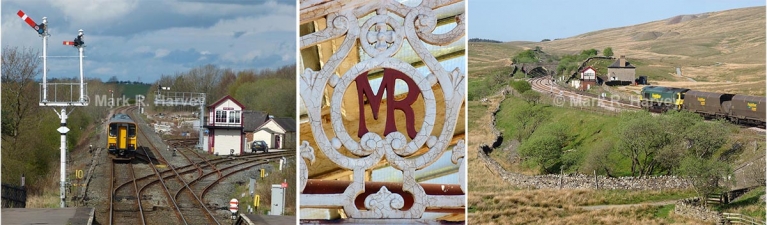
- The vast majority of the original signal boxes were replaced within thirty years of the line’s opening. Furthermore, of the forty locations known to have hosted a signal box at one time or another, only 12 still retain a standing signal box.[7]
- Signalling equipment has been removed or replaced with modern equivalents on a regular basis in response to changing regulations and improvements in technology.
- Redundant occupation and accommodation bridges were being removed as early as 1915 and at least 15 have already been demolished or in-filled.[8]
- Many of the remaining bridges have been altered to replace bridge-decks, strengthen arches, install handrails, or otherwise make them fit for 21st century use.[9]
- Cuttings and embankments have been re-engineered to reduce the risk of landslips. The vegetation on the sloping sides of these structures was meticulously trimmed and grazed for decades to maintain visibility, reduce the risk and severity of fire and as a display of pride; in more recent times these areas were allowed to grow wild - to 'revert to nature'; now, these areas are being actively managed again to reduce the problem of 'leaves on the line' and the ever present danger of landslips.
- Almost all of the wooden-sleepered, fish-plate jointed track was replaced with steel-sleepered continuous-welded rail and the vast majority of this has, in turn, been replaced with concrete-sleepered continuous-welded rail.
- Passenger platforms at open stations have been raised and / or re-surfaced, while the platforms at many of the closed stations have been either partially or entirely demolished.
- Redundant telegraph poles (and associated wires) have been removed from all but a few miles of the SCRCA's length.
- New passenger-related structures have been constructed at most of the open stations (e.g. the new northbound platform and waiting room at Ribblehead; new waiting rooms at Settle, Garsdale, Kirkby Stephen, Appleby and Langwathby (with plans for at least one more); 'preserved' passenger footbridges at Settle and Kirkby Stephen; and modern 'heritage-style' lighting at all of the open stations). Redundant structures have been demolished at several stations (most notably at Long Preston, Crosby Garrett and Cotehill).
- Goods yards and siding areas have been left to revert to nature, de-tracked, used for non-railway purposes, or built-upon (the most notable in the latter category being the former goods yards at Petteril Bridge Junction and Settle).
What does all this mean for the SCRCA Project?
Despite more than a century of change, a significant (and perhaps a surprising) number of historic structures have survived, many in (or close to) their original form. However, the pressure for change is relentless and it is driven by a wide-range of financial, operational, technological and social / cultural factors. If the best of what remains is to survive to be enjoyed by future generations, the change process will need to be carefully managed on a permanent and continuous basis. We believe that this extremely difficult task will be made slightly easier if everyone involved has easy access to a comprehensive database of accurate and well-researched information about the remaining historic structures, including their historical and modern-day context. The mission of the SCRCA Project Team is to provide that information via the Settle-Carlisle Railway Conservation Area (SCRCA) web-portal.
Footnotes
- Source: Section 69(1)(a) of the Planning (Listed Buildings and Conservation Areas) Act 1990.
- Source: Historic England Advice Note 1 (Second Edition) "Conservation Area Appraisal, Designation and Management" published in February 2019, pages 5 & 6 .
- The reorganisation of local government for North Yorkshire and Cumbria in 2023 may result in significant changes to both responsibilities and priorities for planning matters, especially for the southernmost and northernmost sections of the conservation area.
- Source: First item, Table 1, page 7 of “Understanding Place: Conservation Area Designation, Appraisal and Management”, English Heritage (2011).
- Source: General Principle 16 of the Department for Culture, Media and Sport publication “Principles of Selection for Listing Buildings” (2010)
- Source: Paragraph 6, page 21 of “Understanding Place: Conservation Area Designation, Appraisal and Management” (English Heritage, 2011)
- Of the 12 remaining signal boxes: 10 are still in operational use (the box at Garsdale had some serious structural problems but Network Rail's application for listed building consent for the necessary remedial work was accepted by the YDNPA on 6th November 2013 and the remedial work has since been carried out) and 2 are preserved (Armathwaite Station and Settle Station - the latter after being physically moved several hundred yards). The box at Long Meg Sidings (built in 1955, disused since 1983) was demolished as recently as January 2013.
- The annotated land plans kindly donated to the FoSCL archive by a retired senior railway engineer indicate that 13 bridges between Settle Junction and Peterril Bridge Junction had been filled-in or demolished prior to 2012 (almost certainly in order to reduce inspection & maintenance costs). The demolished bridges are:
Bridge No 087 (occupation - demolished 1970)
Bridge No 099 (occupation - demolished)
Bridge No 138 (occupation - demolished)
Bridge No 142 (occupation - demolished 1975)
Bridge No 143 (occupation - demolished approx 1936)
Bridge No 144 (occupation - demolished approx 1948)
Bridge No 163 (occupation - demolished)
Bridge No 170 (occupation - demolished 1927)
Bridge No 174 (occupation - demolished 1927)
Bridge No 176 (occupation - infilled 2009)
Bridge No 351 (occupation - demolished 19/9/1920)
Bridge No 355 (footpath - demolished, release to remove dated 1/11/1960)
Bridge No 357 (occupation - demolished Jan 1915)
In addition, the following bridges have been demolished or 'entombed' since 2012:
Bridge No 064 (occupation - demolished 15/10/2015)
Bridge No 322 (occupation - entombed March 2017) -
The list of bridges supplied by Network Rail on 19th February 2015 provides 'reconstruction years' for 13 bridges within the SCRCA, namely:
Bridge SKW1/33 (reconstructed in 1977)
Bridge SAC/19 (reconstructed in 2010)
Bridge SAC/181 (reconstructed in 1978)
Bridge SAC/203 (reconstructed in 1949)
Bridge SAC/246 (reconstructed in 1980)
Bridge SAC/247 (reconstructed in 2010)
Bridge SAC/254 (reconstructed in 2013)
Bridge SAC/259 (reconstructed in 2009)
Bridge SAC/269 (reconstructed in 2012)
Bridge SAC/279 (reconstructed in 2013)
Bridge SAC/295 (reconstructed in 2010)
Bridge SAC/297 (reconstructed in 2001)
Bridge SAC/317 (reconstructed in 1904)
It is also clear (from site visits, photographs and information gleaned from a wide variety of additional sources) that many more bridges have been strengthened, re-decked or completely rebuilt at least once during their operation life. These include:
Bridge SAC/2 (reconstructed in 1997)
Bridge SAC/21 (reconstructed October 24th to 28th, 2020)
Bridge SAC/25 (reconstructed October 24th to 28th, 2020)
Bridge SAC/68 (widened on both sides during WW2, probably circa 1941)Bridge SAC/115 (strengthened in 1904)
Bridge SAC/177 (strengthened prior to Aug 2013)
Bridge SAC/181 (strengthened in 1904, reconstructed in 1978, re-decked and crash protection added in 2014)
Bridge SAC/226 (strengthened prior to May 2013)
Bridge SAC/234 (reconstructed prior to Aug 2012)
Bridge SAC/237 (reconstructed in 2014)
Bridge SAC/240 (completely demolished and replaced during 1978-79)
Bridge SAC/247 (reconstructed prior to Aug 2012)
Bridge SAC/254 (strengthened in 1904, then redecked at some point between Aug 2012 and April 2013)
Bridge SAC/269 (reconstructed prior to May 2013)
Bridge SAC/279 (reconstructed at some point between Aug 2012 and June 2020)
Bridge SAC/286 (reconstructed at some point between Aug 2012 and Aug 2020)
Bridge SAC/288 (strengthened in 1904, reconstructed in 1989)
Bridge SAC/295 (reconstructed prior to Aug 2012)
Bridge SAC/297 (reconstructed prior to Aug 2012)
Bridge SAC/347 (reconstructed prior to Aug 2012)
Bridge SAC/350 (reconstructed prior to Aug 2012)
Acknowledgements
Text and photographs by Mark R. Harvey (© Mark R. Harvey).