At the beginning of 2012, a very small independent group of volunteers launched a long-term project with the following objectives:
- To identify, catalogue and create a comprehensive record of key railway-related sites and structures within (or associated with) the Settle - Carlisle Railway Conservation Area (SCRCA); then
- to gradually research and document the history[1] of key locations in order to
- create a reliable, useful and interesting online resource and thereby
- assist those responsible for managing it, while also
- facilitating and encouraging its interpretation and enjoyment by the general public.
The statistics below illustrate the scale of the SCRCA Project and the wide variety of location types that are being catalogued and recorded:
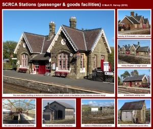
- 24 railway stations (13 open / operational and 11 closed) which include:
- 48 signal boxes (11 operational, 2 preserved, 35 demolished / removed)
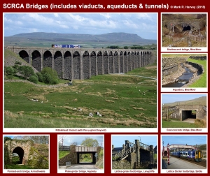
- 398 numbered bridges, including:
- 251 underline bridges
- 111 overline bridges
- 22 viaducts
- 14 tunnels
- 145 'culverts'
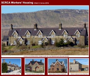
- 232 former railway workers’ houses (all now in private ownership)
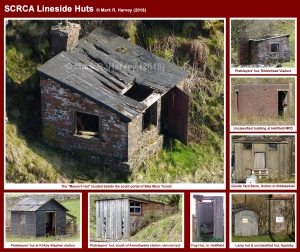
- 379 other lineside buildings (almost all of which are now disused and in various stages of decay), including:
- 48 lamp huts (a.k.a. "oil stores" or "naphtha stores")
- 162 platelayers' huts
- 58 fog huts (some of which were probably used / re-used as toilets)
- 111 other railway-related buildings (including former "stores", "coal offices", "blacksmith's shops", etc.)
- 305 Mileposts
- 118 Gradient posts
In the longer term, it is hoped that the scope of the SCRCA Project may be extended to cover some of the smaller structures, including boundary markers, signals, signs and some of the key archaeological sites connected with the construction of the Settle-Carlisle Railway. A start has been made on the latter for the Ribblehead-Blea Moor area, see SCRCA site 247770: Ribblehead Railway Construction Camp.
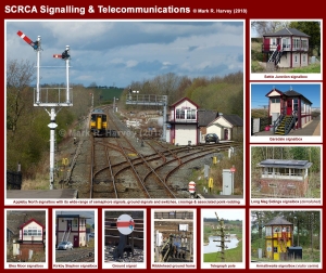
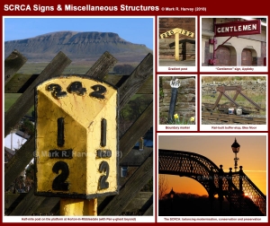
The image gallery below showcases a few of the site- and structure-types associated with the SCRCA.
Introductory Image Gallery
Tip: To view a larger version of an image, click / tap on the thumbnail.
Background & Context
The 'Background & Context' briefing document places the SCRCA Project in context by providing:
- a brief overview of the purpose and management of Conservation Areas in general;
- the background to evaluating Conservation Area structures that may be under threat of alteration or demolition / removal;
- the historical precedent for embracing 'managed change' within the SCRCA; and
- a quick look at the implications of all this for the SCRCA Project.
The SCRCA web-portal
(aka the SCRCA Project Database)
One of the primary objectives of the SCRCA Project is to provide public access to the material we generate (insofar as it is appropriate for us to do so). The Settle-Carlisle Railway Conservation Area (SCRCA) web-portal was created to enable us to meet this objective and it can be used to:
- 'Virtually Visit' the operational sites and standing structures and to Virtually Explore the conservation area using interactive maps or aerial imagery.
- Delve into the details of these sites and structures via the comprehensive Gazetteer. This option provides access to all of the locations in the database including:
- structures that have been demolished;
- sites that are no longer operational;
- archaeological sites; and
- locations that have not yet been assessed (the details of which may be inaccurate).
The SCRCA Project uses a wide variety of both general and specialist terminology. The latter includes terms drawn from the fields of archaeology, architecture and conservation, as well as from railway engineering and railway operations. The Glossary of Terms lists - and provides brief definitions for - some of this essential 'jargon'. All of the locations (sites and structures) associated with the SCRCA Project have been classified by location 'type'. Some have been further classified by location 'variant'. A list of the types and variants (with definitions and examples) can be accessed via the Location Types and Location Variants options in the footer menu.
Some of the locations within the conservation area benefit from additional official protection such as 'listing' (for structures) and 'scheduling' (for sites). The various classifications are listed and briefly explained on the Protection Categories page.
A series of articles accompanies and expands upon the location-specific information and the SCRCA Project Reference Sources pages highlight opportunities for further reading.
The SCRCA Project: Notes regarding data control, copyright and usage page covers the subjects indicated by its title.
Get involved
If you'd like to help us with any aspect of the SCRCA Project, we would very much like to hear from you.
- The key tasks associated with the project are listed and briefly explained on the Getting Involved page.
- The material we are seeking is briefly summarised on the Plea for Information and Images page.
- You can get in touch with us via our dedicated Contact Us page.
Notes
[1]: The initial emphasis of the historical research will be to:
- identify interesting and informative primary source material relating to key railway-related sites and structures within (or associated with) the SCRCA then,
- where permitted and feasible, to either summarise, transcribe or obtain / create high quality digital images of that material and then,
- where permitted, to upload the resulting material to the SCRCA Project database.
As and when resources permit, this primary source material will be incorporated into (or referenced from):
- a series of introductory notes for the relevant sites and structures and
- a set of accompanying background articles.

