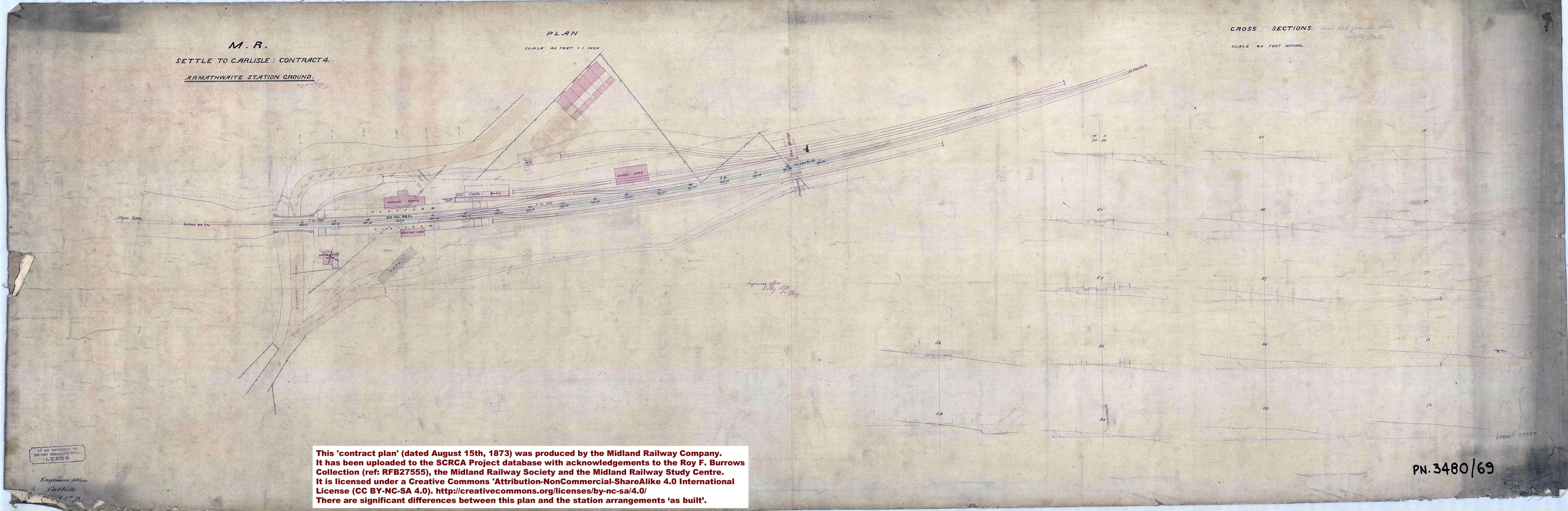
This plan was produced by the Midland Railway Company and it almost certainly formed part of the legal documentation associated with the construction of the Settle and Carlisle Railway. It was produced by the "Engineers Office Carlisle ??? 3rd, 1873" (the month is not legible due to damage at the corner of the original rolled sheet). A handwritten annotation below the title reads "August 15th 1873" and includes the initials "E.P." (believed to be E. Page of Derby Engineer's Office).
Tip: To open a larger (3.5Mb) version of this image, click / tap on the thumbnail above.
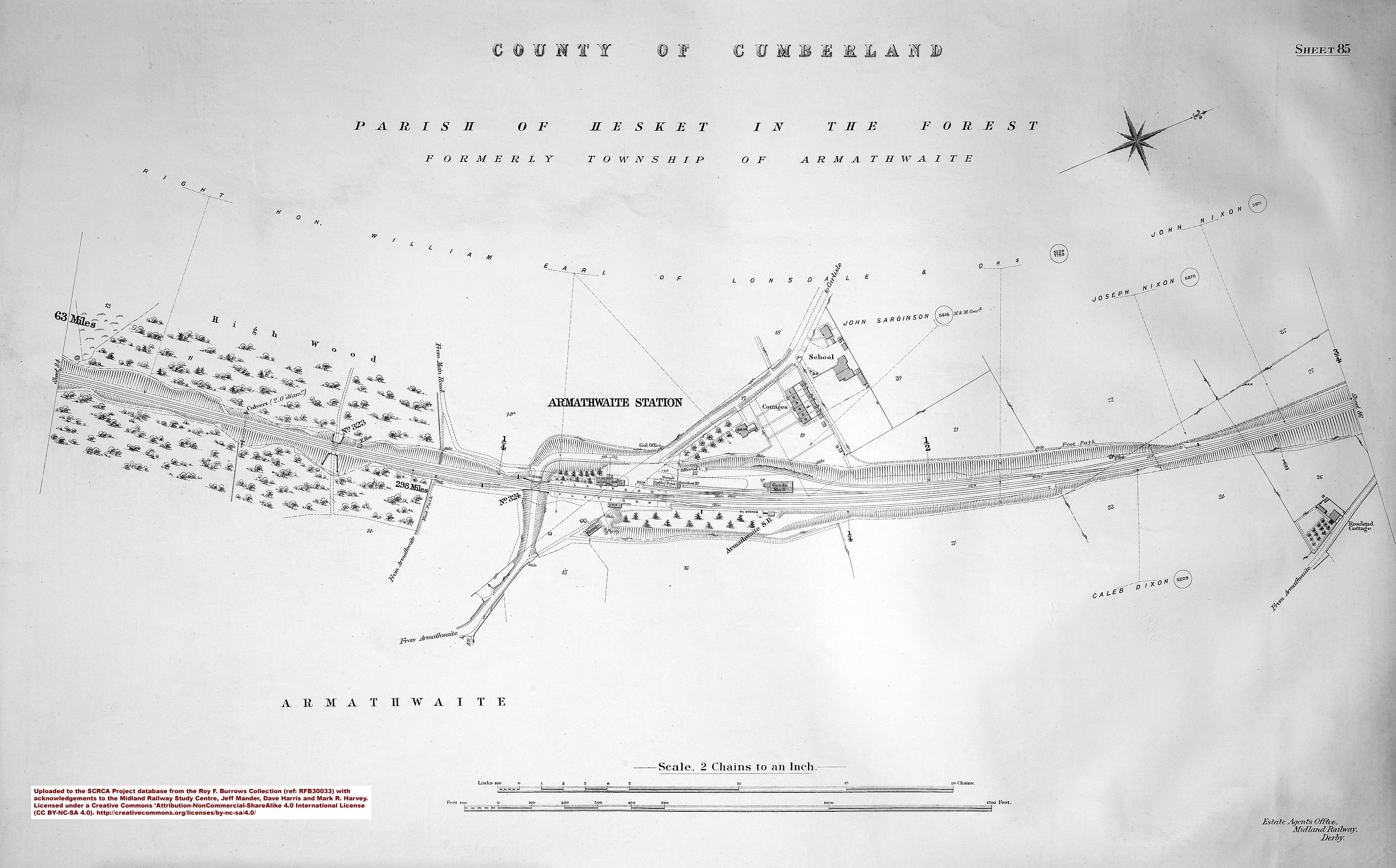
A comparison with the 'as built' arrangement depicted on the 1911/12 land plan (sheet 85) provides us with a fascinating insight into the planning and construction process. The following are especially worthy of note:
- The original alignment of the road (compared with the new / present alignment).
- The centre line for the track alignment, with clear reference marks at 1 chain intervals.
- The mileage figures (which are almost certainly measured from the southern boundary of "Contract 4").
- The curvature information ("RADIUS 84 CHs").
- The spot heights (in both blue ink and pencil).
- The cross-sections (at right-angles to the railway alignment / running lines) showing the 'lie of the land' at 1 chain intervals, including the pencilled instruction / reminder "and work from the centre, not the fence".
- The temporary road providing access to the station work site on the west (down) side.
- A scale of "1 inch - 40 feet" is indicated by text, but there is no confirmatory drawn scale (and there is no compass rose to aid orientation either).
- The "Huts" located where one of the bungalows is located in modern times. (These huts were almost certainly built by the Midland Railway Company to provide temporary accommodation for the construction workers a.k.a. the navvies.)
- Many of the structures were built as per this plan, including the railway tracks. However, there are significant differences between the arrangements depicted in this plan and the arrangements 'as built'. The key differences are:
- The position and orientation of the station master's house.
- The position and orientation of the workers' cottages (although the number of dwellings is unchanged).
- The "proposed over bridge". (It is possible, perhaps even likely, that this bridge may have been rendered unnecessary by the purchase of the extra parcel of land that was eventually used for the workers' cottages. It is interesting to speculate which came first: the need / desire to change the location of the houses, or the need / desire to purchase of the additional land in order to avoid having to building the bridge.)
- The signal box, oil store / lamp hut and sawdust hut. (All of which were built, but none are marked on this contract plan.)
Acknowledgements
This contract plan was produced by the Midland Railway Company. It has been uploaded to the SCRCA Project database with acknowledgements to the Roy F. Burrows Collection (ref: RFB27555), the Midland Railway Society and the Midland Railway Study Centre. It is licensed under a Creative Commons 'Attribution-NonCommercial-ShareAlike 4.0 International License (CC BY-NC-SA 4.0). http://creativecommons.org/licenses/by-nc-sa/4.0/
Text by Mark R. Harvey (© Mark R. Harvey, 2020).