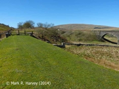
The trackbed of the railway that once ran from Garsdale to Hawes and beyond.
SCRCA Location Type: Hawes Branch
Examples
The following examples from the SCRCA Project database illustrate this location type. Locations are only displayed here if they have been 'assessed' and if a default image is available. Show / hide tips
- The locations are grouped by 'variant' (where appropriate), then sorted by Location ID.
- To view the full Location Summary for one of the sites or structures, click on the relevant location name / description.
- To view a larger version of one or more of the images in a slideshow format, click on one of the thumbnail images.
NB: The slideshow will NOT run on devices with a screen width of less than 400px, or if you attempt to open it in a new window. - To view details of ALL the locations of this type in the database (regardless of their status etc.), use the Gazetteer.
|
Errors and omissions |

