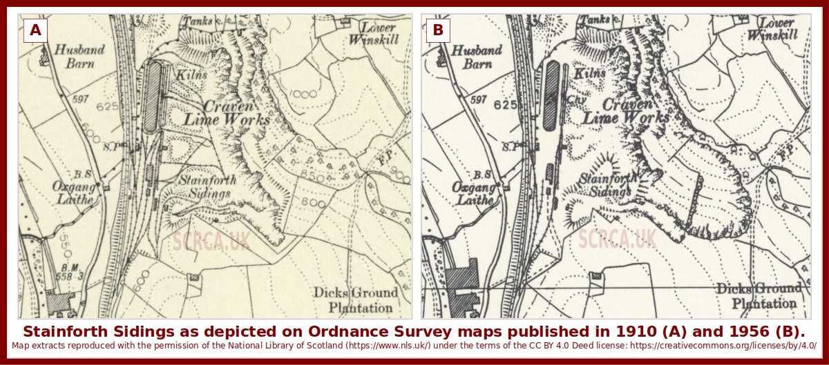
The image is a montage of two extracts from Ordnance Survey maps published in 1910 (A, left) and 1956 (B, right). They both depict the same area and therefor allow key changes in the site layout to be easily identified.
The map extracts are reproduced here with the permission of the National Library of Scotland (https://www.nls.uk/) under the terms of the CC BY 4.0 Deed license: https://creativecommons.org/licenses/by/4.0/
