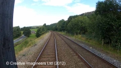
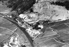
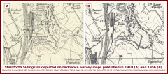
SCRCA structure 238150: Stainforth Sidings (a.k.a. Langcliffe Lime Works Sidings)

SCRCA Location Introduction

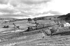
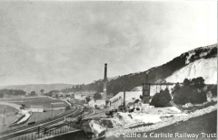
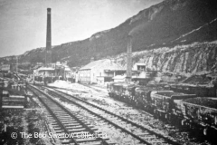
The sidings at Stainforth were installed to serve two separate businesses, namely the Craven Lime Company (at the south end of the Langcliffe Quarry site) and Thomas Murgatroyd (a little further to the north). In both cases, limestone was extracted from quarry faces driven into the nearby Winskill Crag, then processed on site (as required to suit customer orders) before being loaded into railway wagons for delivery via the Midland Railway Company's steadily expanding system.

Lime and limestone were being despatched from the site by rail during 1873 and the traffic flow may have begun as early as 1872 (while the Settle & Carlisle Railway was still being constructed and several years before the through-route officially opened).

By April 1876, both companies had their own dedicated railway facilities on this site. The Craven Lime Company had "extensive sidings" to serve its massive (state-of-the-art) Hoffmann kiln, while Thomas Murgatroyd had a single siding to serve its more traditional draw kilns.

Thomas Murgatroyd found it difficult to compete with its larger neighbour and ceased trading within 20 years of opening.

The Craven Lime Company ceased lime production in the 1930s and, in 1939, the site was transferred to Settle Limes Ltd. It was used to store crushed stone, which was initially transported by rail from the Helwith Bridge quarries just a few miles to the north.

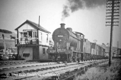
Rail traffic to / from the sidings ceased completely at some point prior to 29 Sep 1963 (when Stainforth Sidings Signal Box was officially closed).

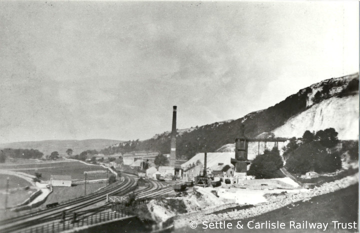
Stainforth Sidings and Craven Lime Works, context view from the south.

Key details from the Location Record

Location Type
Siding
Location Variant
Siding Type - Rail-served industry
Assessment status
Assessed
Current Use(s)
Demolished
Shown on a land plan?
Yes 
Construction / installation period
2: MR construction phase (1869 to 31st Dec 1876)
Distance from London St.Pancras
238 miles (chains not estimated)
Position relative to running lines
Up
Visibility
This location IS visible from nearby publicly accessible land.
Accessibility (ease of access)
Easy
Protection Category
Not Applicable - demolished or relocated
Geographic Location
  View this location on mapping. or on aerial imagery.

Image Gallery

Tips: To view a larger version of an image, click on its thumbnail (i.e. the small image). To view the acknowledgements and notes associated with an image, click / tap on the image title.

Further Reading (Snippets)

The following 'snippets' contain additional information relating to this location.

Tip: To view a snippet, click / tap on its title.


Errors and omissions

Reasonable efforts are being made to ensure the accuracy of the information obtained and uploaded as part of the SCRCA Project. However, it is possible that a few errors will have crept-in. If you notice any such errors, we would be grateful if you would bring them to our attention using the SCRCA Project Contact Form. The Friends of the Settle-Carlisle Line and the members of the SCRCA Project Team do NOT guarantee the accuracy of the information contained in this database. If you intend to use and / or act upon any of this information, you are advised to verify its accuracy BEFORE doing so.