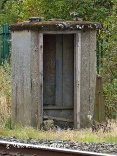
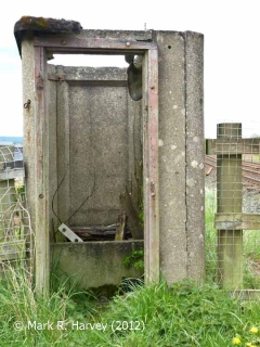
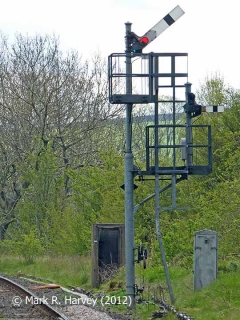
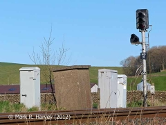
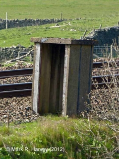
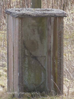
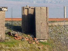
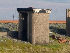
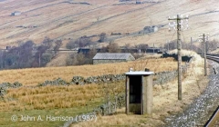
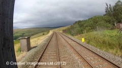
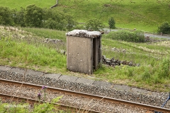
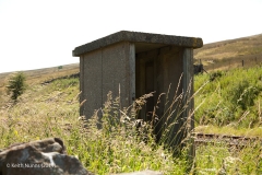
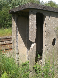
Fog huts are small 'sentry-box' style structures that were located close to selected semaphore signals[1] to provide shelter for a ‘fog signal man’[2].
Within (or associated with) the SCRCA, a fog hut was provided in direct line-of-sight of the front of most ‘distant’ signals and a few 'stop' signals.
All of the surviving fog huts within (or associated with) the SCRCA are tall, thin windowless structures constructed from pre-cast concrete panels topped with either a pre-cast concrete, asbestos or felted timber roof.[3] They do not appear to have had integral fireplaces or internally fitted stoves, but contemporary accounts suggest that a small coal-fired brazier may have been located outside the doorway to provide a source of warmth. Many of the structures include the remains of a door frame. However, it is not clear if these are contemporary with the structures' use as fog-huts, or if they are later additions (perhaps to allow the structures to be used for other purposes such as a 'privvies' / toilets[3] or stores). If a door was fitted when the structure was used as a fog hut, it is likely that the door would have been propped / fastened open when the hut was in use (to provide a clear line of sight & sound towards the signal(s) being protected). In at least some cases, the doors were of the stable type (i.e. in two sections), so the lower section could be closed while the upper section remained open.
The need for ‘fog signal men’ on Britain's mainline railways has been eliminated due to the widespread introduction of AWS[4] and most of the associated fog huts have subsequently been either demolished or simply left to decay.
For additional information relating to the use of these small but important structures, see the notes below, plus the accompanying 'Review of secondary sources for fog huts, fog signal men and fogging duties'.
[2] The role of the 'fog signal man' (a.k.a. 'fog man') was to observe the state of the adjacent signal(s) during times of poor visibility (e.g. during fog and periods of falling snow) and to place small explosive detonators on - or remove detonators from - the running-rail(s) each time the signal(s) changed. If the wheels of a moving train ran over one of the detonators, the resulting small explosion gave the locomotive crew an audible warning that the signal ahead was ‘on’ (i.e. at danger). In addition to a supply of detonators, each fog man would have been equipped with a set of flags (red, yellow and green) and a lamp (usually capable of showing red, green, amber and clear light). These fog signal men would often be stationed beside the track for many hours (usually in cold, wet and / or windy conditions) and it was vital that they were able to remain alert. Specially designed (and carefully positioned) 'fog huts' were therefore constructed to provide shelter, without obstructing either sight or sound. The fog signal men for a given area were usually accountable to the nearest Station Master, but coordinated / supervised by the signal man on duty at the relevant signal box. The fog signalling procedure was governed by 'Fog Signalling Regulations'. The details of these varied over time and also from company to company (and, in some cases, from signal to signal).
[3] For the purposes of the SCRCA Project, all structures fitting this description are currently being categorised as fog huts. However, it is clear that at least some of these structures were converted for use as track side toilets at some point in their history (and some may have been installed specifically for that purpose). For the structures that are labelled 'Fog Hut' on the 1911 land plans, the original use is clear, but that is not the case for the remainder.
[4] AWS = Automatic Warning System, which provides train drivers with an in-cab audible and visible indication of the state of each signal.

