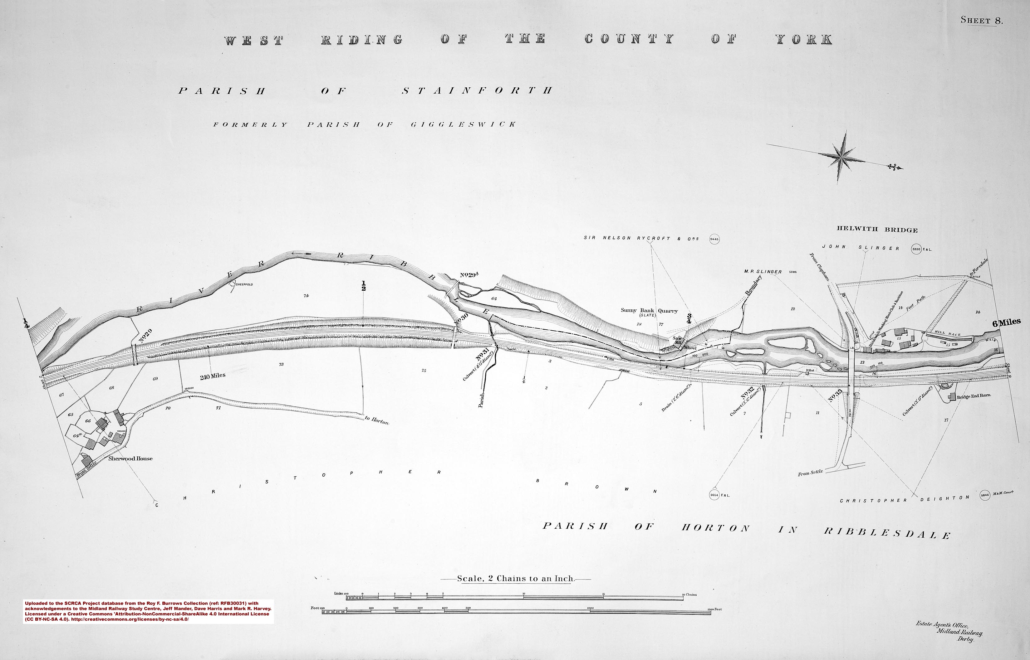
SCRCA structure 240150: Bridge SAC/30 - Sedgwick (occupation)
![Bridge SAC/30 - Sedgwick (occupation) [nid:1847]](/sites/2/files/styles/scale_0720x0720/public/drupal/img/l/5549/2012-08-30/240150_2012-08-30_CIL_BO_Cab-view-B-Ahead_Frame-018560.jpg?itok=o2aYqsy8 "Bridge SAC/30 - Sedgwick (occupation) [nid:1847]")
Key details from the Location Record
- Location Type
- Bridge (Overline)
- Location Variant
- Span - Arch (single)
- Assessment status
- Assessed
- Current Use(s)
- Railway ops
- Shown on a land plan?
- Yes
- Construction / installation period
- 2: MR construction phase (1869 to 31st Dec 1876)
- Distance from London St.Pancras
- 240 miles and 15 chains
- Position relative to running lines
- Above
- Visibility
- This location is NOT visible from nearby publicly accessible land.
- Accessibility (ease of access)
- No Access
- Protection Category
- Conservation Area Only
- Geographic Location
- View this location on mapping. or on aerial imagery.
Image Gallery
Tips: To view a larger version of an image, click on its thumbnail (i.e. the small image). To view the acknowledgements and notes associated with an image, click / tap on the image title.
Elevation views
: Elevation view form the west")
Cab-views
![Bridge SAC/30 - Sedgwick (occupation) [nid:1847]](https://scrca.foscl.org.uk/sites/2/files/drupal/img/l/5549/2012-08-30/240150_2012-08-30_CIL_BO_Cab-view-B-Ahead_Frame-018560.jpg "Bridge SAC/30 - Sedgwick (occupation) [nid:1847]")
|
Errors and omissions |