What are railway land plans and why were they created?
The railway land plans referenced as part of the SCRCA Project were initially created during the 19th century as part of the standard parliamentary and legal processes associated with the promotion and construction of a new railway line.
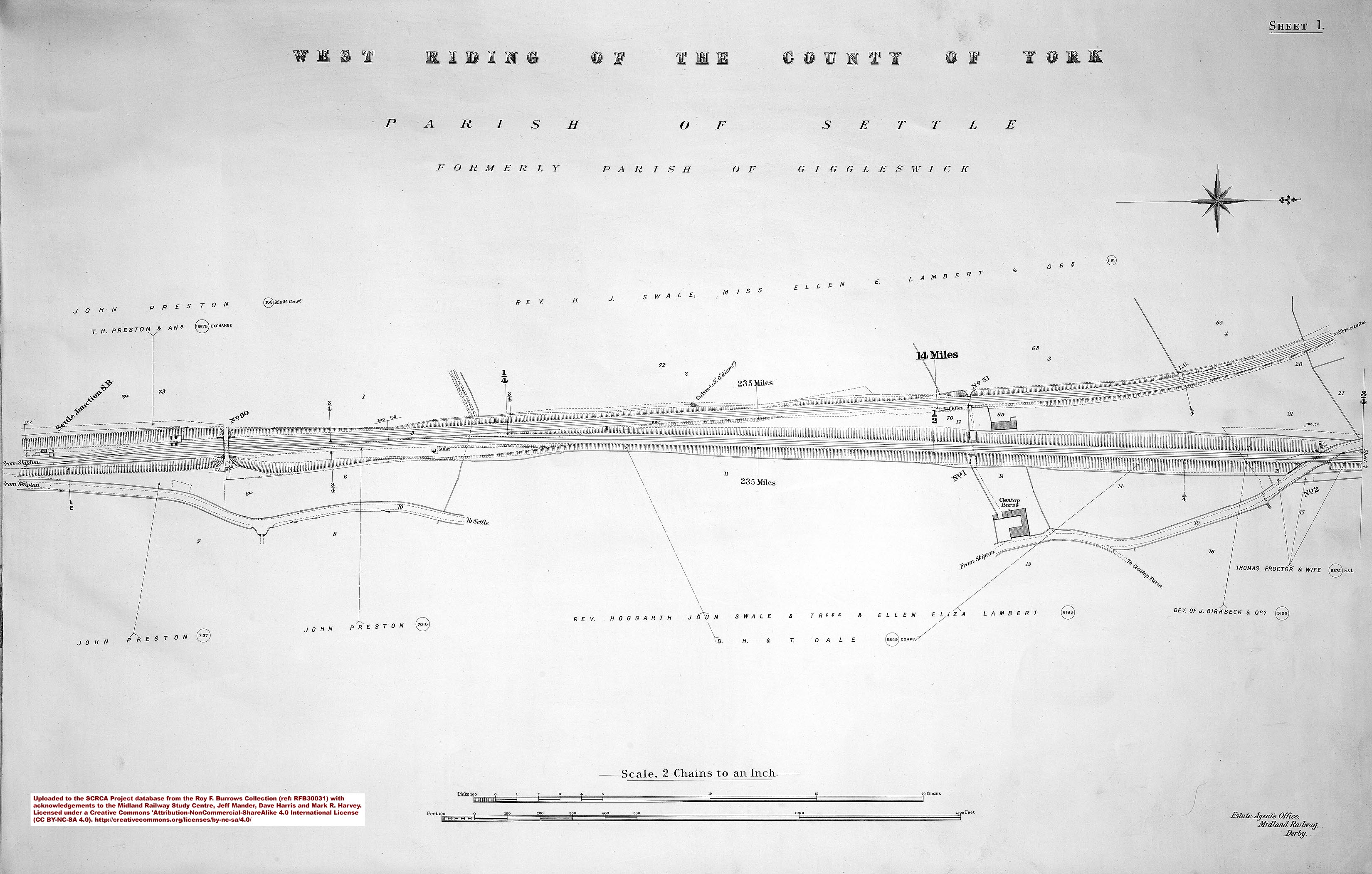
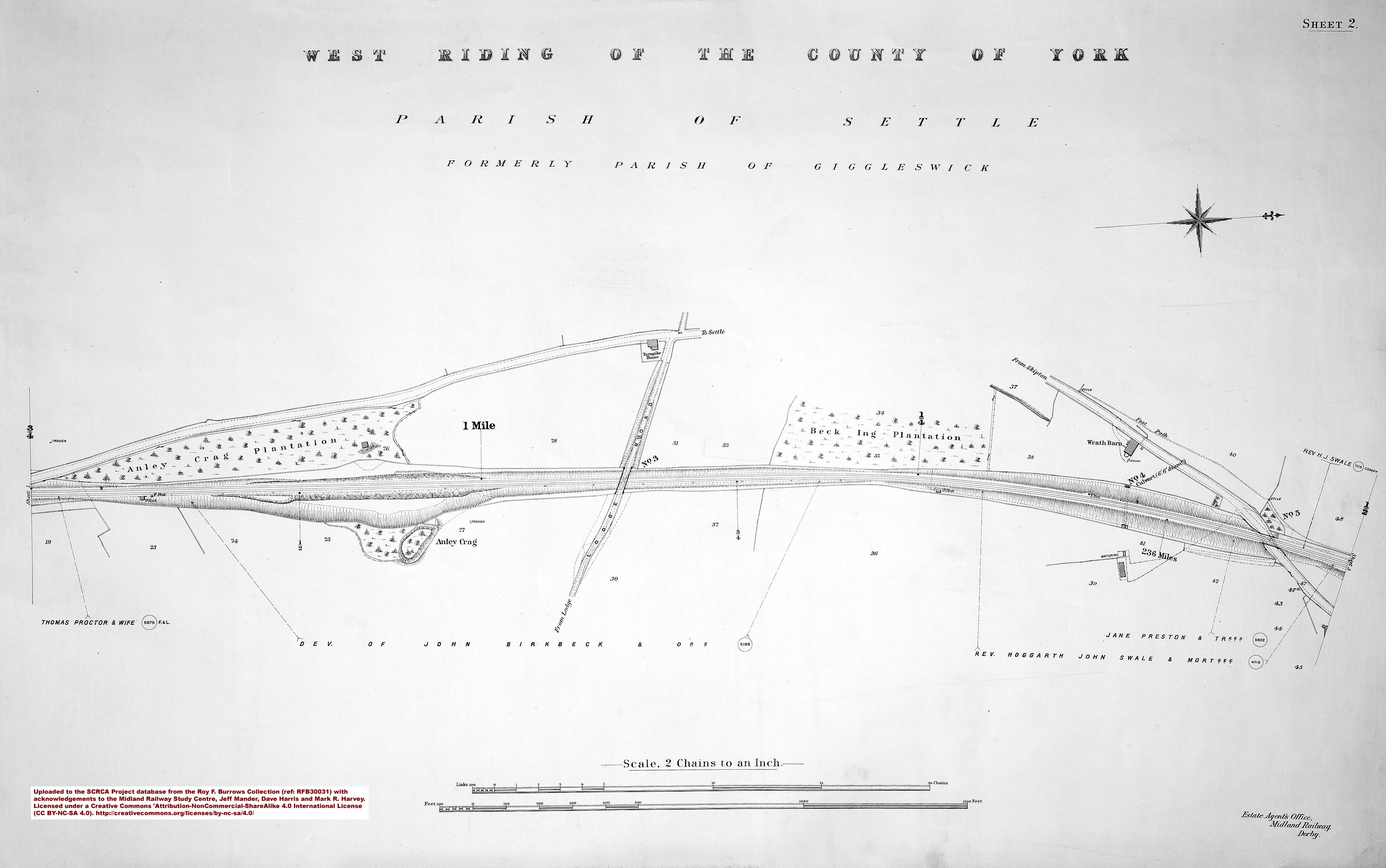
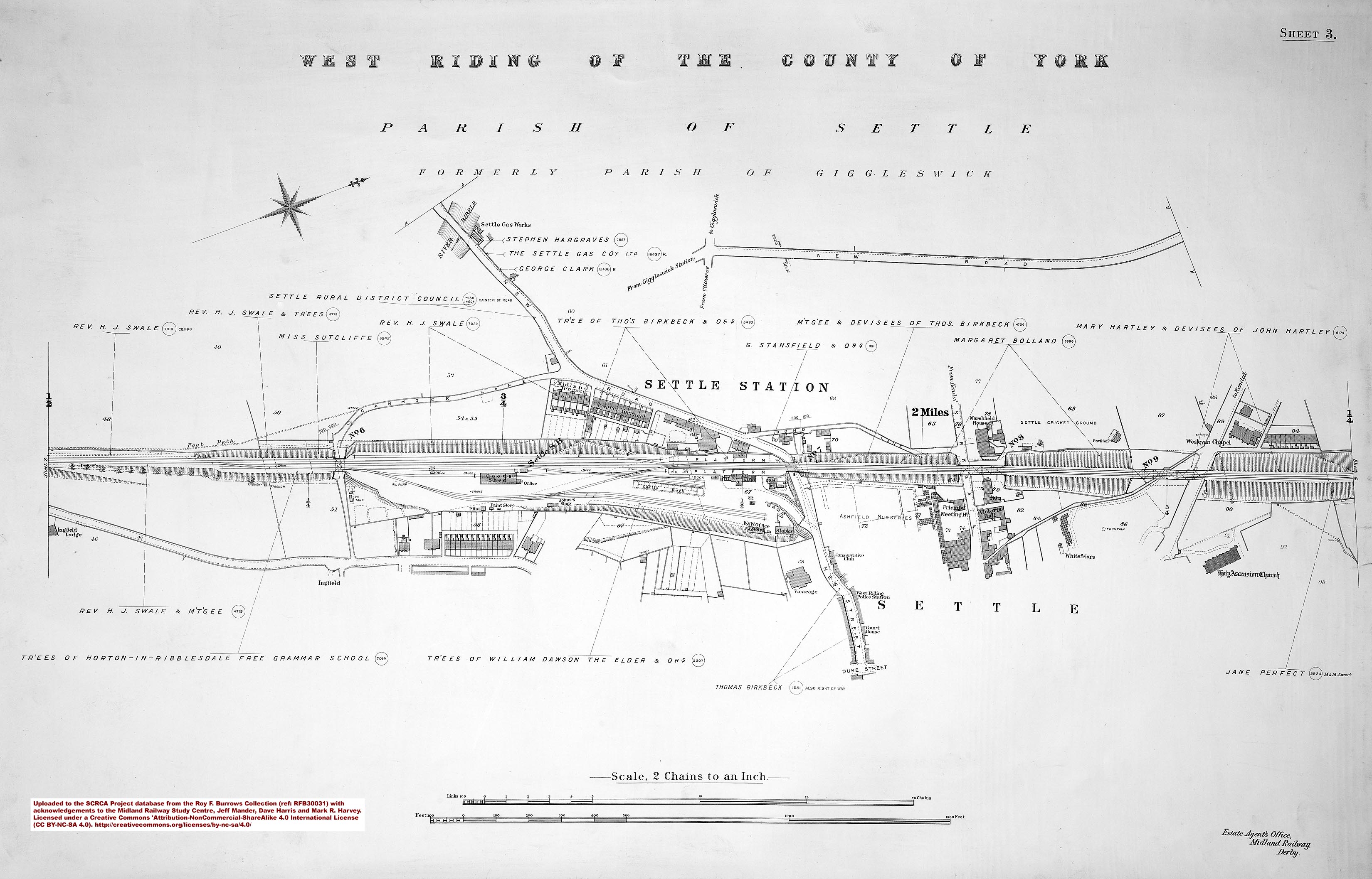
One set of land plans was produced for each proposed railway and the plans were typically drawn at a scale of two chains to one inch. (One chain = 66 feet or 22 yards or 20.1168 metres.) These plans accurately defined the route of the proposed line and clearly identified the owners of all land and property that would be directly affected by the line's construction (hence the term used to describe this type of document). Each set of land plans would typically be cross-referenced to a schedule listing all the land and property that would be subject to compulsory purchase as part of the relevant Railway Act. If Parliamentary approval was granted for a given railway, the land plans produced at the Parliamentary stage would typically form the basis for all subsequent construction plans (to assist with the management of the construction project, including 'Contract Plans') and all subsequent operational plans (to assist with the maintenance and general management of the finished railway). They were also used as the basis for 'Rating Plans' (submitted to local authorities as part of the process for calculating the rateable value of the railway company's property). Within the railway industry, these 'land plans' (and extracts from them) are often referred to as 'Line Plans'.
What information is depicted on these land plans?
The land plans obtained as reference documents for the SCRCA Project cover the full length of the railway line between Hellifield Junction and Petteril Bridge Junction (near Carlisle), including the Hawes Branch. These plans depict the following features associated with - or located immediately adjacent to - the railway:
- the boundaries of railway land;
- field boundaries;
- water courses;
- roads and paths;
- the layout of railway tracks (including the main running lines, junctions, stations areas and sidings);
- signals;
- mileposts (including the original set measured from Settle Junction and the current set installed during the 1901-1902 re-mileaging exercise);
- gradient posts (with the gradients that they depict);
- key railway-related structures (including embankments, cuttings, bridges (including viaducts & tunnels), culverts, level crossings, station buildings & platforms, signal boxes, lamp huts, platelayers' huts, fog huts, workers' housing, etc.); and
- non-railway buildings adjacent to the railway boundary.
Are these land plans available to the general public?
Due to copyright and privacy restrictions, some of the land plans referenced as part of the SCRCA Project cannot be made available for public viewing. However, two of the sets have been made available via this website courtesy of the Midland Railway Study Centre (see acknowledgements below).
Set 1: Settle-Carlisle land plans from the Roy F. Burrows Collection [2]
This set was originally published in 1911-1912 and it covers the main Settle and Carlisle Railway between Settle Junction and Petteril Bridge Junction. It is available in two formats, both created using high-quality photographic techniques:
- A pdf file containing the full set of 97 land plans (and the 3 cover sheets) is available on CD. This can be obtained by post from the Midland Railway Study Centre (MRSC) in return for a modest donation. For more information, please contact the MRSC direct via the e-mail address provided near the bottom of the page at: http://www.midlandrailwaystudycentre.org.uk/.
- Individual sheets in jpg format can be downloaded from the SCRCA Project database using the links provided on all relevant location summary pages and via the links provided in the sheet index below. Please note that these land plans are licensed for personal use only and are subject to the Creative Commons Attribution-NonCommercial-ShareAlike 4.0 International License.
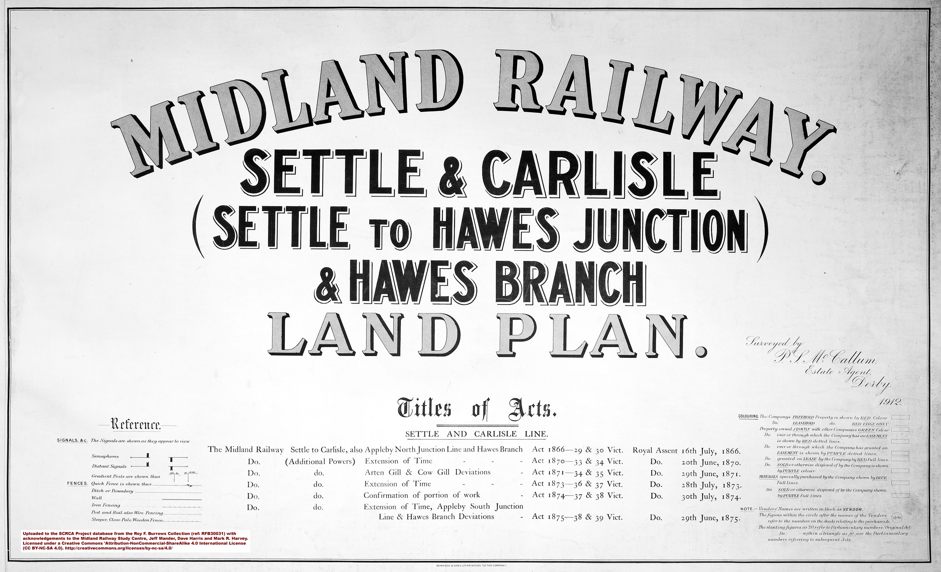 |
Image 1: Cover page and key for RFB30031 - Settle to Hawes Junction published in 1912.
|
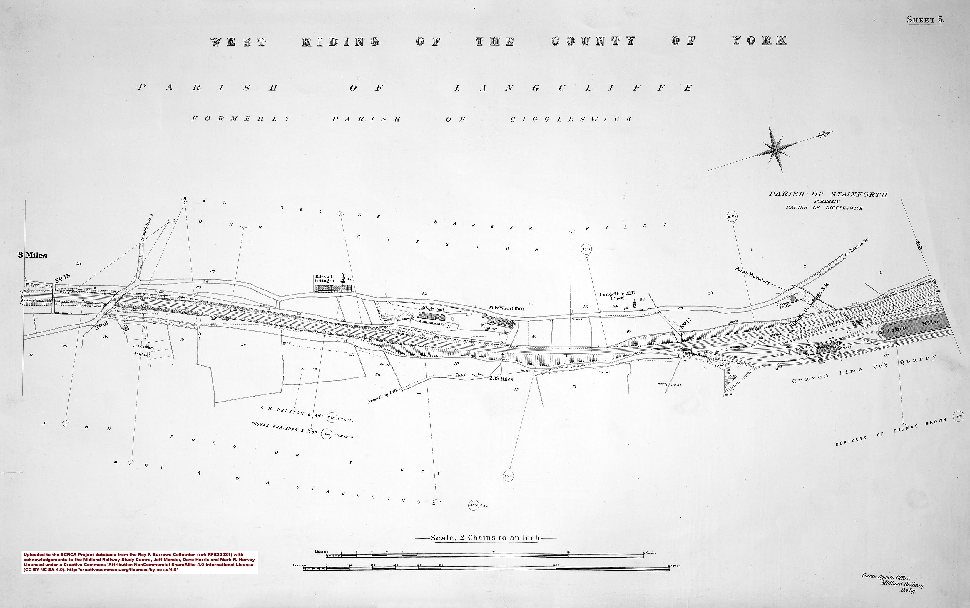
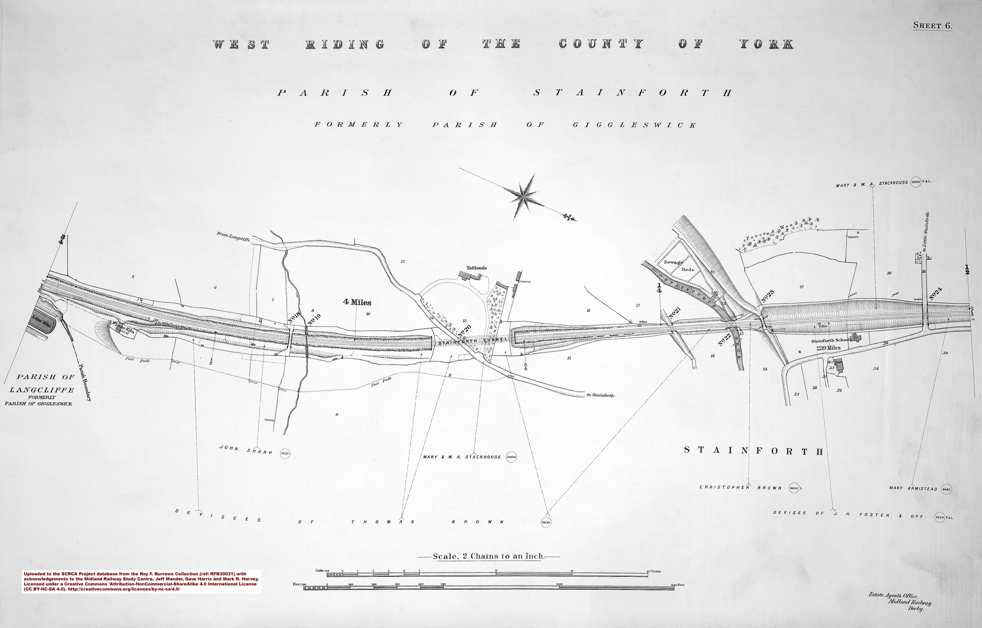
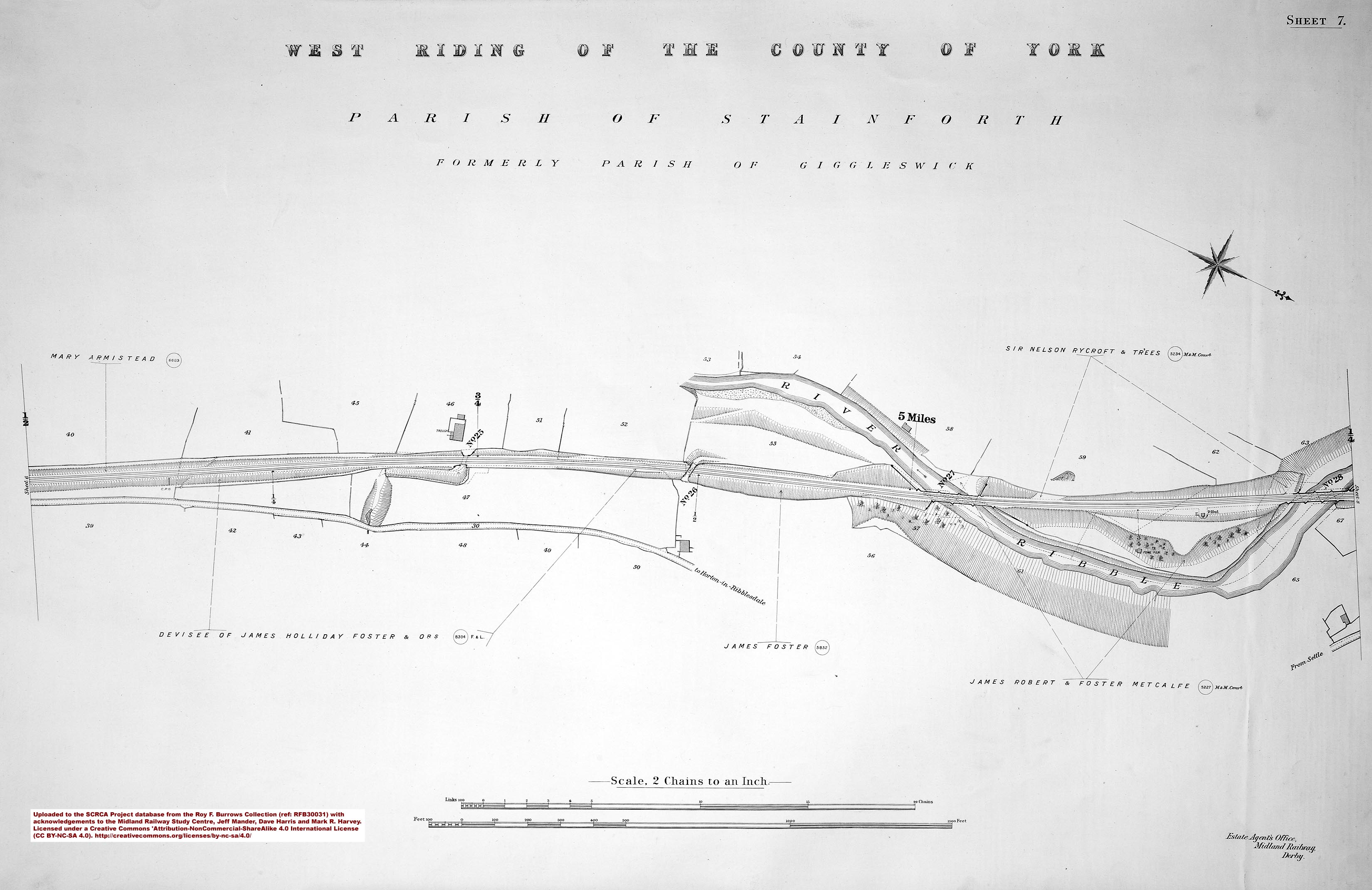
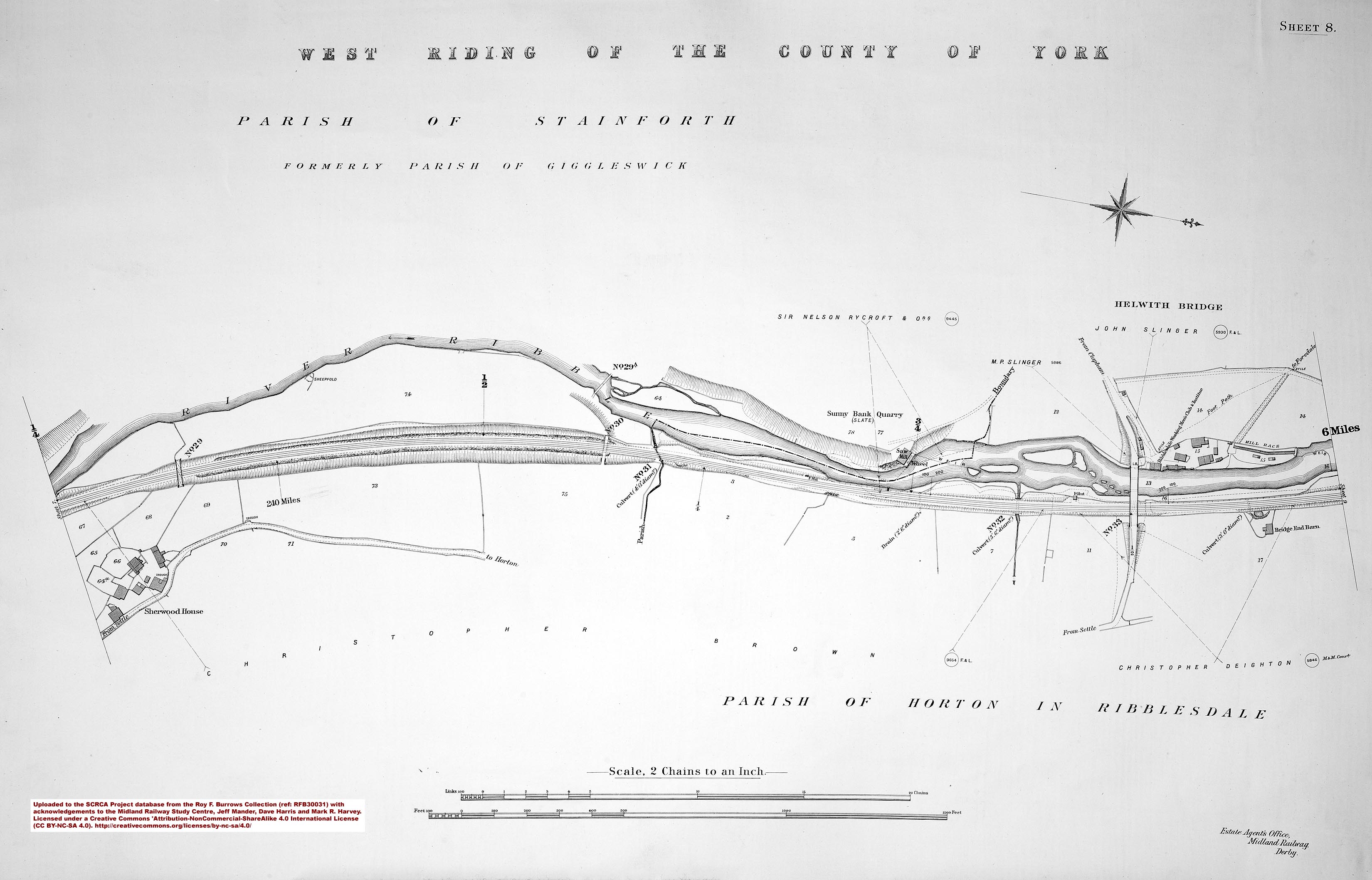
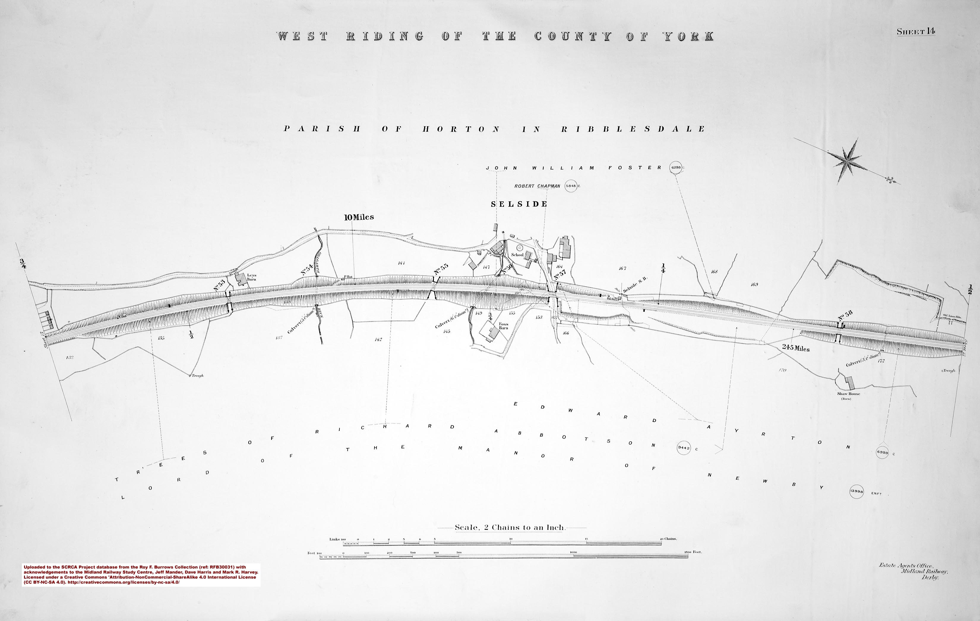
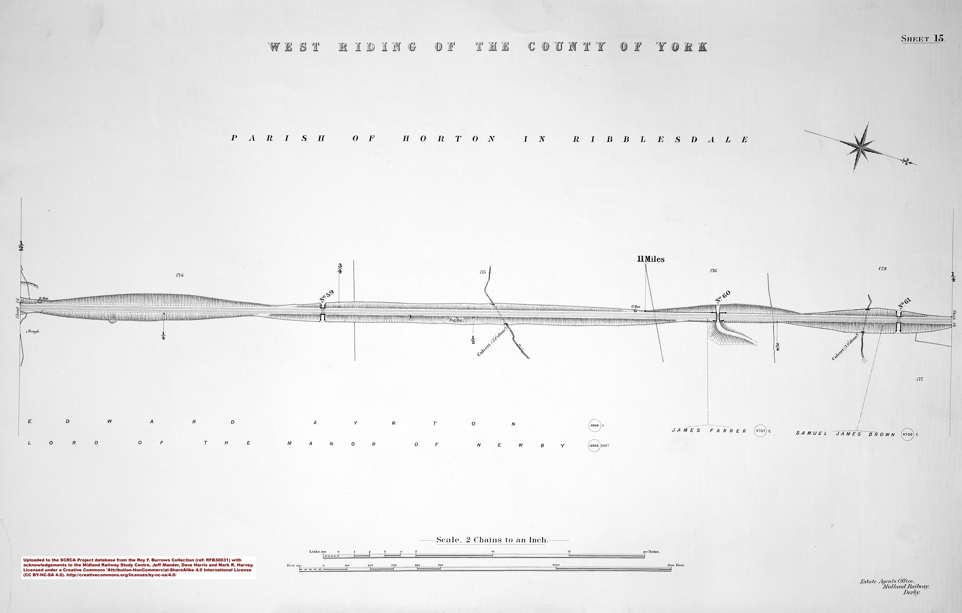
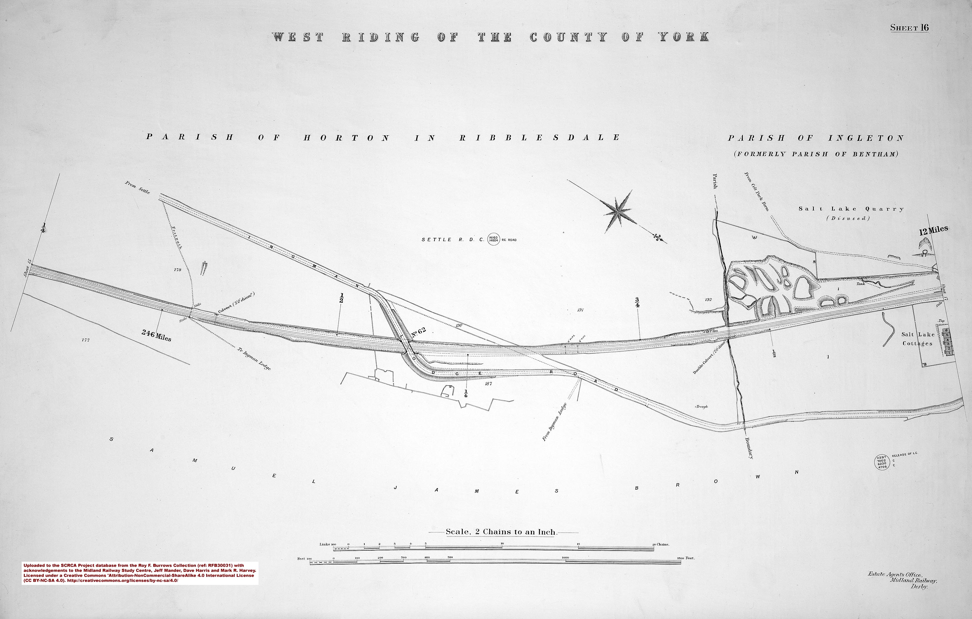
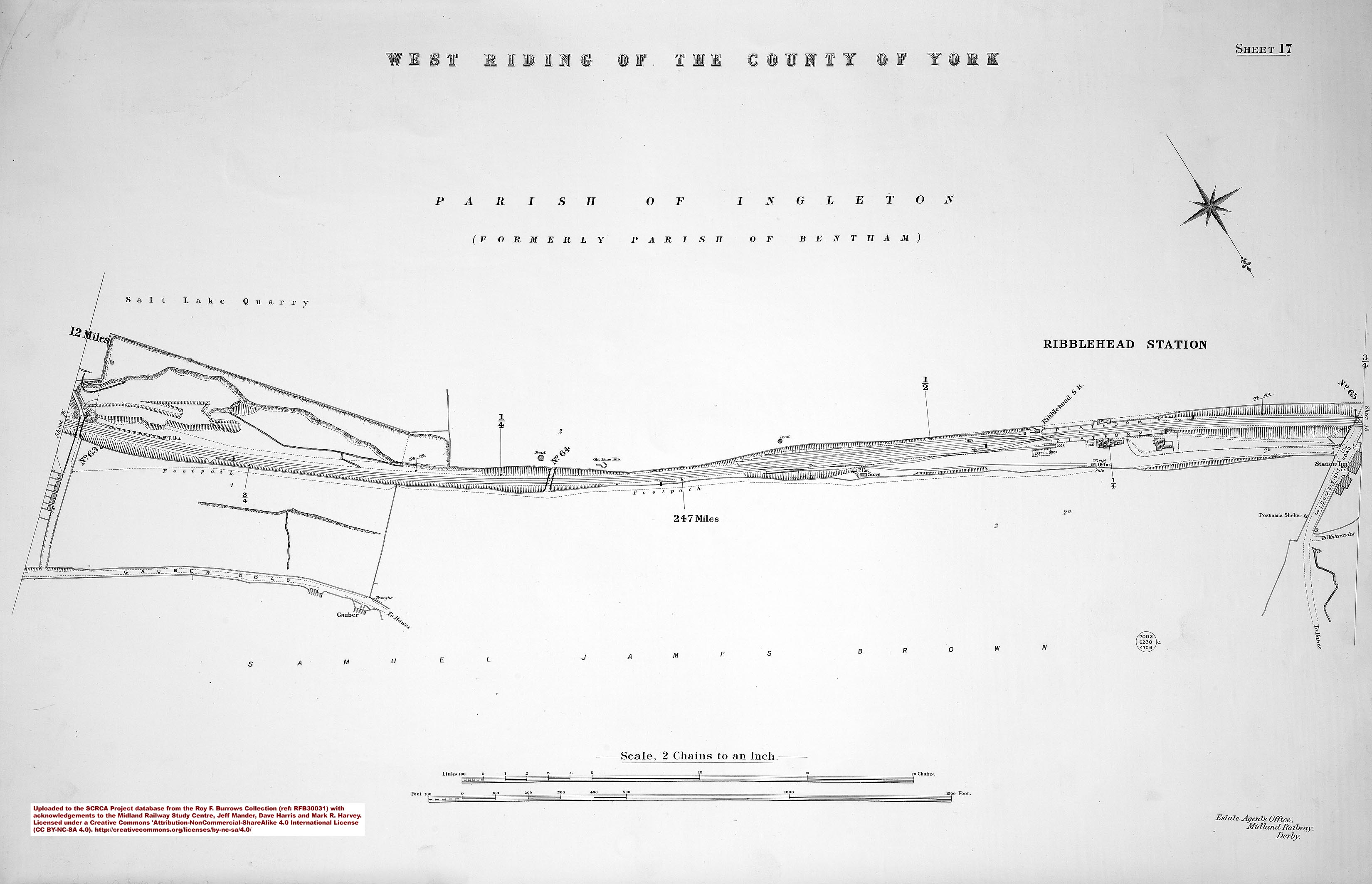
Reference RFB30031 - Settle to Hawes Junction (published in 1912):
- sac-01-1912 = Sheet 1 - 235 miles and Settle Junction.
- sac-02-1912 = Sheet 2 - 236 miles.
- sac-03-1912 = Sheet 3 - Settle Station.
- sac-04-1912 = Sheet 4 - 237 miles.
- sac-05-1912 = Sheet 5 - 238 miles.
- sac-06-1912 = Sheet 6 - 239miles.
- sac-07-1912 = Sheet 7.
- sac-08-1912 = Sheet 8 - 240 miles.
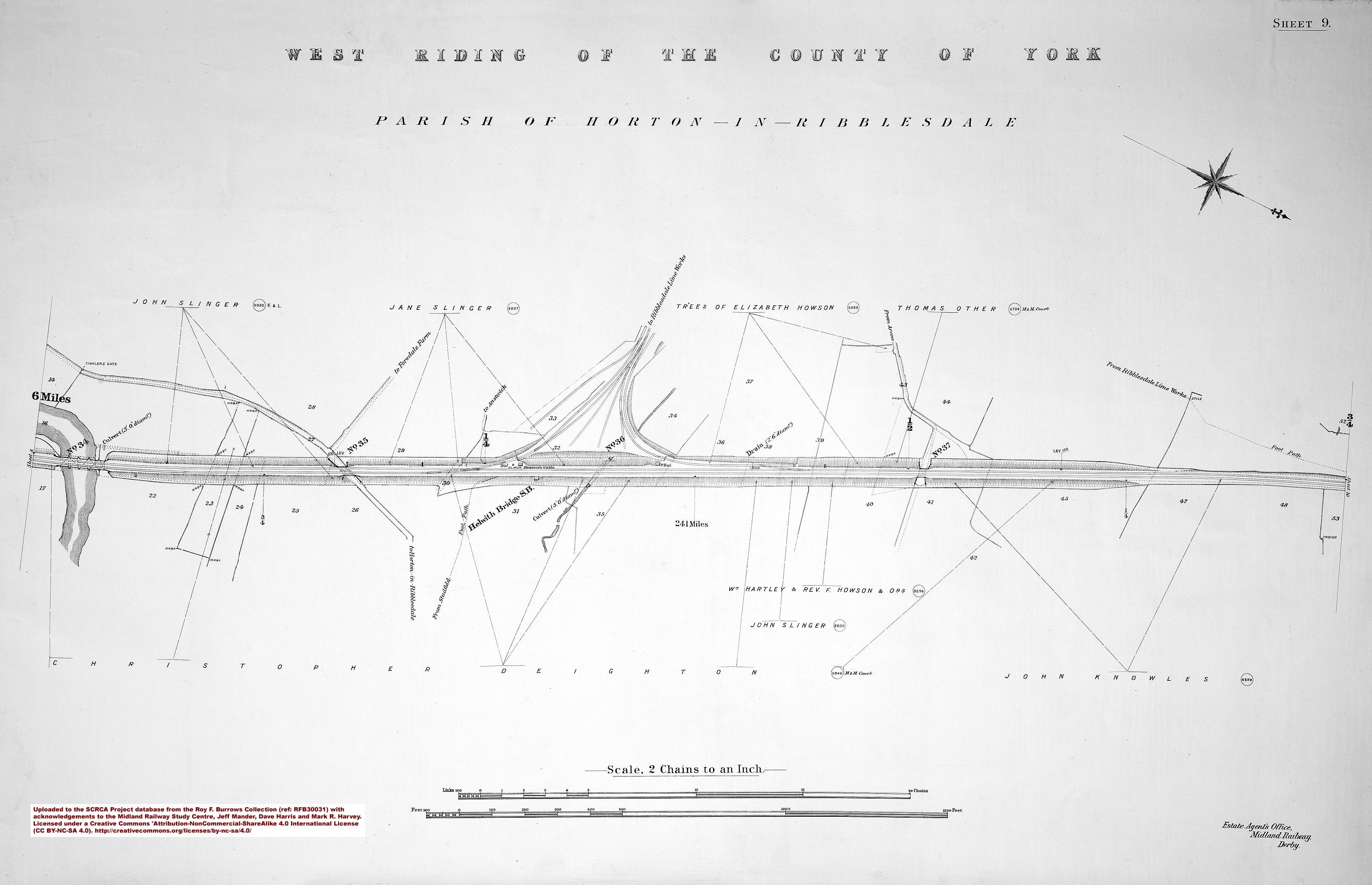
- sac-09-1912 = Sheet 9 - 241 miles.
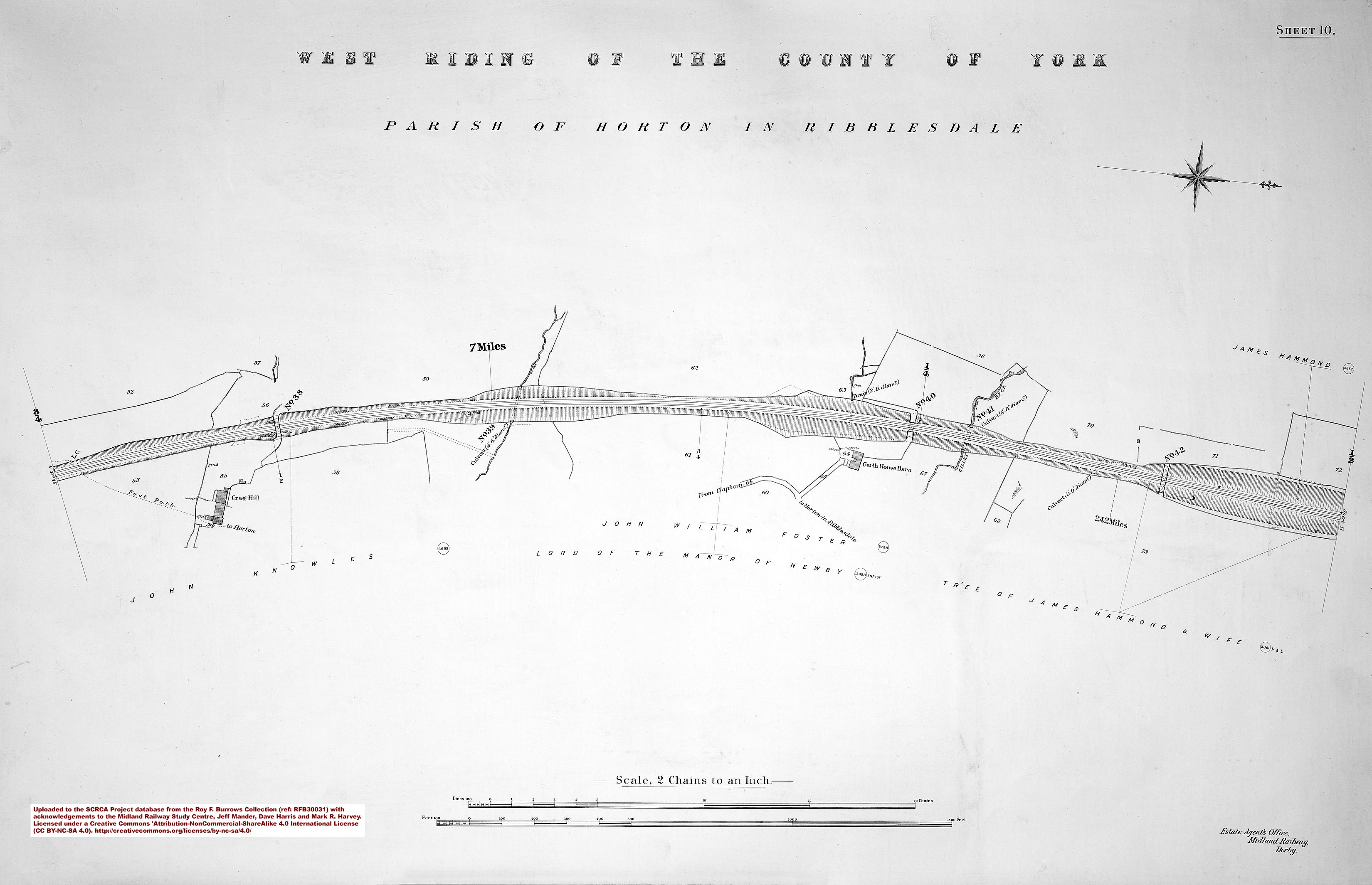
- sac-10-1912 = Sheet 10 - 242 miles.
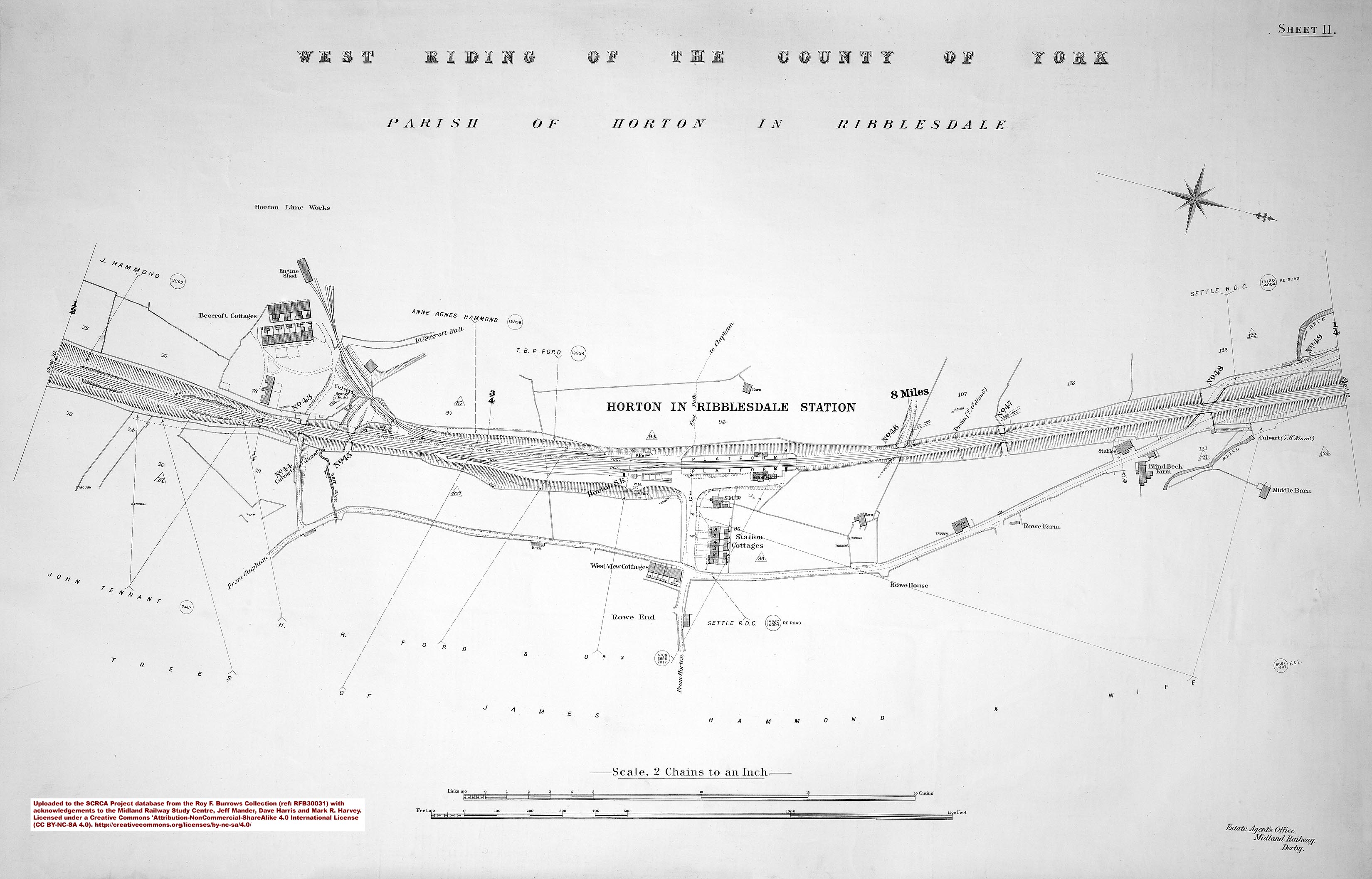
- sac-11-1912 = Sheet 11 - Horton-in-Ribblesdale Station.
- sac-12-1912 = Sheet 12 - 243 miles.
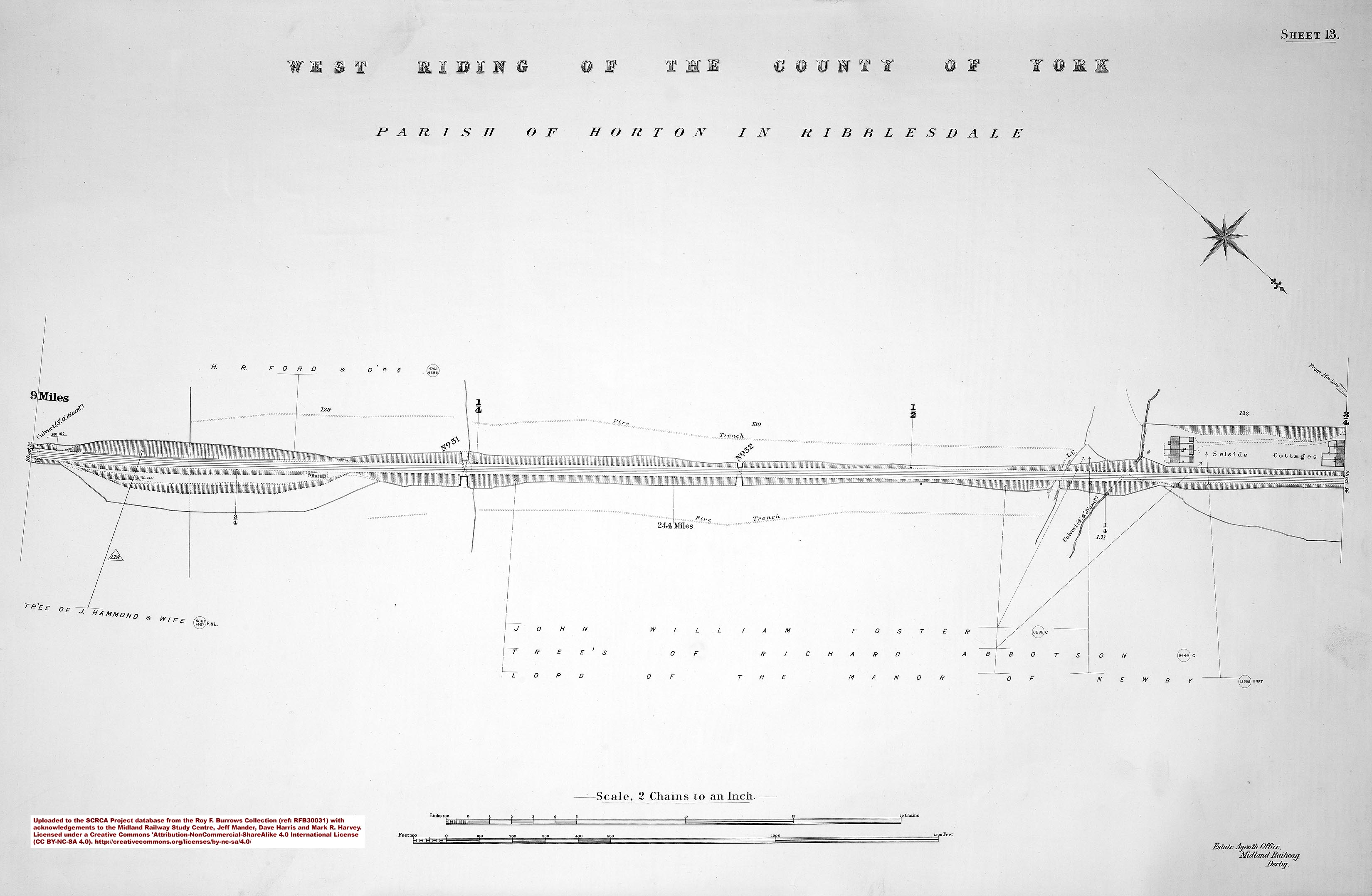
- sac-13-1912 = Sheet 13 - 244 miles.
- sac-14-1912 = Sheet 14 - 245 miles.
- sac-15-1912 = Sheet 15.
- sac-16-1912 = Sheet 16 - 246 miles.
- sac-17-1912 = Sheet 17 - 247 miles and Ribblehead Station.
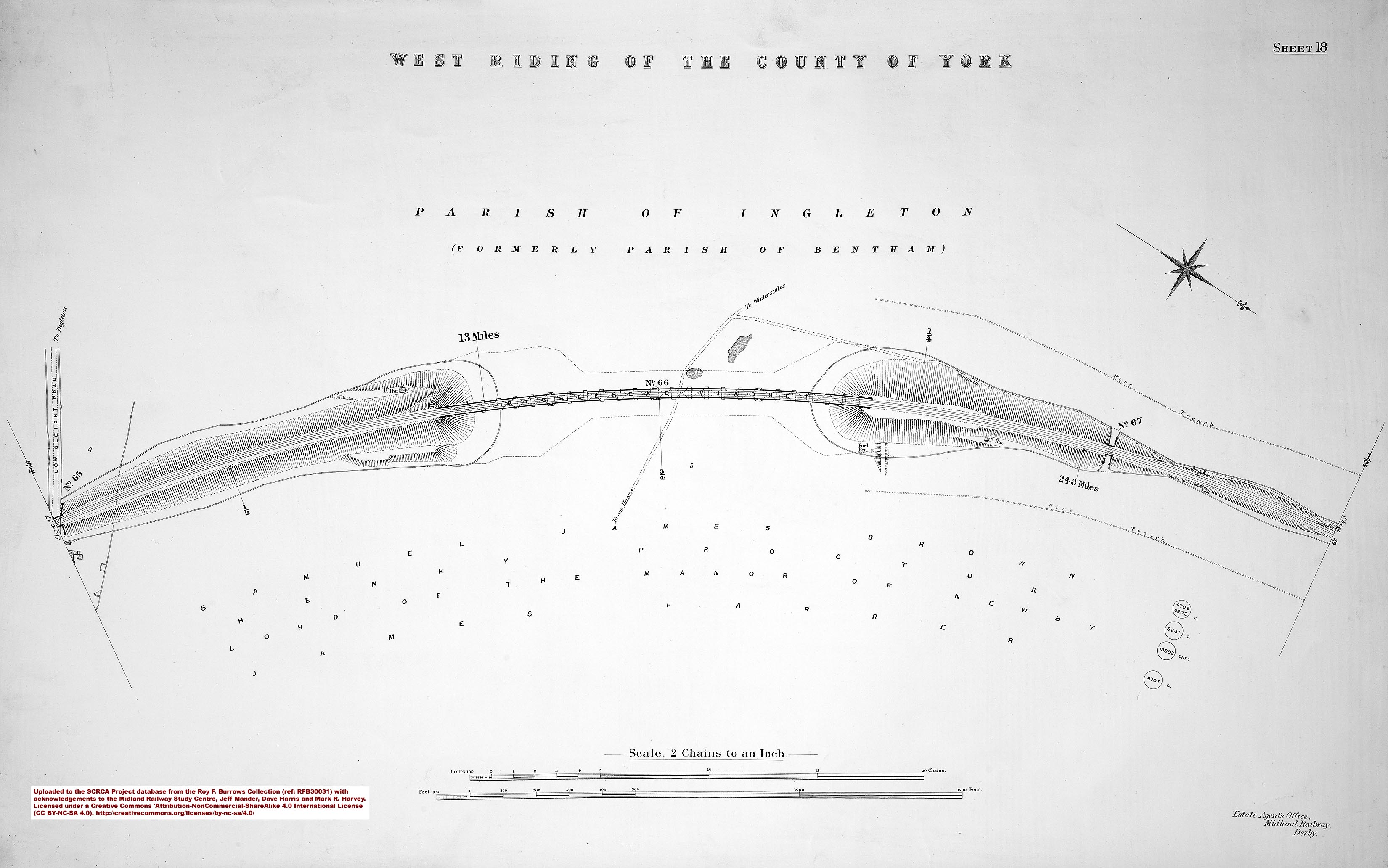
- sac-18-1912 = Sheet 18 - 248 miles and Ribblehead Viaduct.
- sac-19-1912 = Sheet 19.
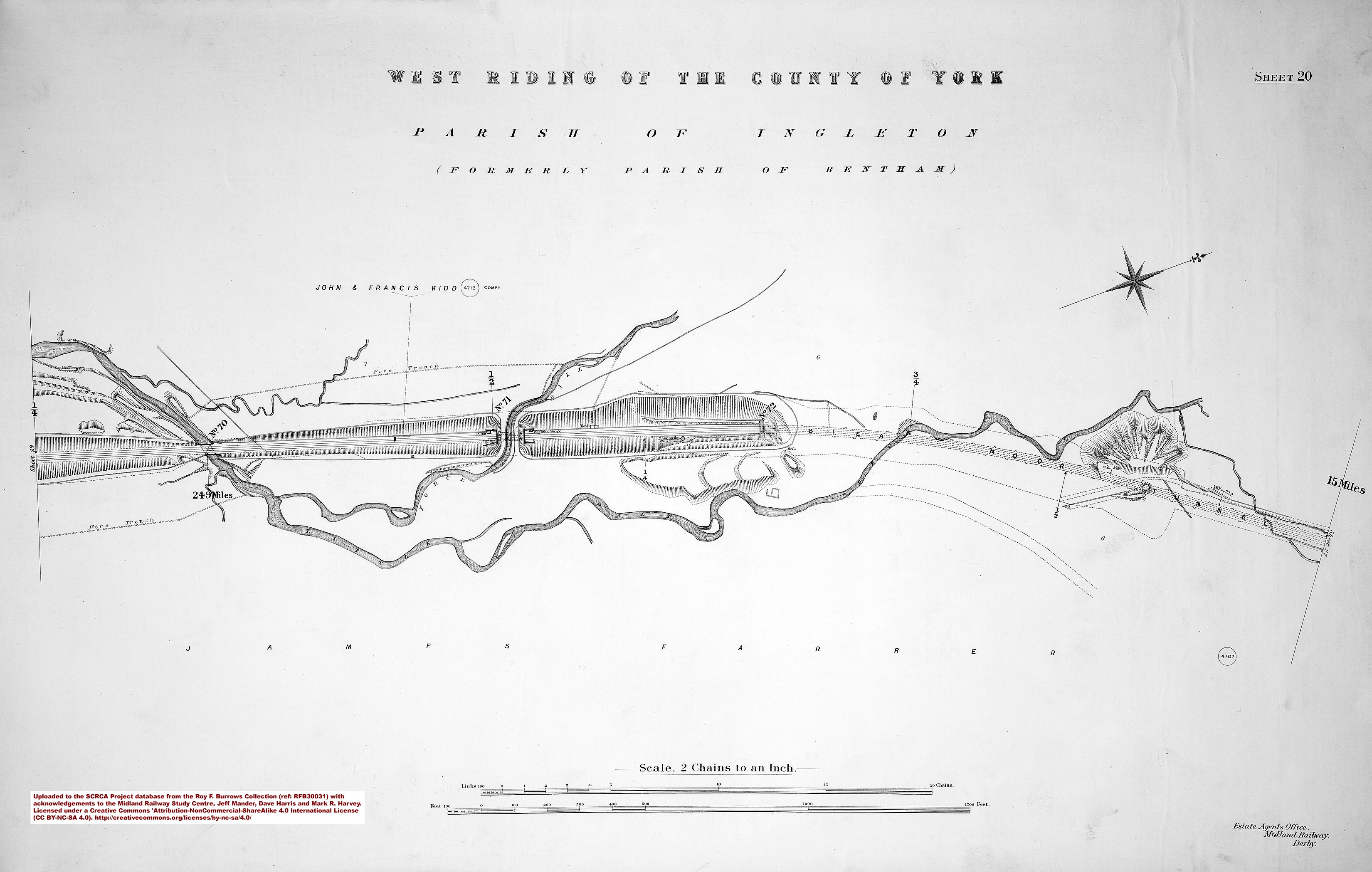
- sac-20-1912 = Sheet 20 - 249 miles.
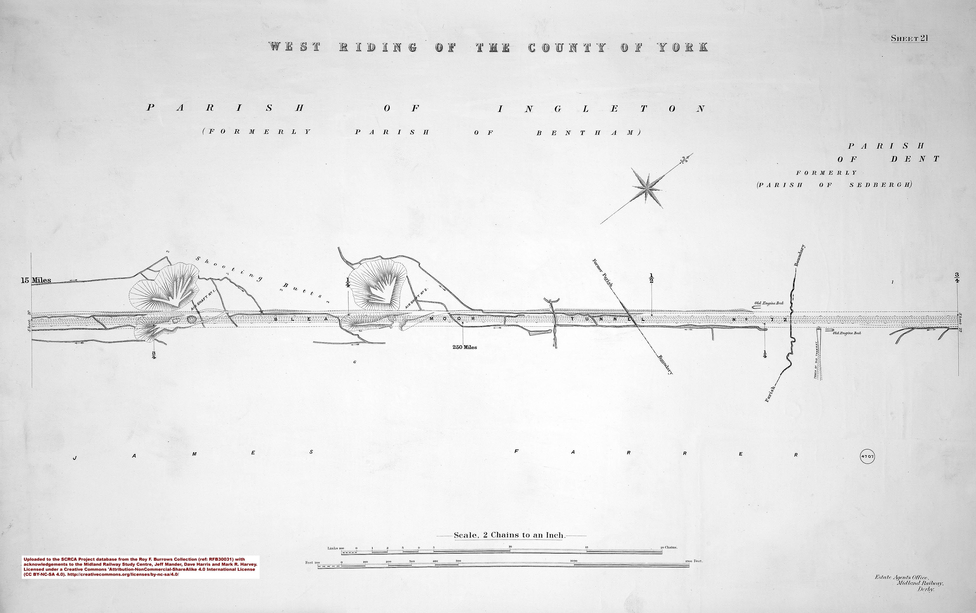
- sac-21-1912 = Sheet 21 - 250 miles.
- sac-22-1912 = Sheet 22 - 251 miles.
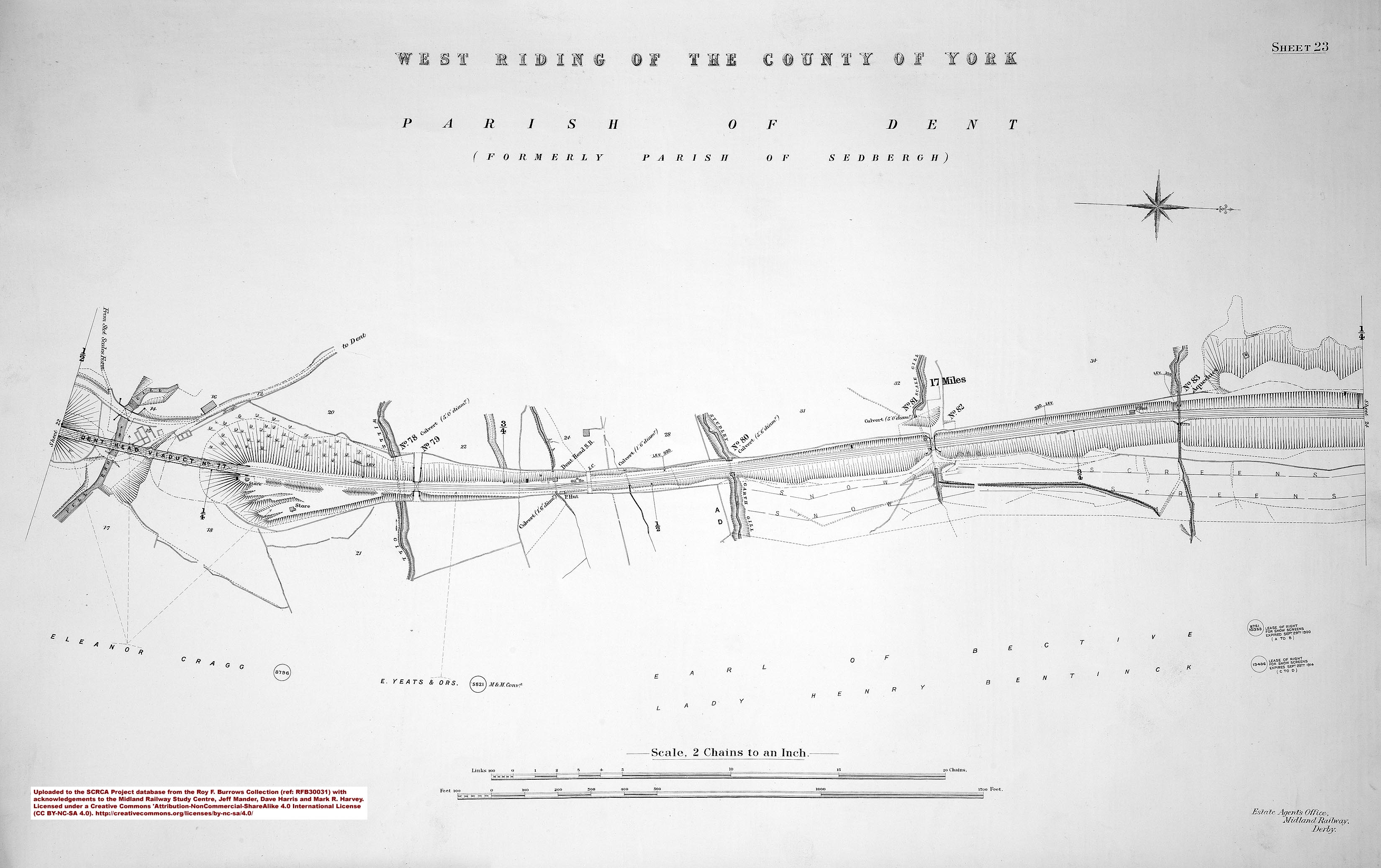
- sac-23-1912 = Sheet 23.
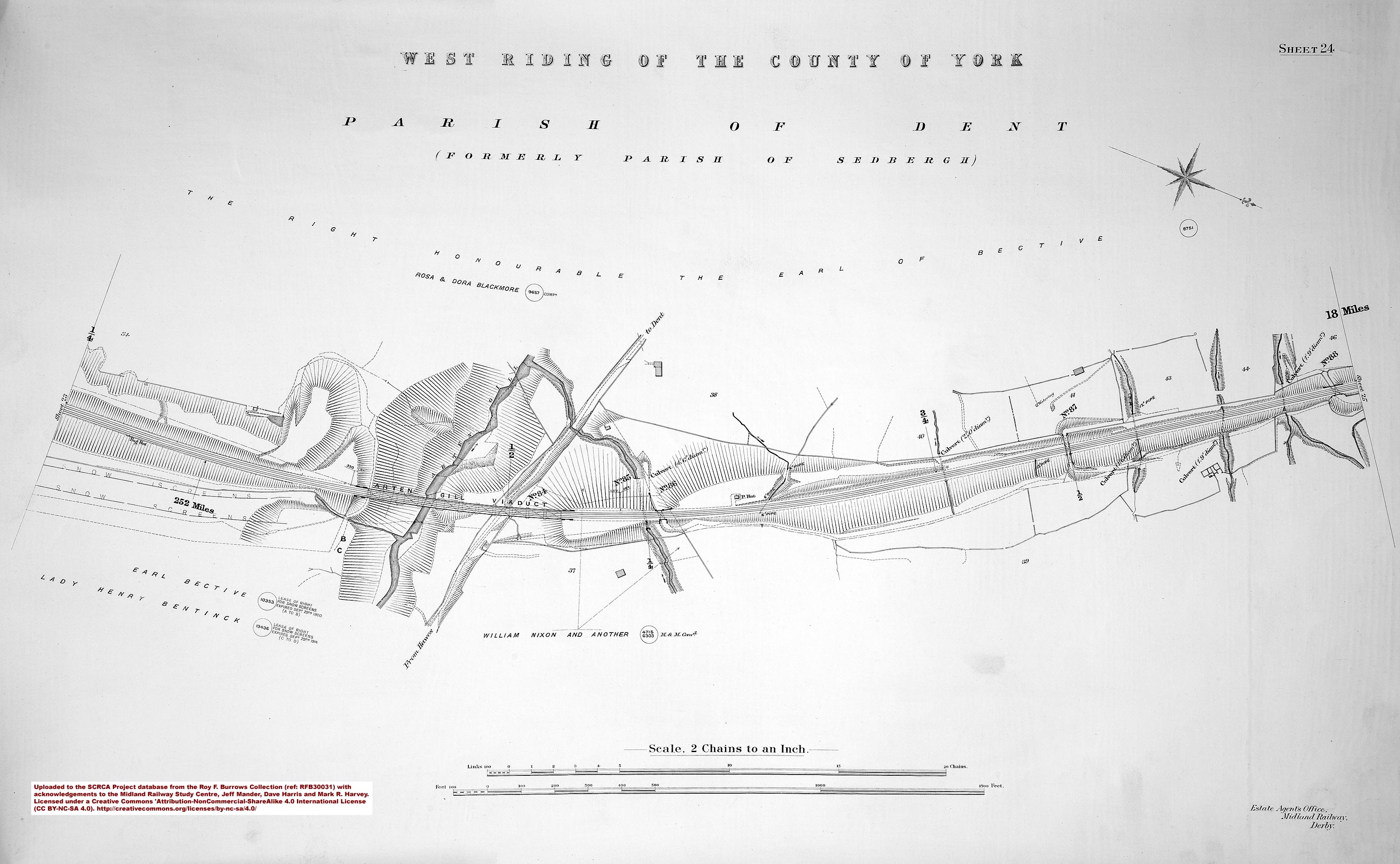
- sac-24-1912 = Sheet 24 - 252 miles.
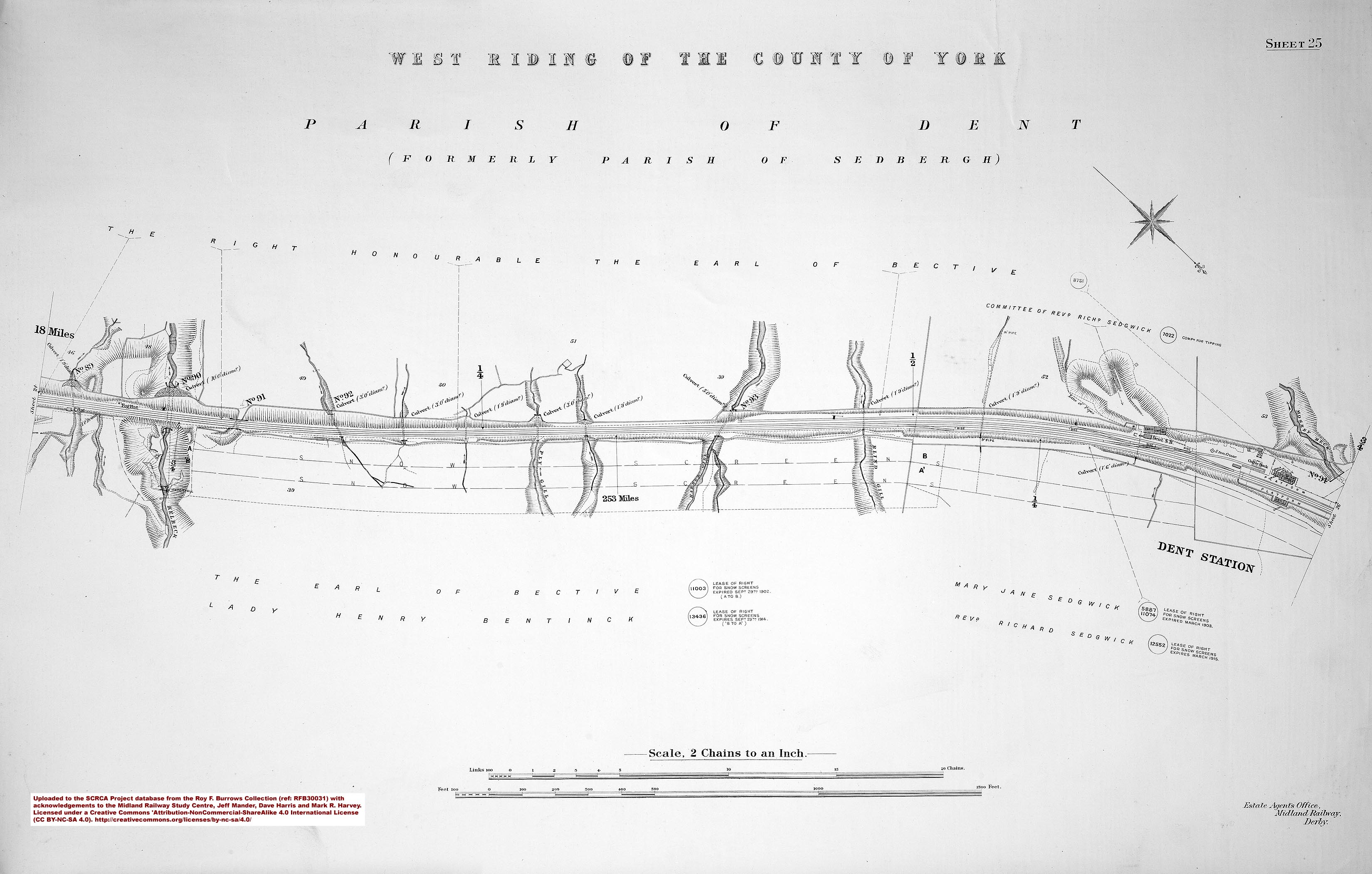
- sac-25-1912 = Sheet 25 - 253 miles and Dent Station.
- sac-26-1912 = Sheet 26 - 254 miles.
- sac-27-1912 = Sheet 27
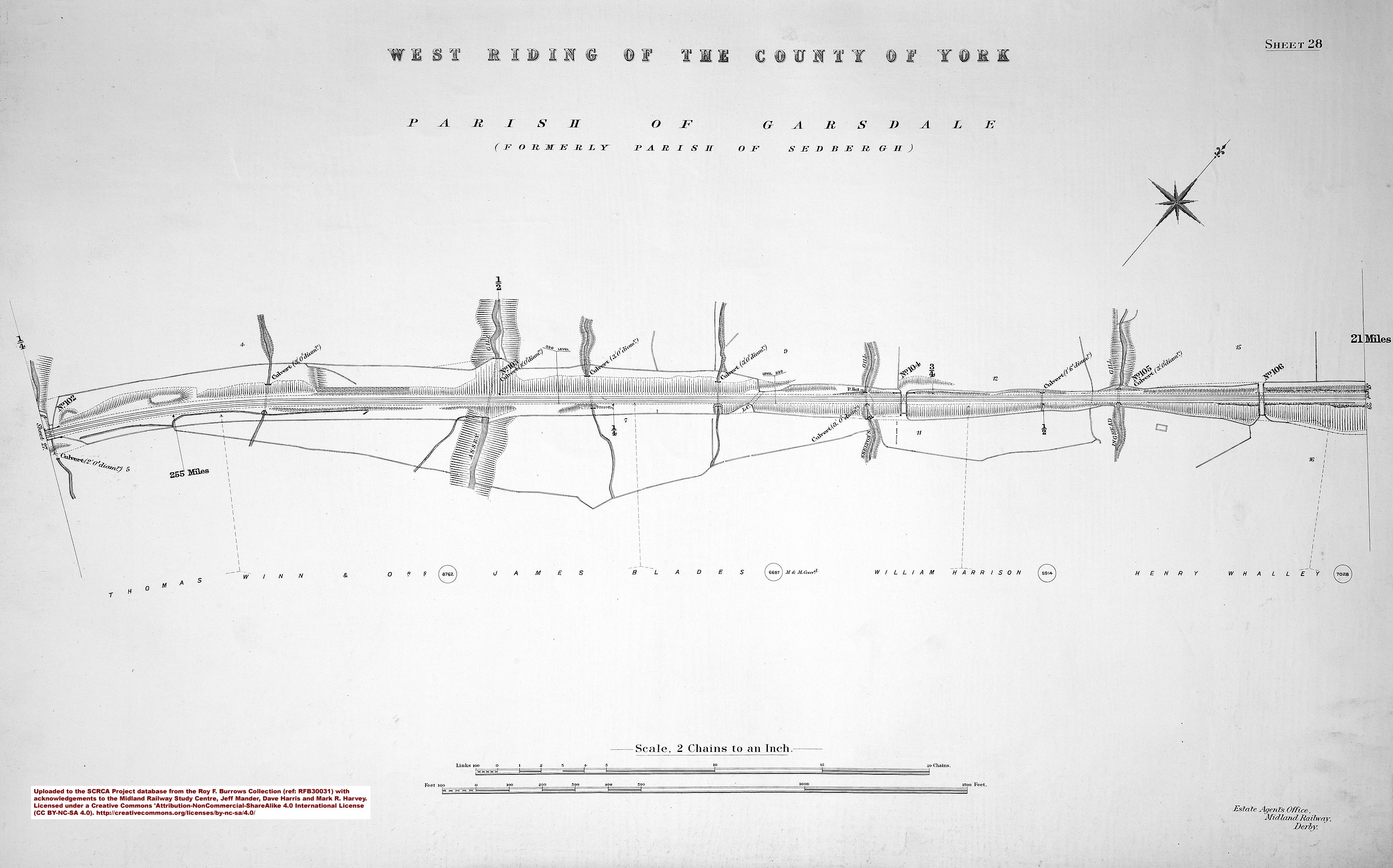
- sac-28-1912 = Sheet 28 - 255 miles.
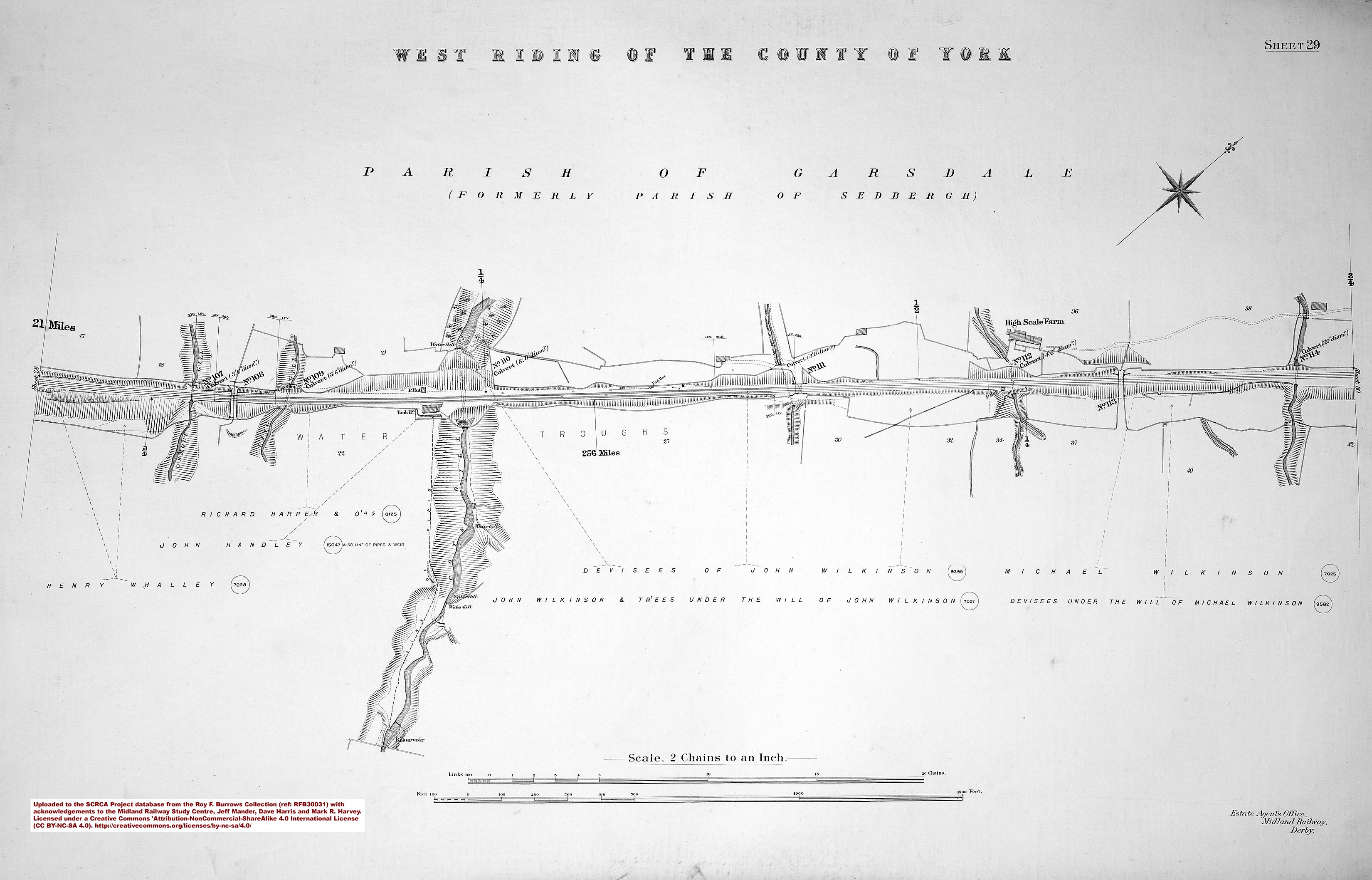
- sac-29-1912 = Sheet 29 - 256 miles.
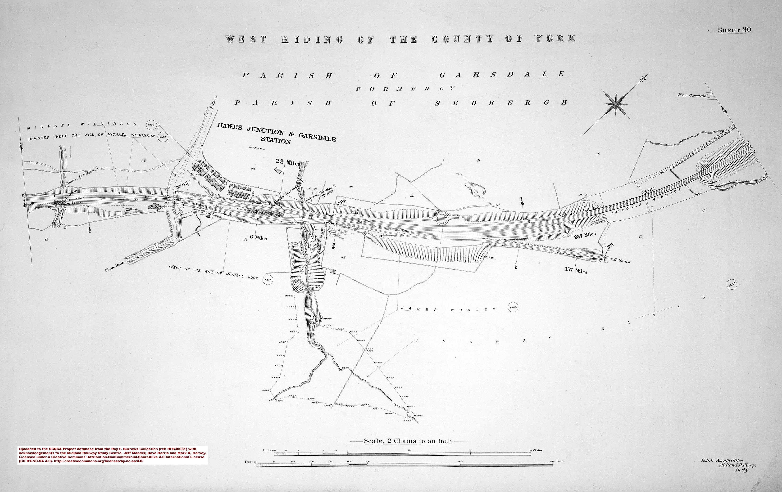
- sac-30-1912 = Sheet 30 - 257 miles and Hawes Junction & Garsdale Station.
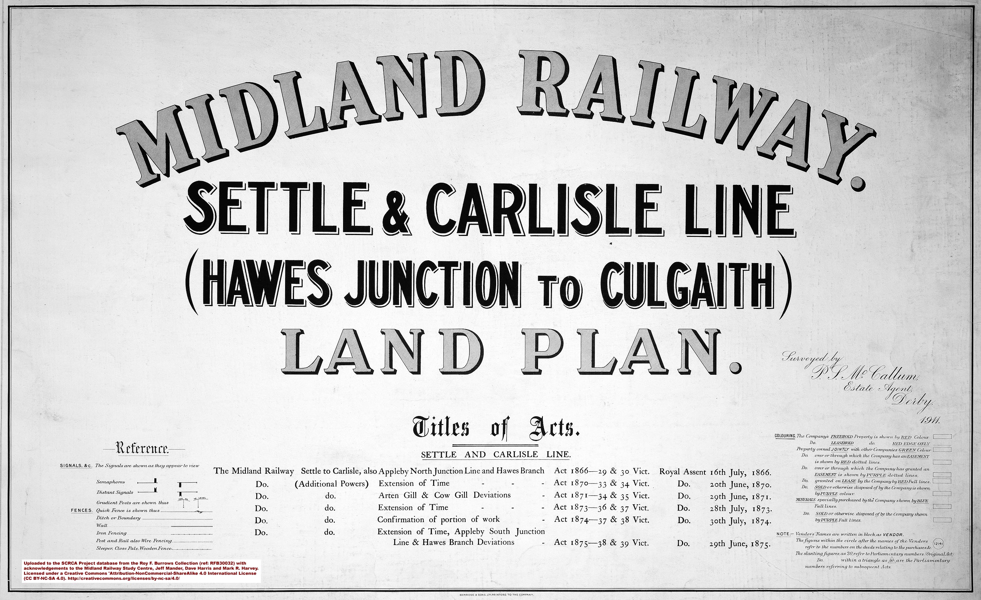 |
Image 2: Cover page and key for RFB30032 - Hawes Junction to Culgaith published in 1911.
|
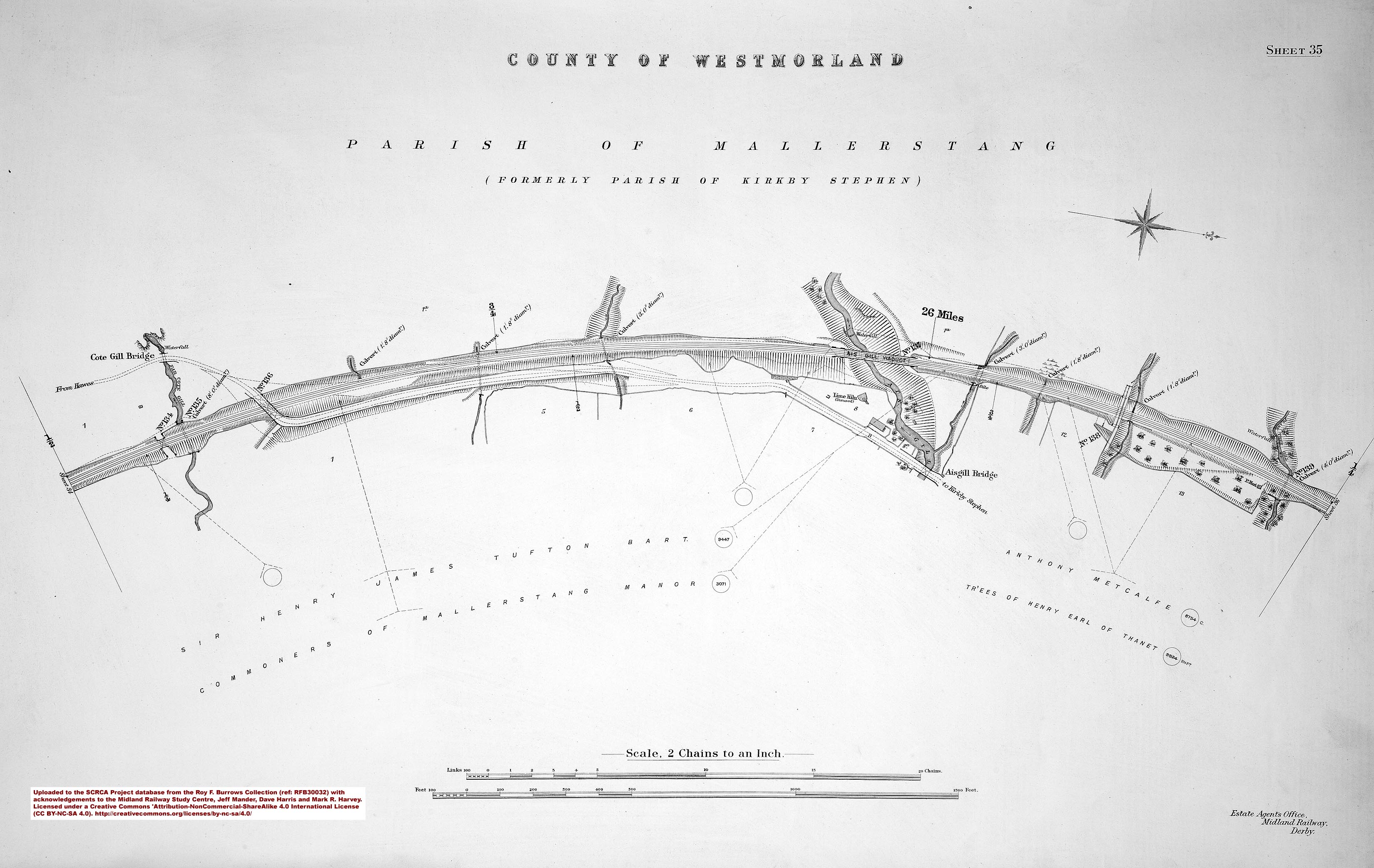
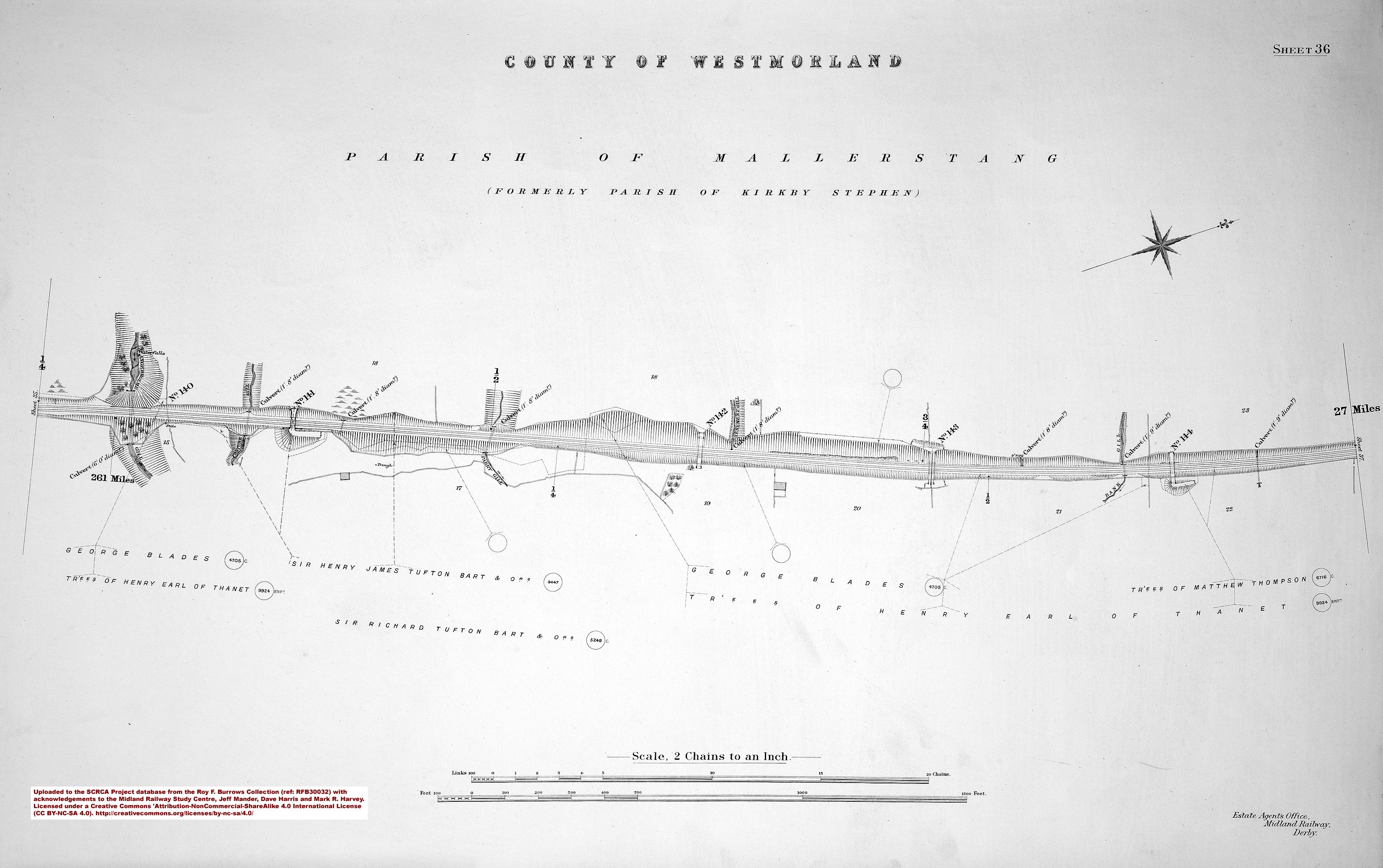
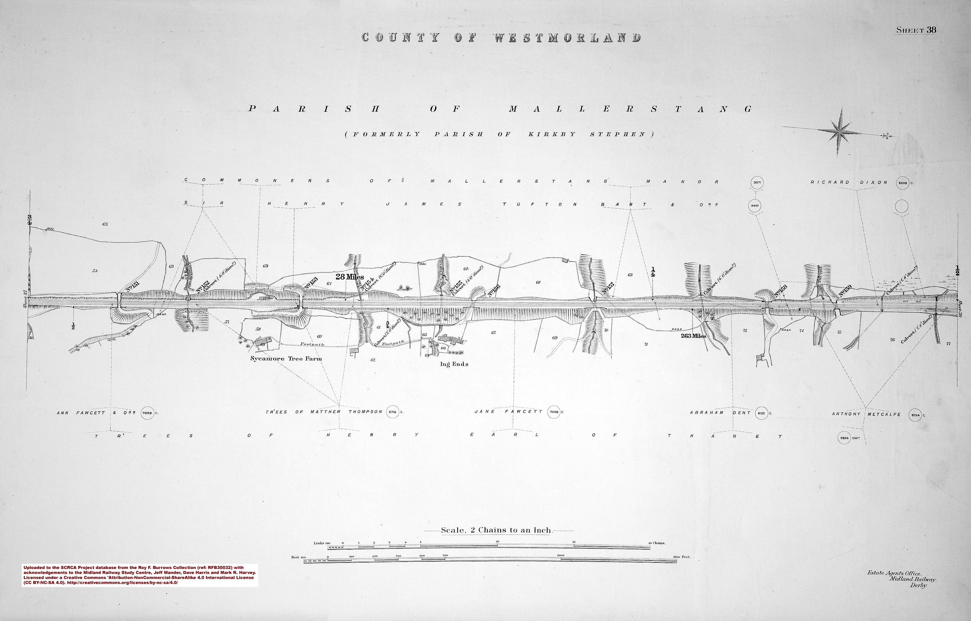
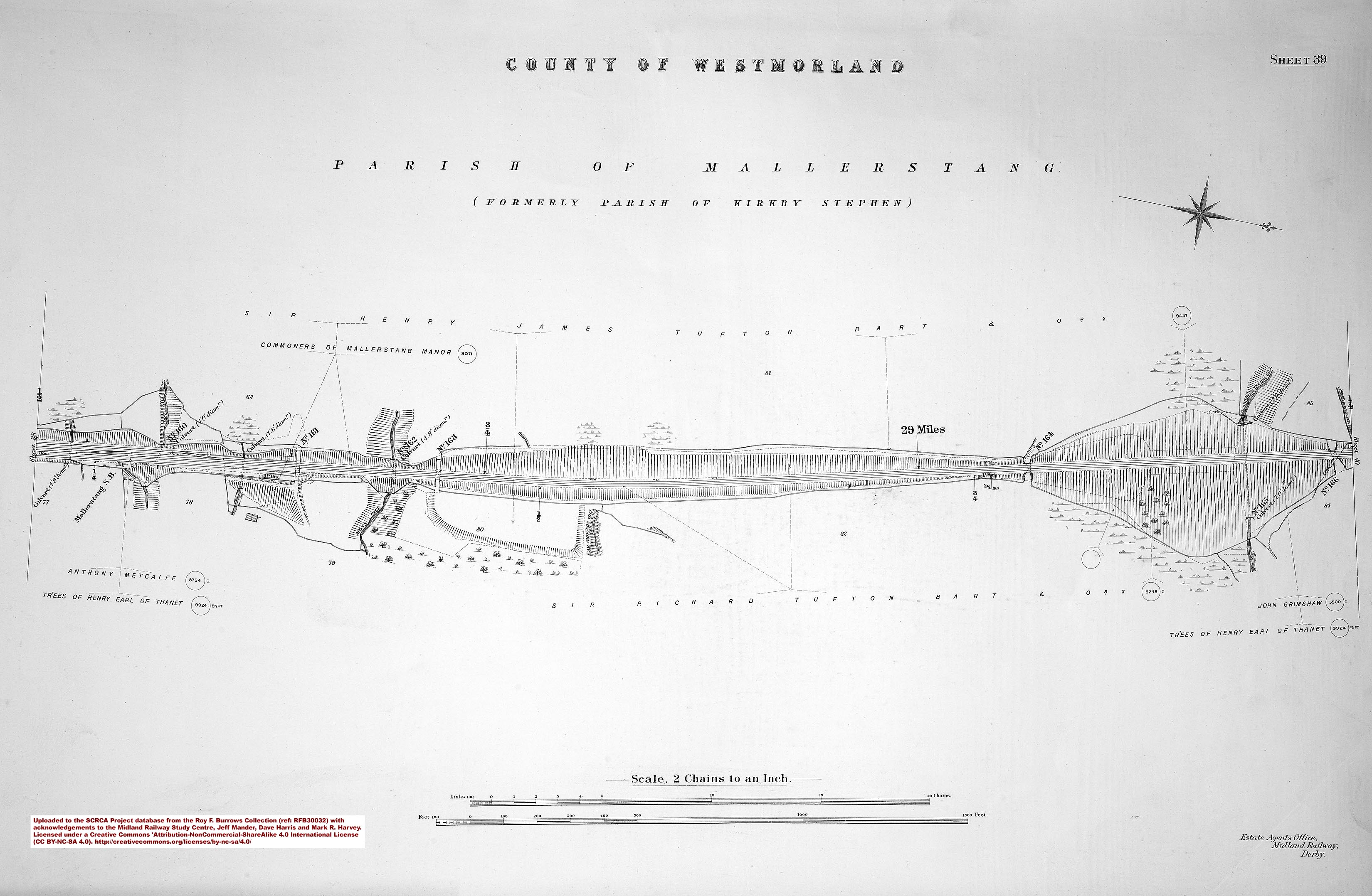
Reference RFB30032 - Hawes Junction to Culgaith (published in 1911):
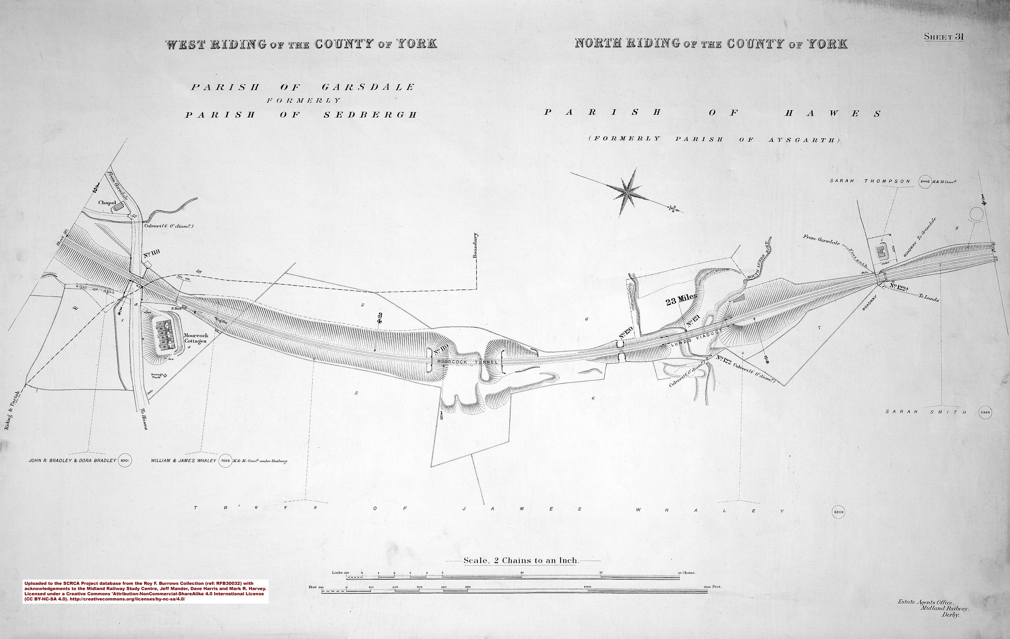
- sac-31-1911 = Sheet 31.
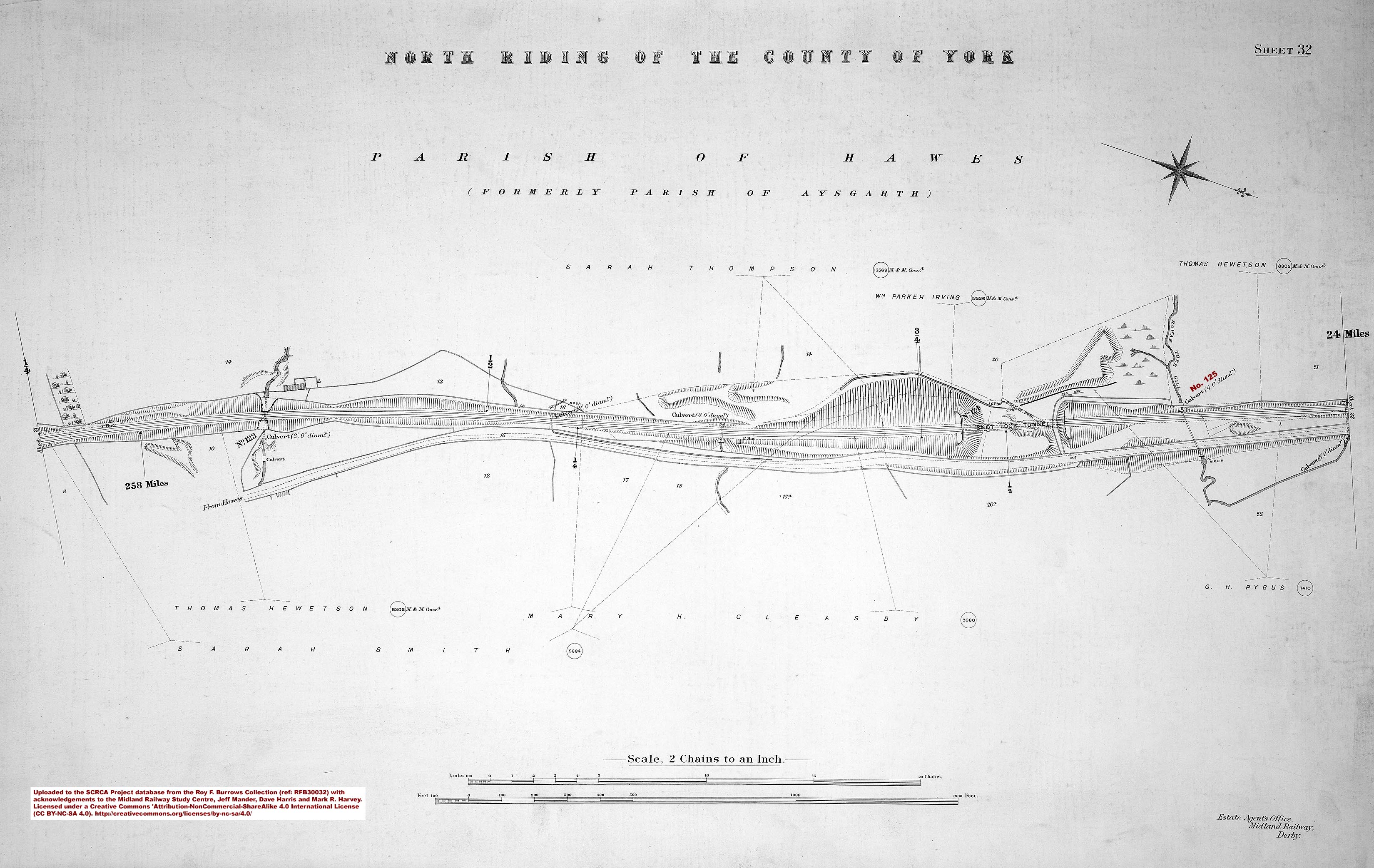
- sac-32-1911 = Sheet 32 - 258 miles.
- sac-33-1911 = Sheet 33 - 259 miles.
- sac-34-1911 = Sheet 34- 260 miles and Aisgill Summit.
- sac-35-1911 = Sheet 35.
- sac-36-1911 = Sheet 36 - 261 miles.
- sac-37-1911 = Sheet 37 - 262 miles.
- sac-38-1911 = Sheet 38 - 263 miles.
- sac-39-1911 = Sheet 30.
- sac-40-1911 = Sheet 40 - 264 miles.
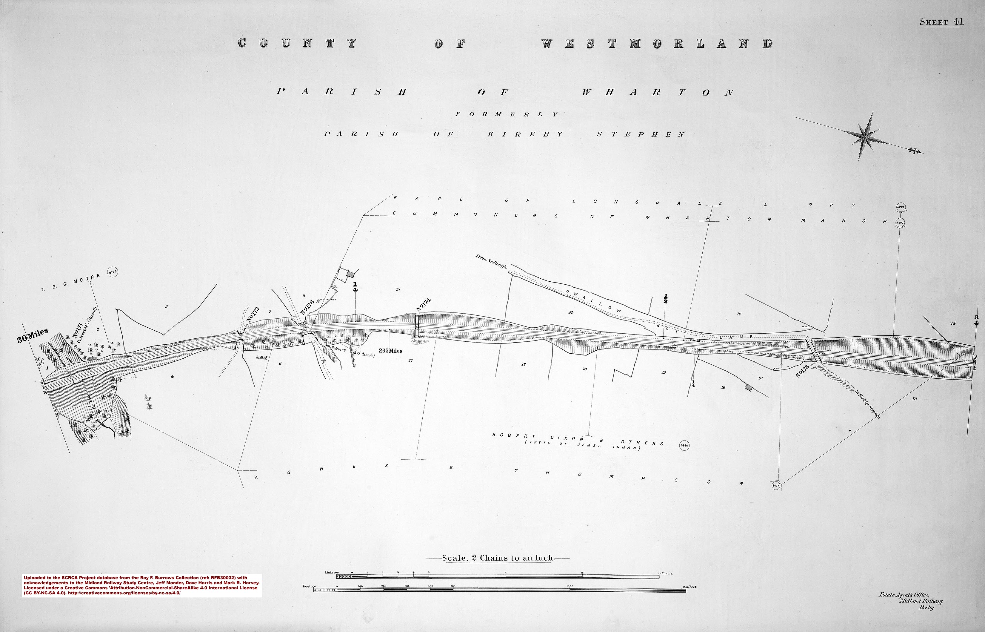
- sac-41-1911 = Sheet 41 - 265 miles.
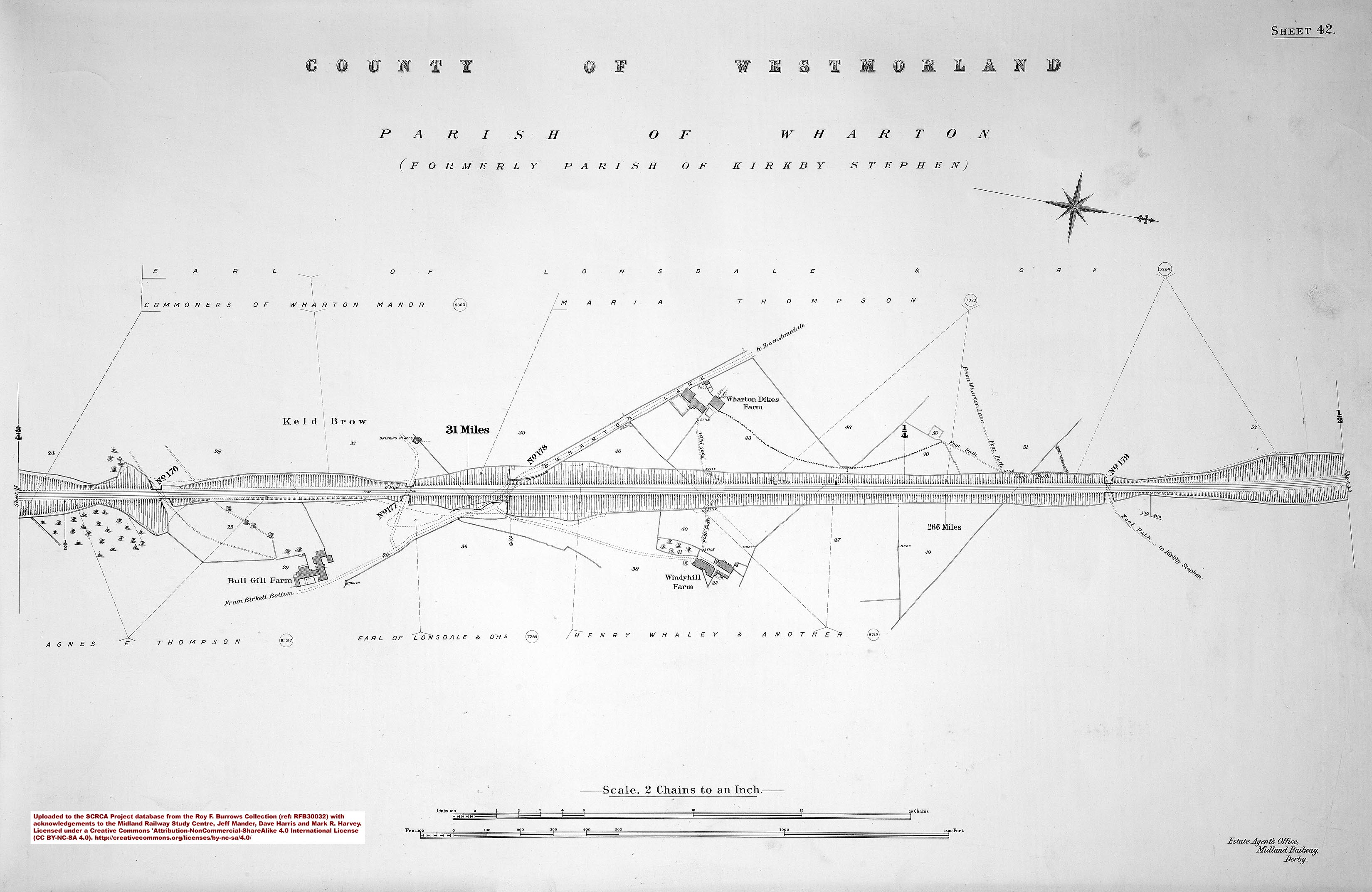
- sac-42-1911 = Sheet 42 - 266 miles.
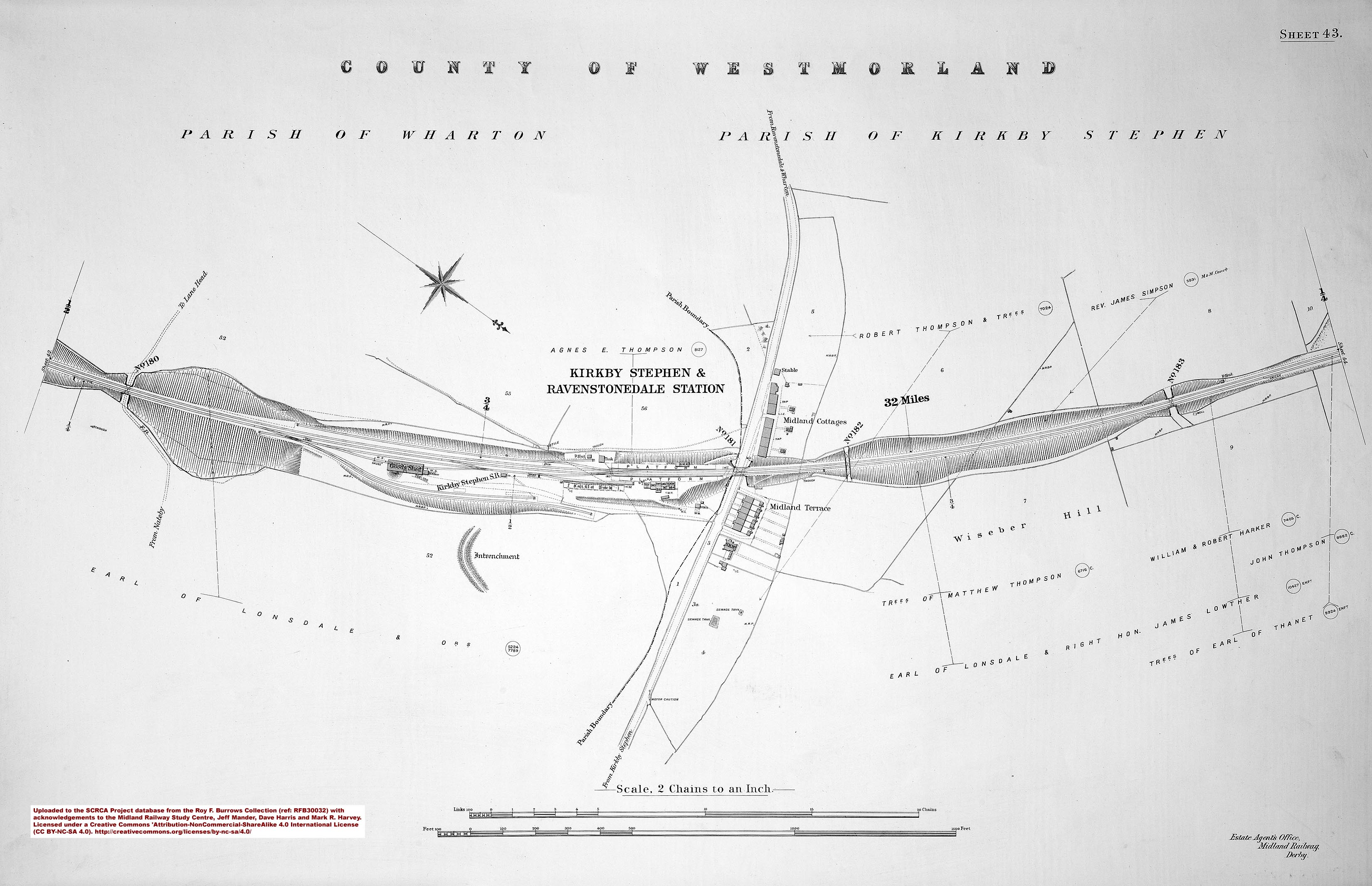
- sac-43-1911 = Sheet 43 - Kirkby Stephen Station.
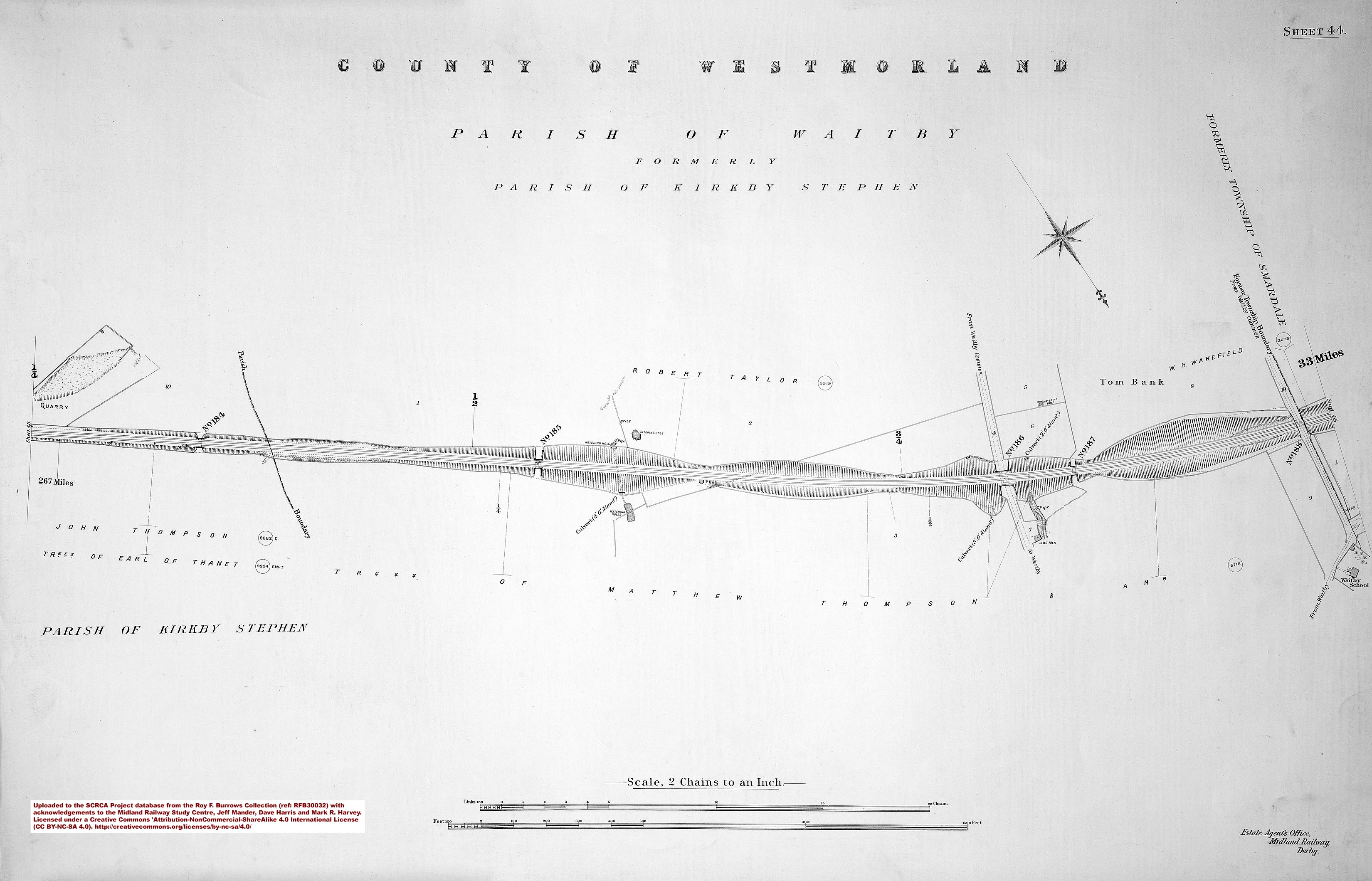
- sac-44-1911 = Sheet 44 - 267 miles.
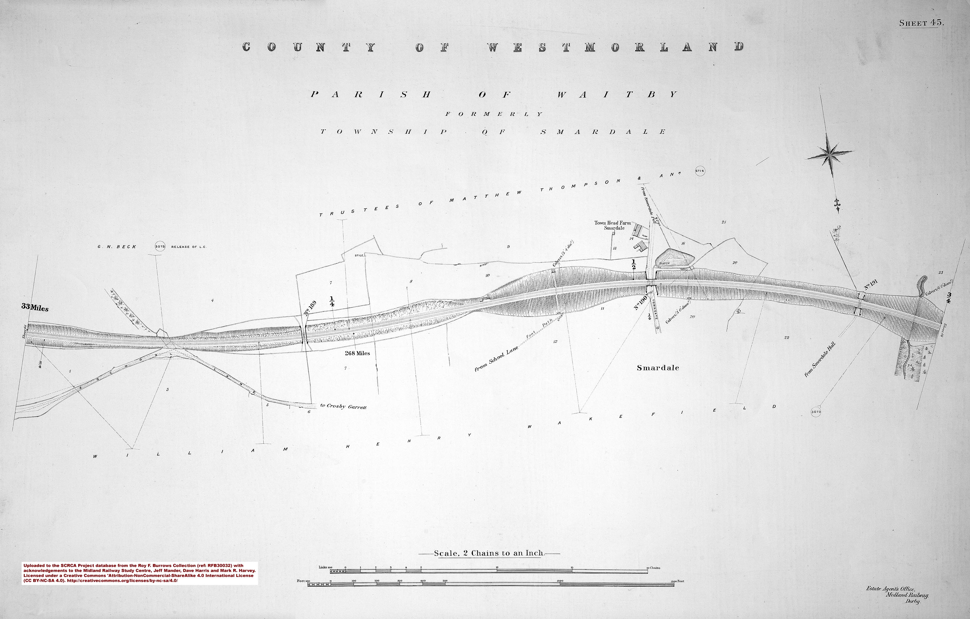
- sac-45-1911 = Sheet 45 - 268 miles.
- sac-46-1911 = Sheet 46 - 269 miles.
- sac-47-1911 = Sheet 47 - Crosby Garrett Station.
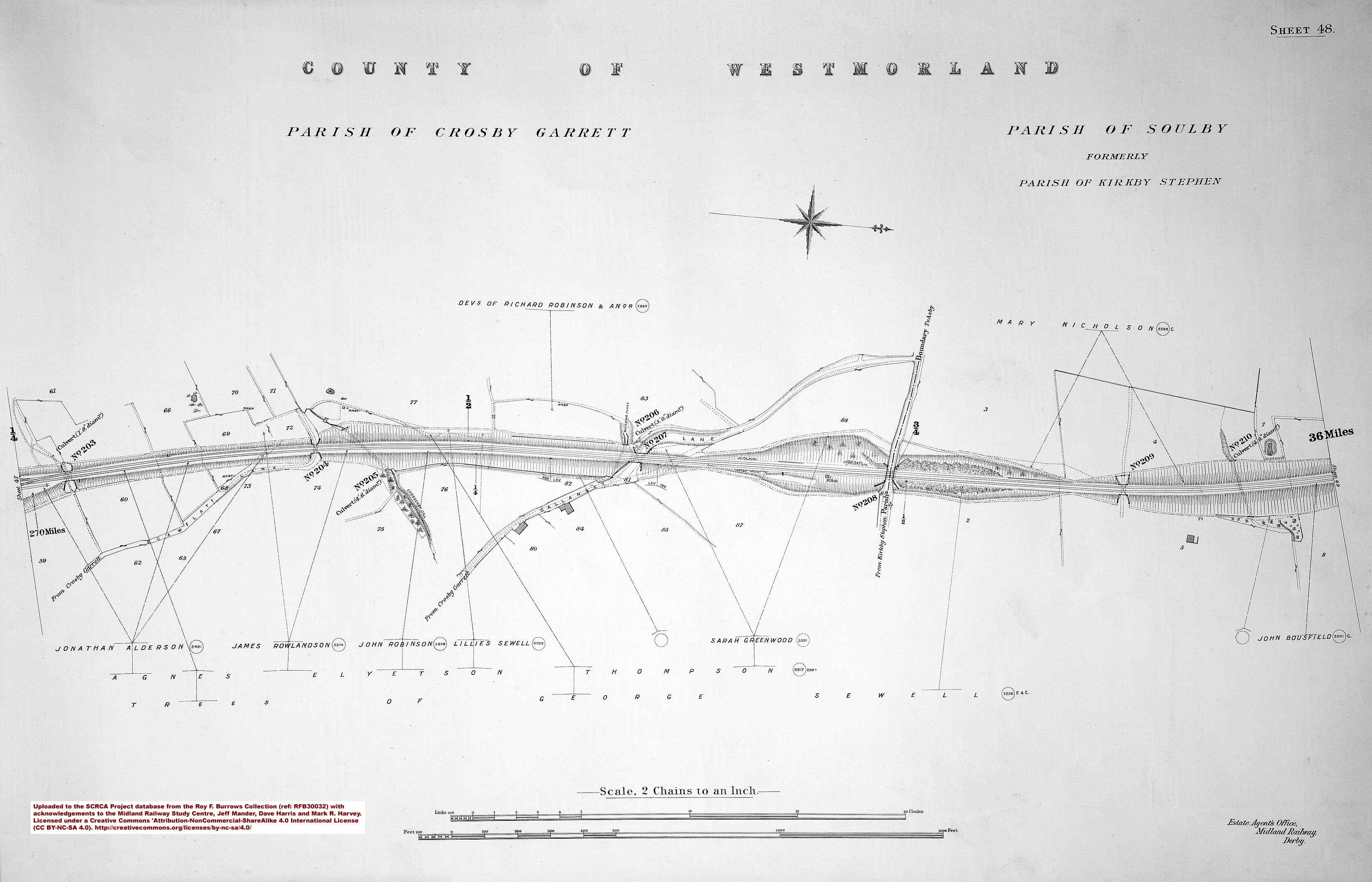
- sac-48-1911 = Sheet 48 - 270 miles.
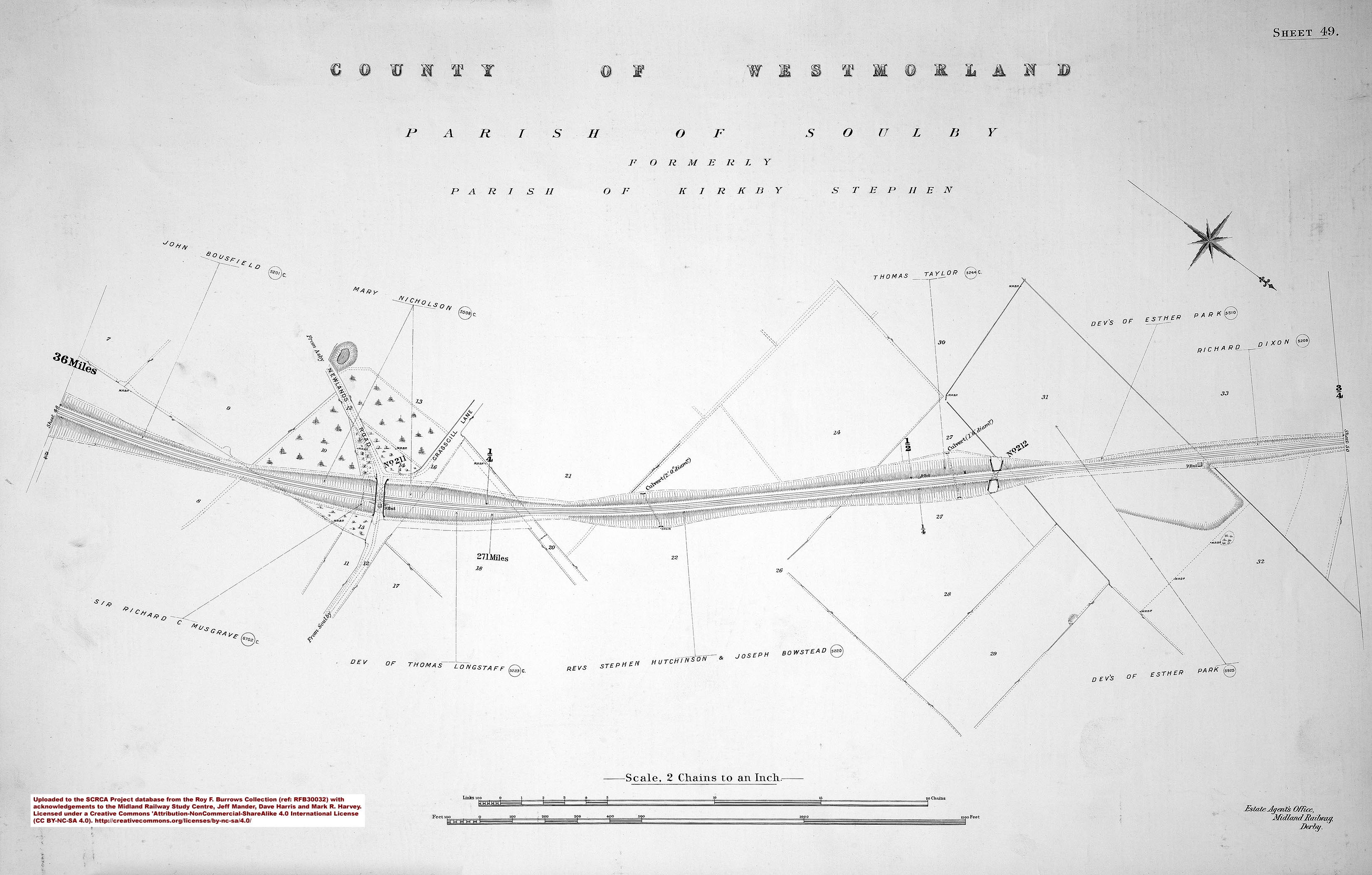
- sac-49-1911 = Sheet 49 - 271 miles.
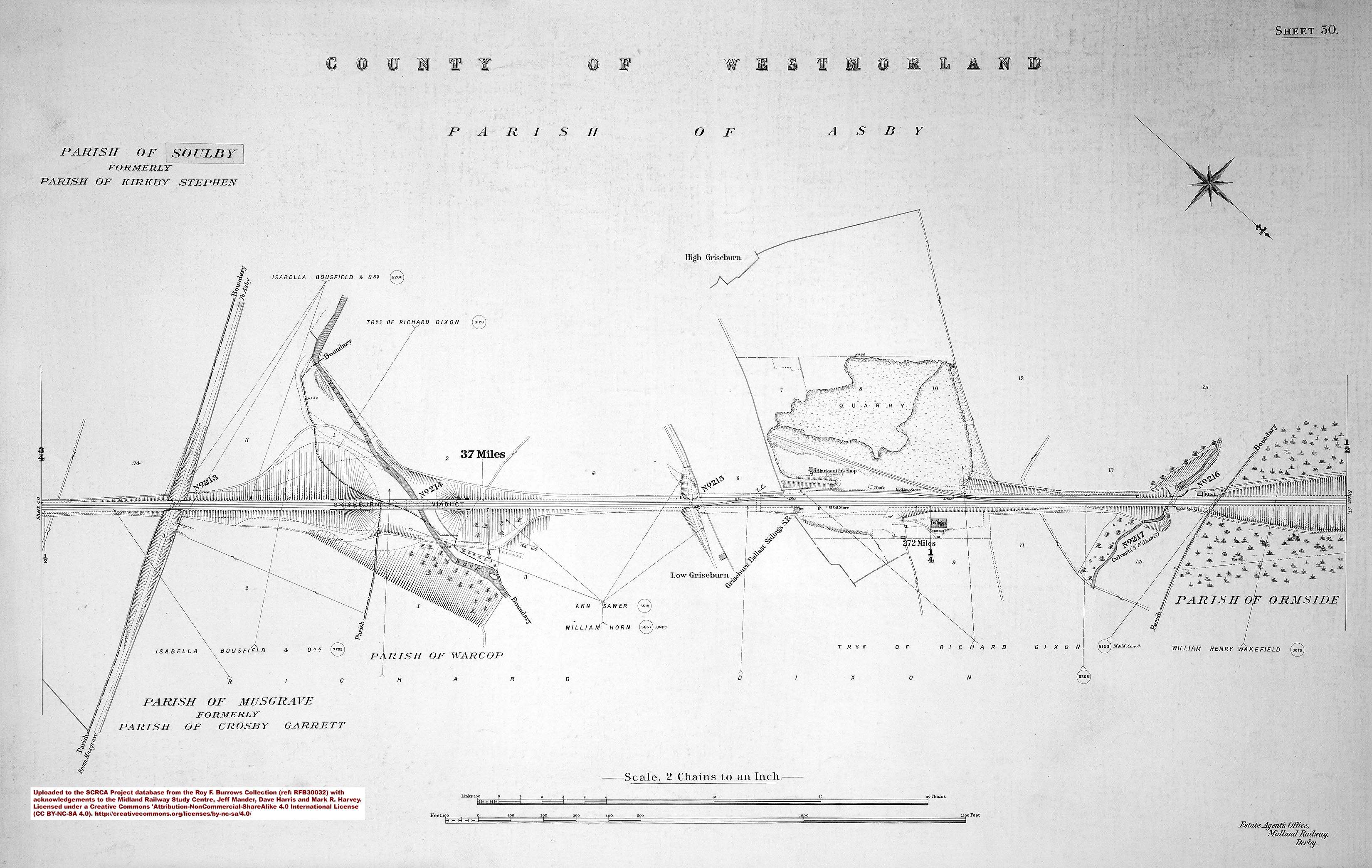
- sac-50-1911 = Sheet 50 - 272 miles.
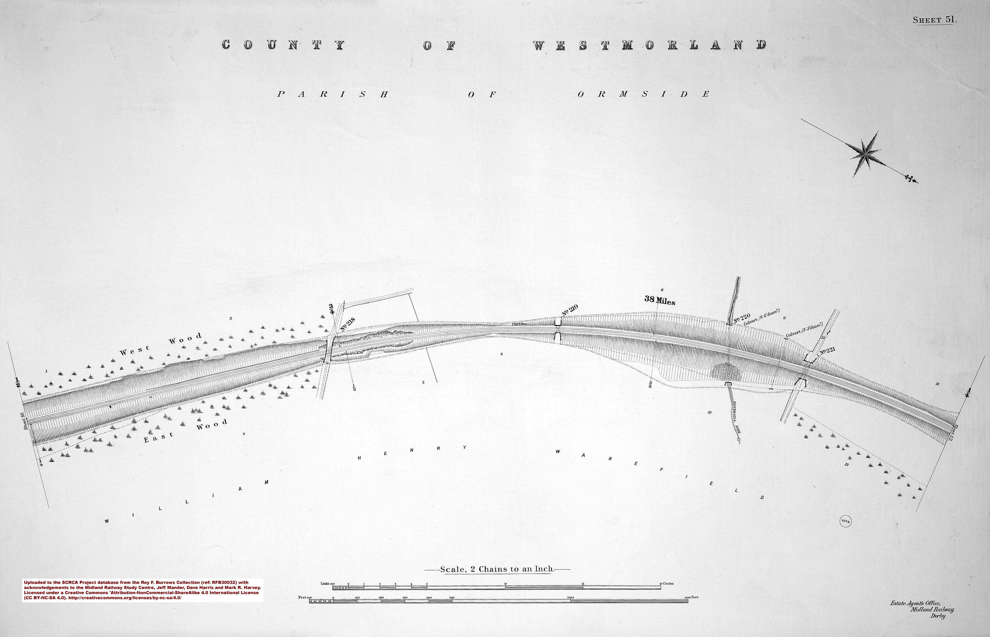
- sac-51-1911 = Sheet 51.
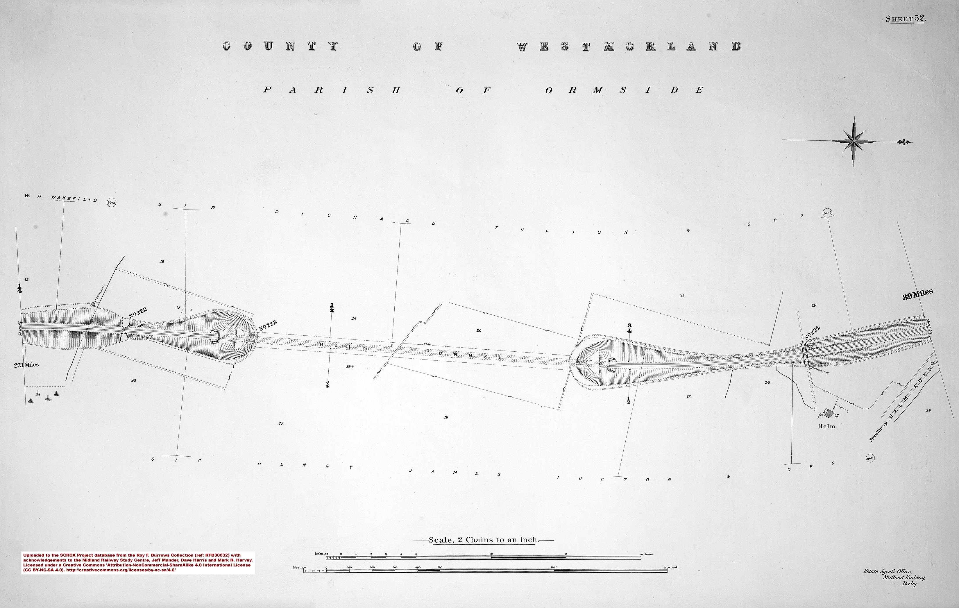
- sac-52-1911 = Sheet 52 - 273 miles.
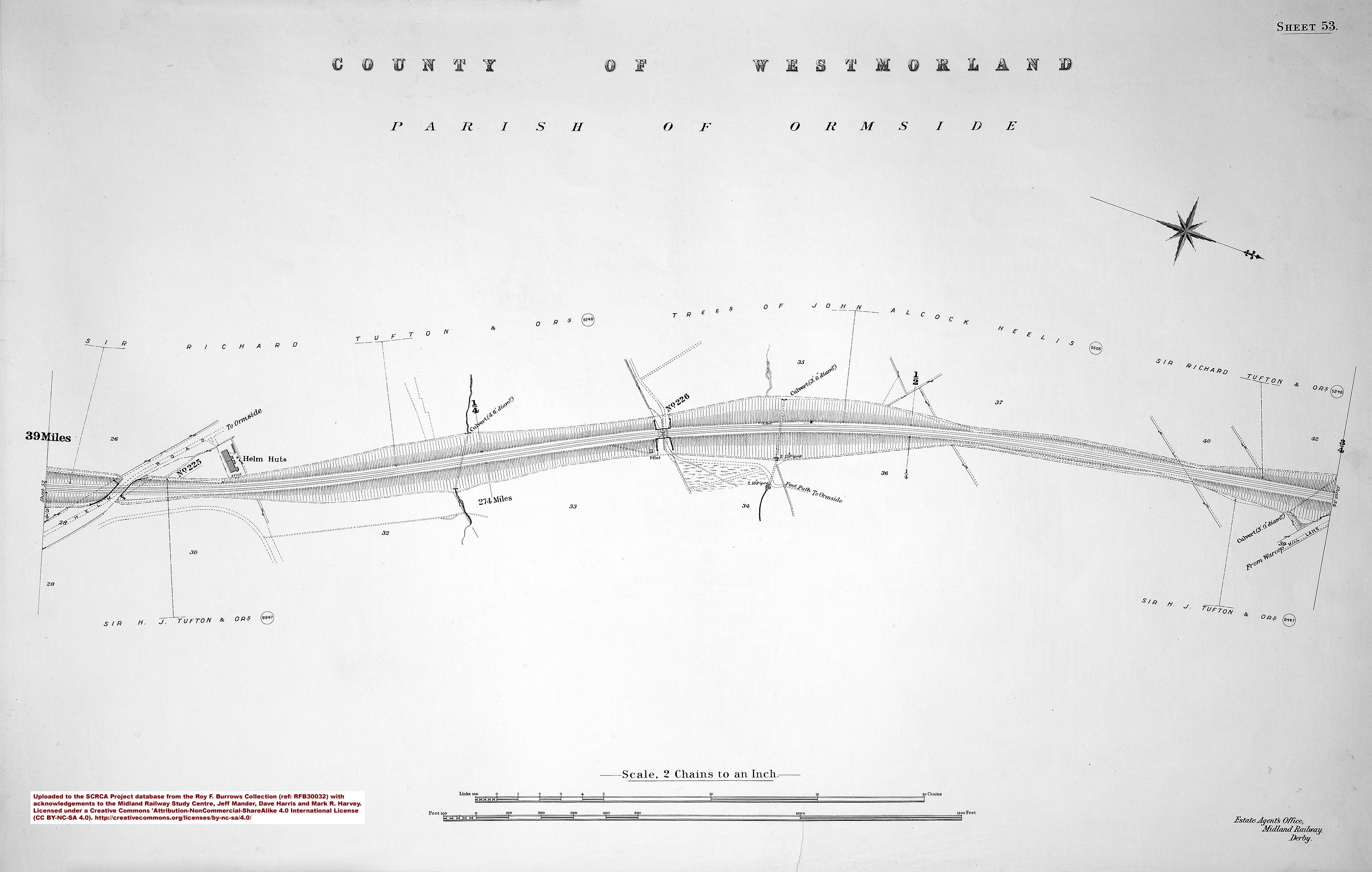
- sac-53-1911 = Sheet 53 - 274 miles.
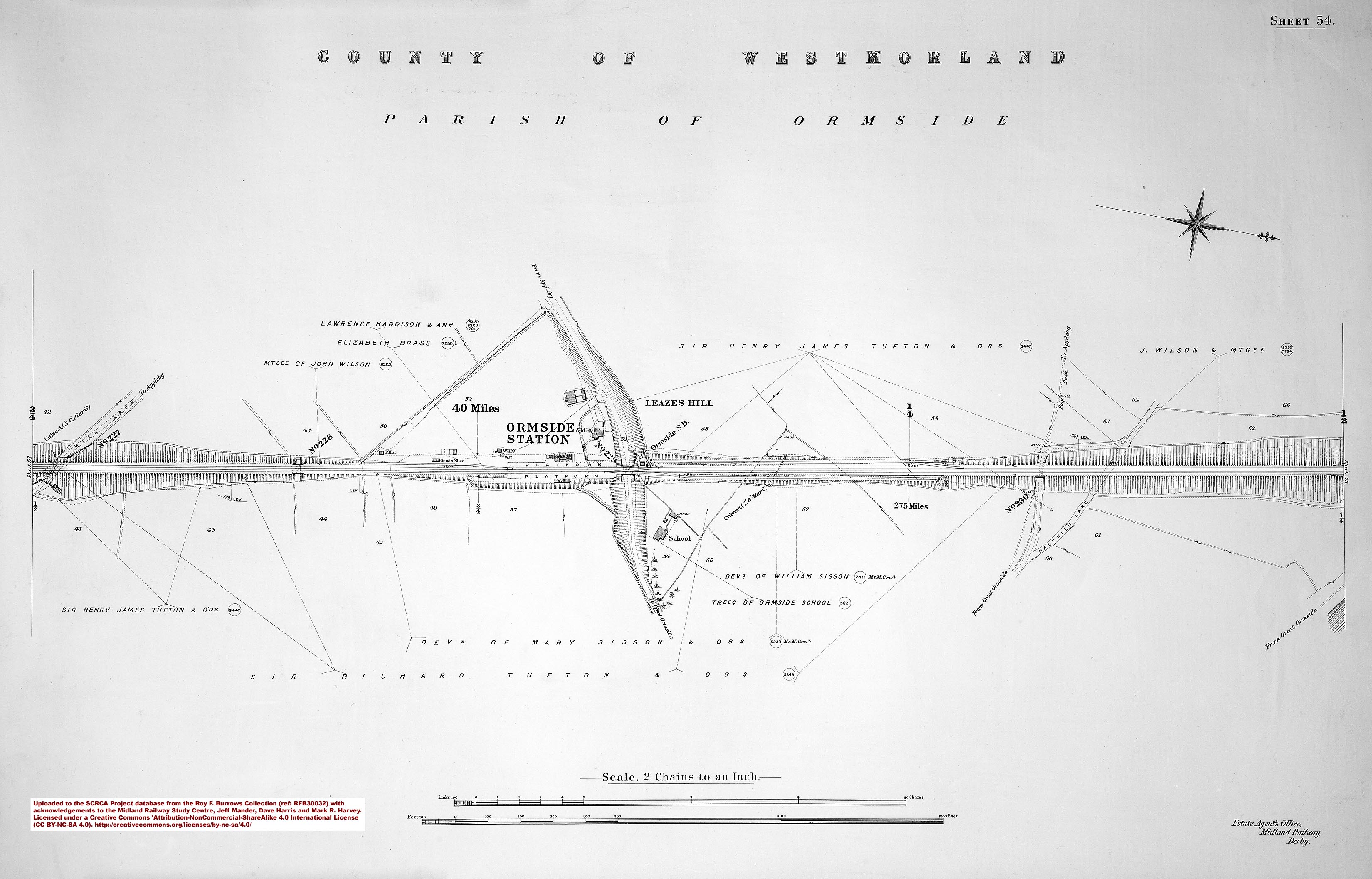
- sac-54-1911 = Sheet 54 - 275 miles and Ormside Station.
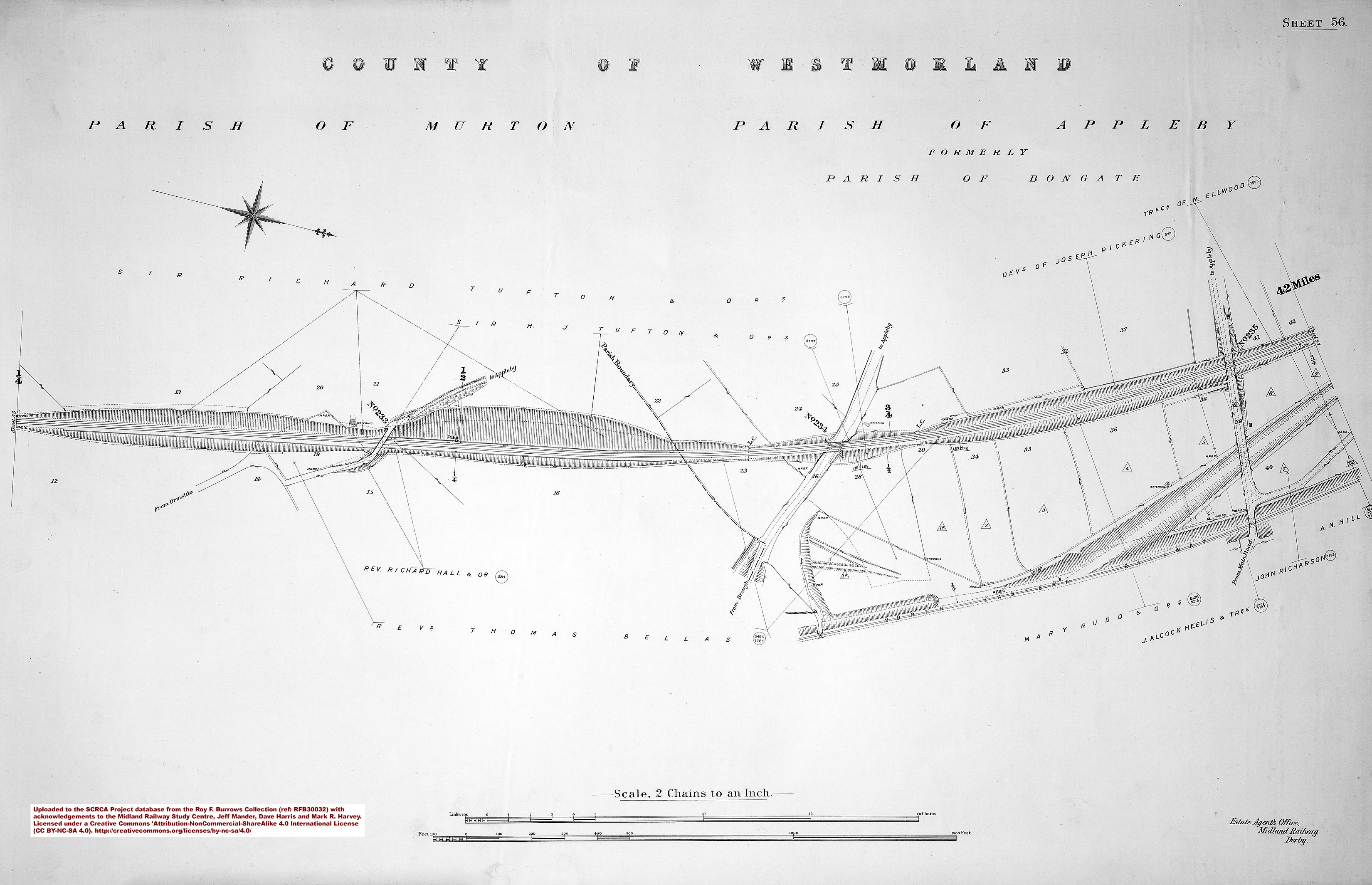
- sac-55-1911 = Sheet 55 - 276 miles.
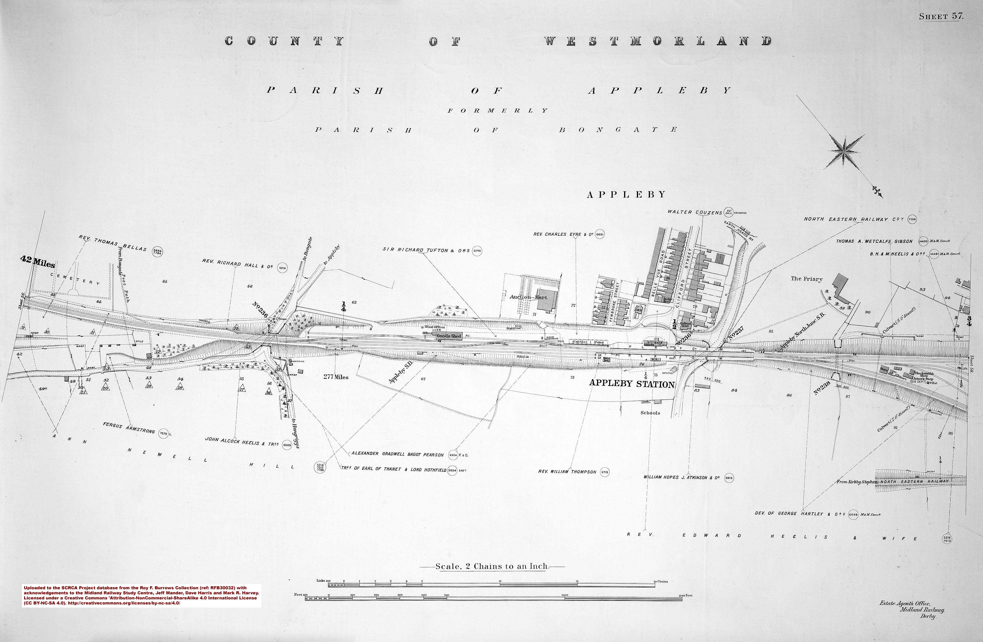
- sac-56-1911 = Sheet 56.
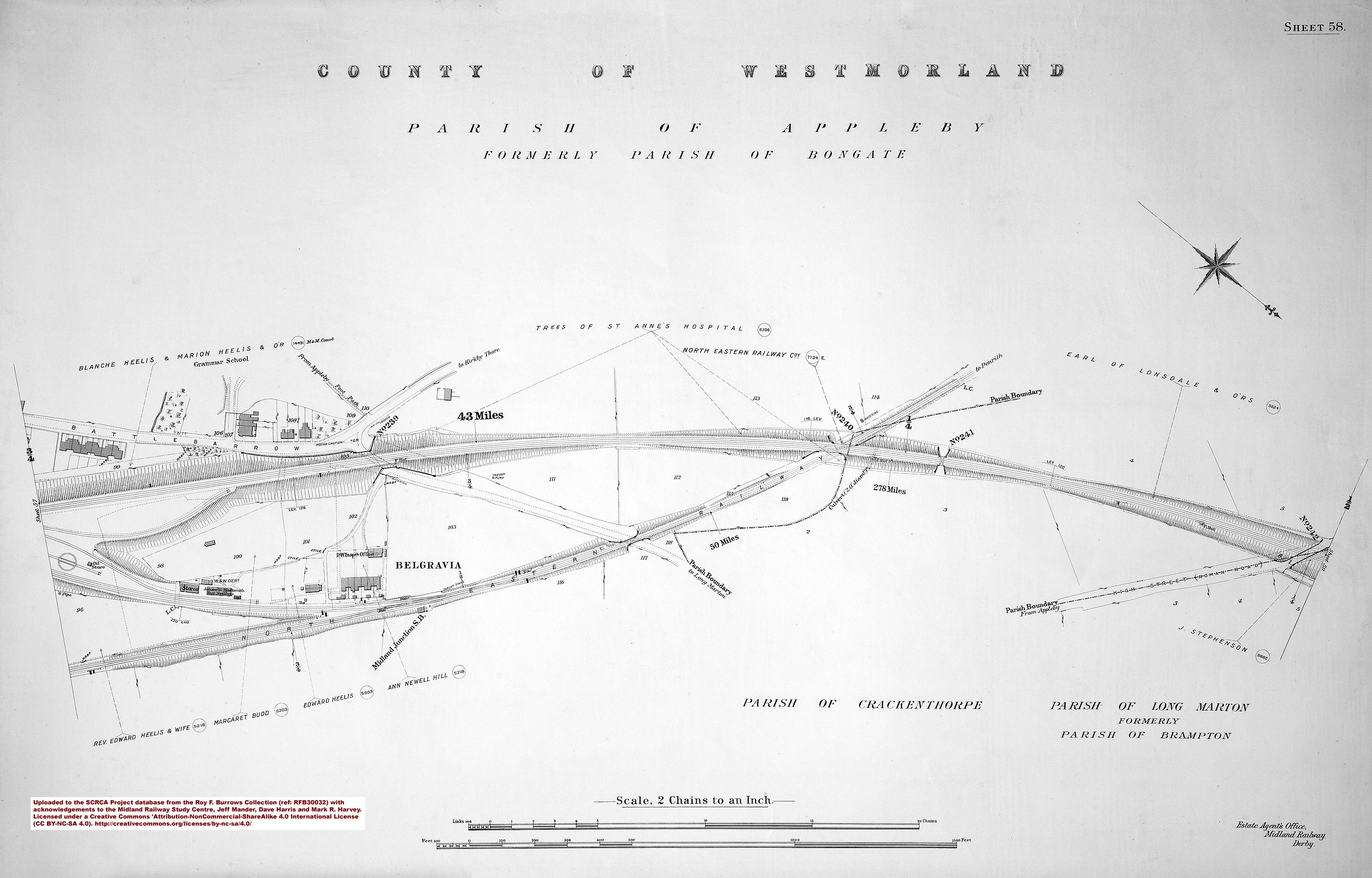
- sac-57-1911 = Sheet 57 - 277 miles and Appleby Station.
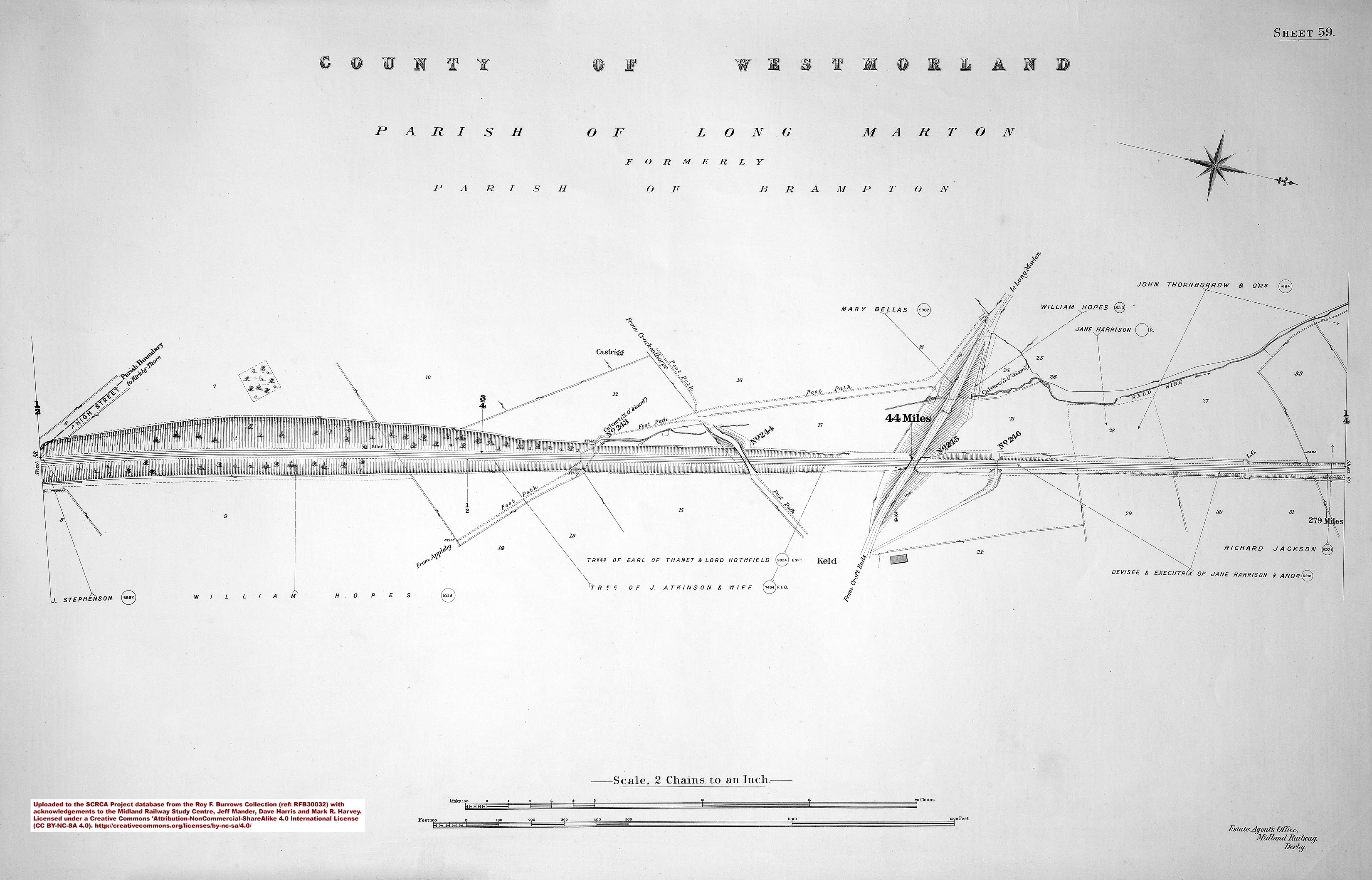
- sac-58-1911 = Sheet 58 - 278 miles.
- sac-59-1911 = Sheet 59 - 279 miles.
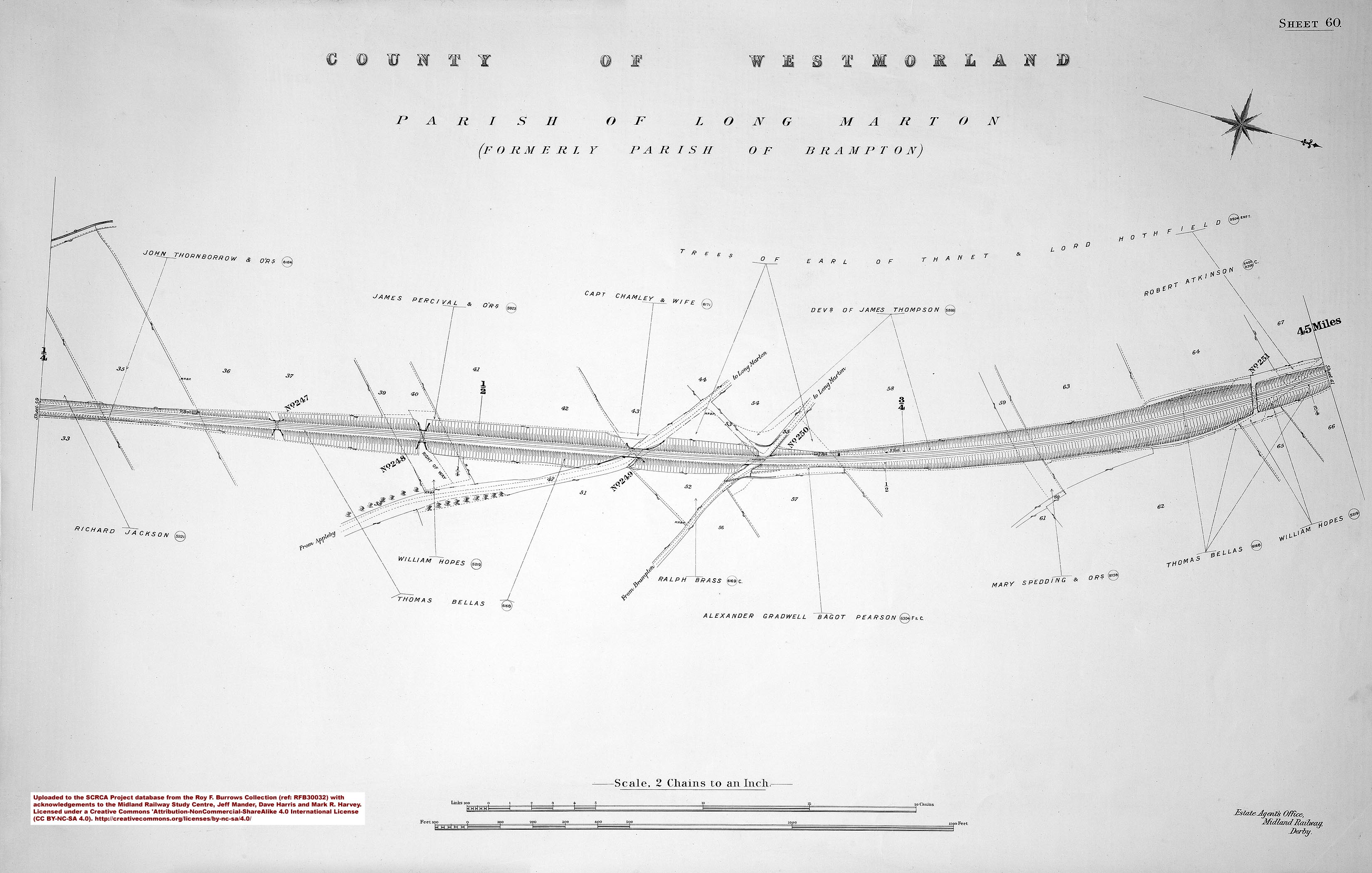
- sac-60-1911 = Sheet 60.
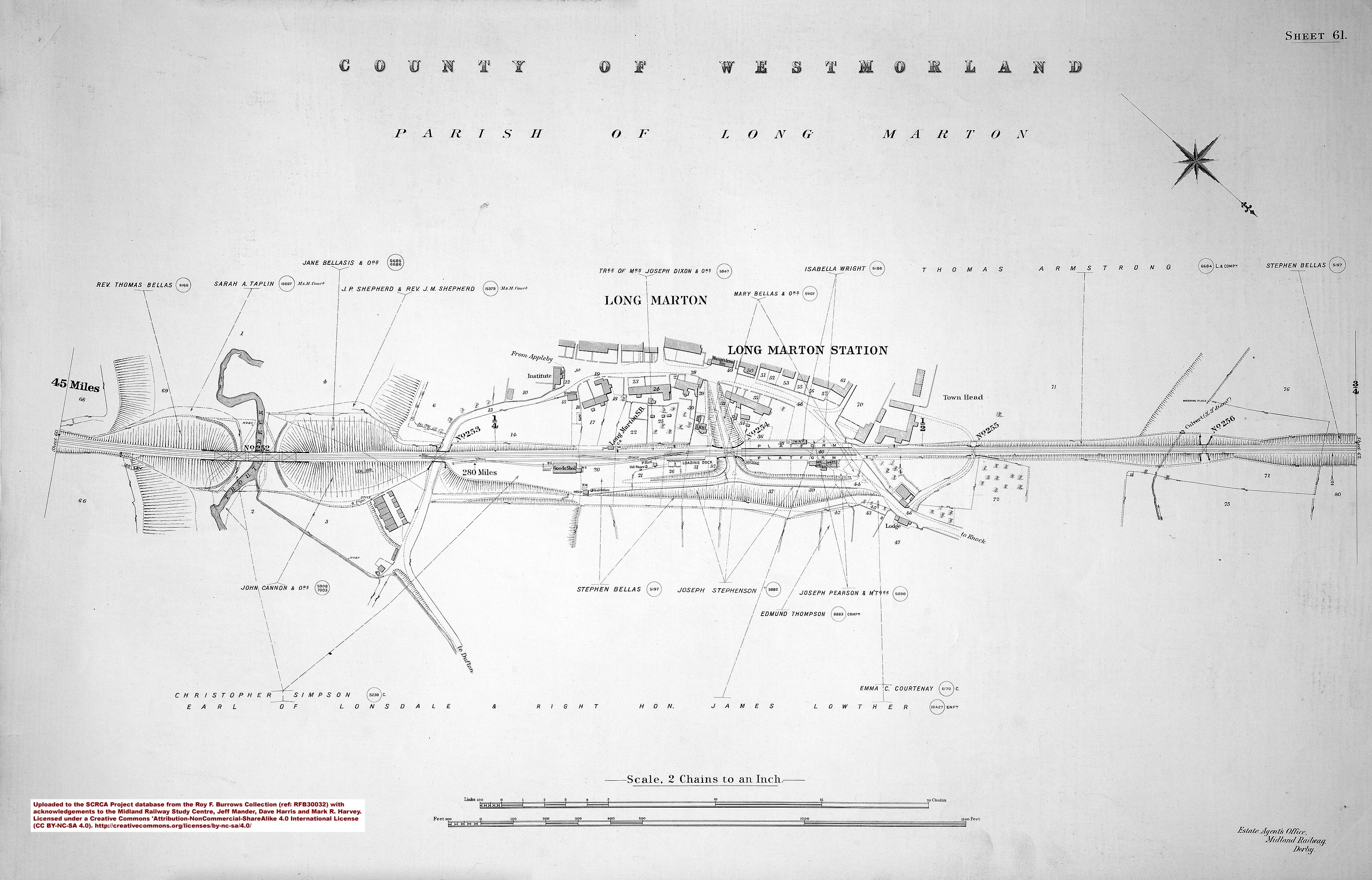
- sac-61-1911 = Sheet 61 - 280 miles and Long Marton Station.
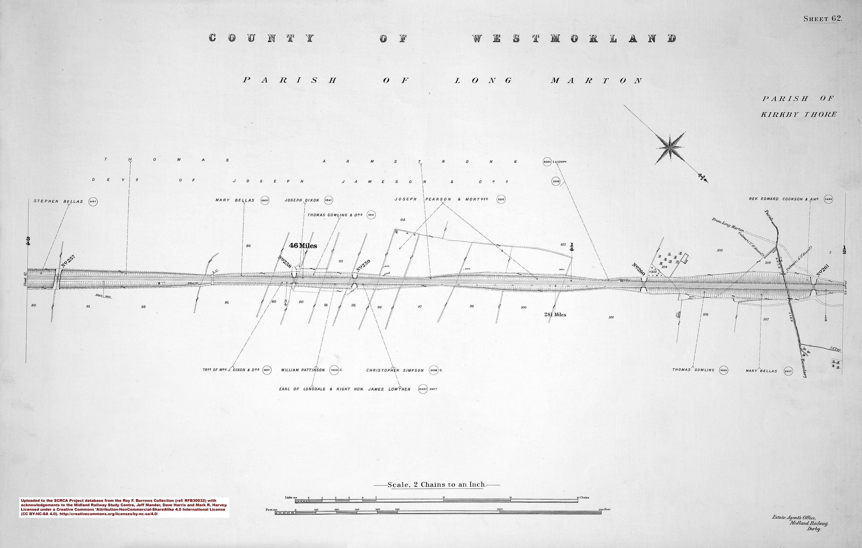
- sac-62-1911 = Sheet 62 - 281 miles.
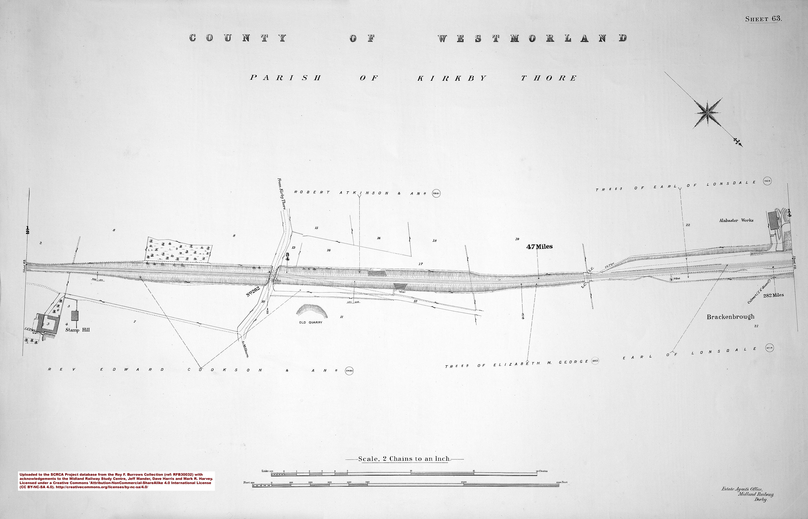
- sac-63-1911 = Sheet 63 - 282 miles.
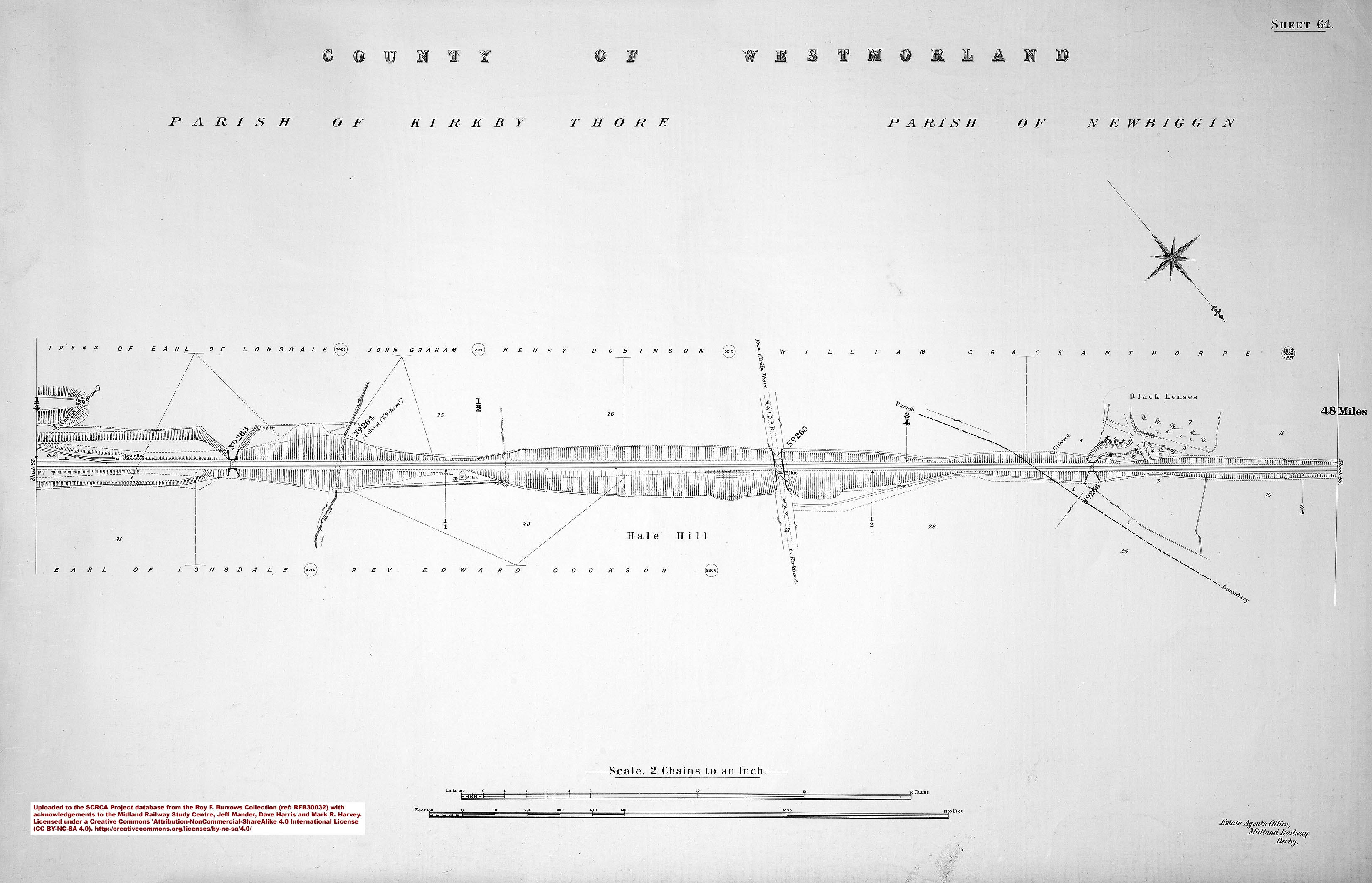
- sac-64-1911 = Sheet 64.
- sac-65-1911 = Sheet 65 - 283 miles and New Biggin Station.
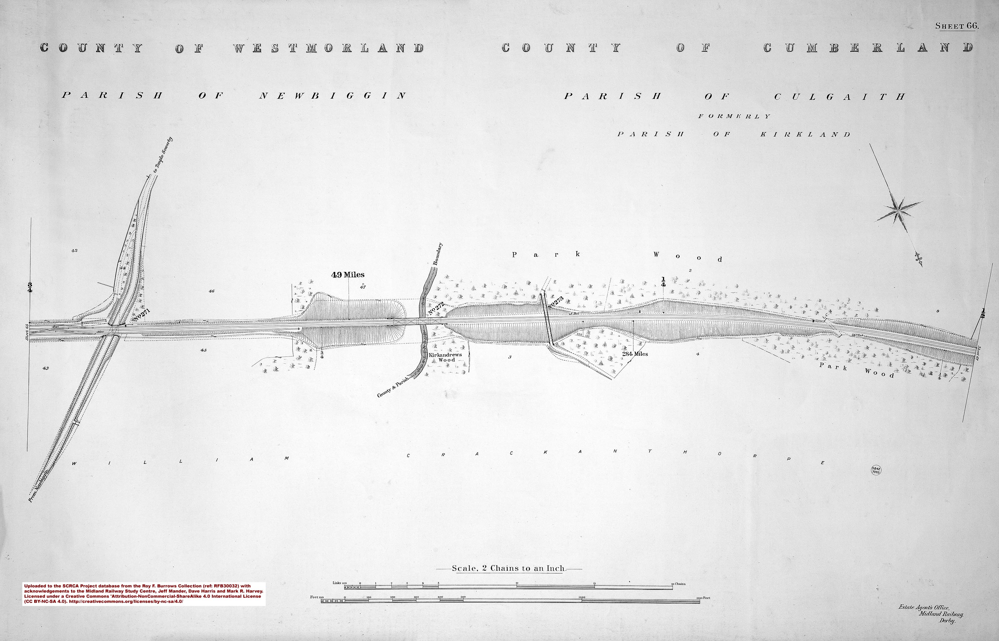
- sac-66-1911 = Sheet 66 - 284 miles.
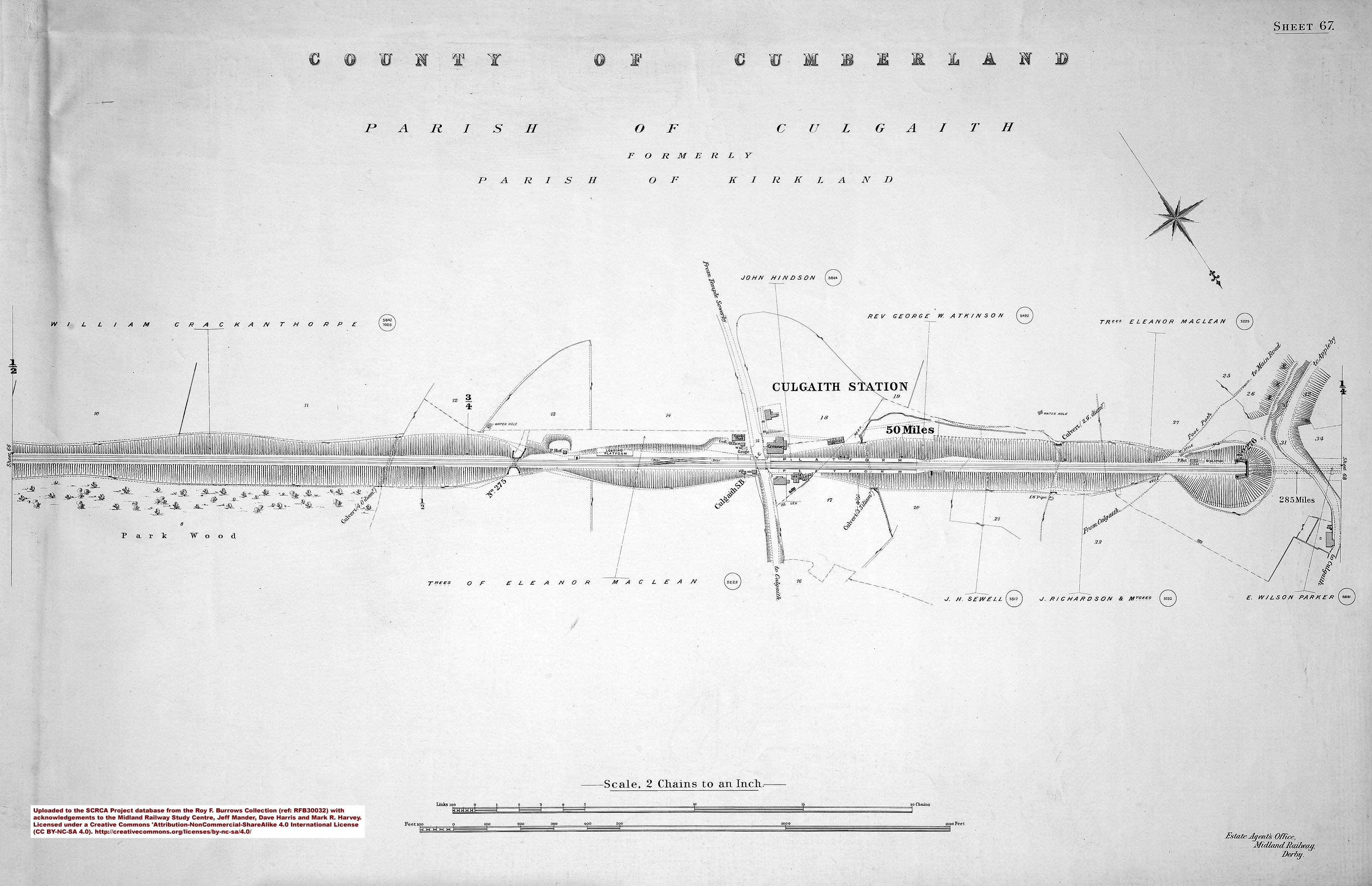
- sac-67-1911 = Sheet 67 - 285 miles and Culgaith Station.
 |
Image 3: Cover page and key for RFB30033 - Culgaith to Carlisle published in 1912.
|
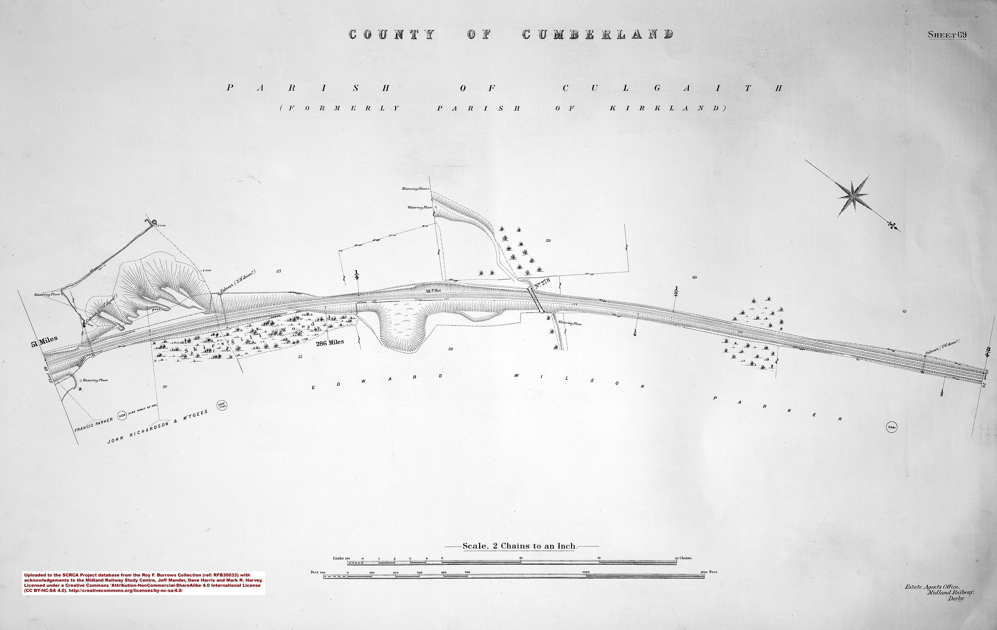
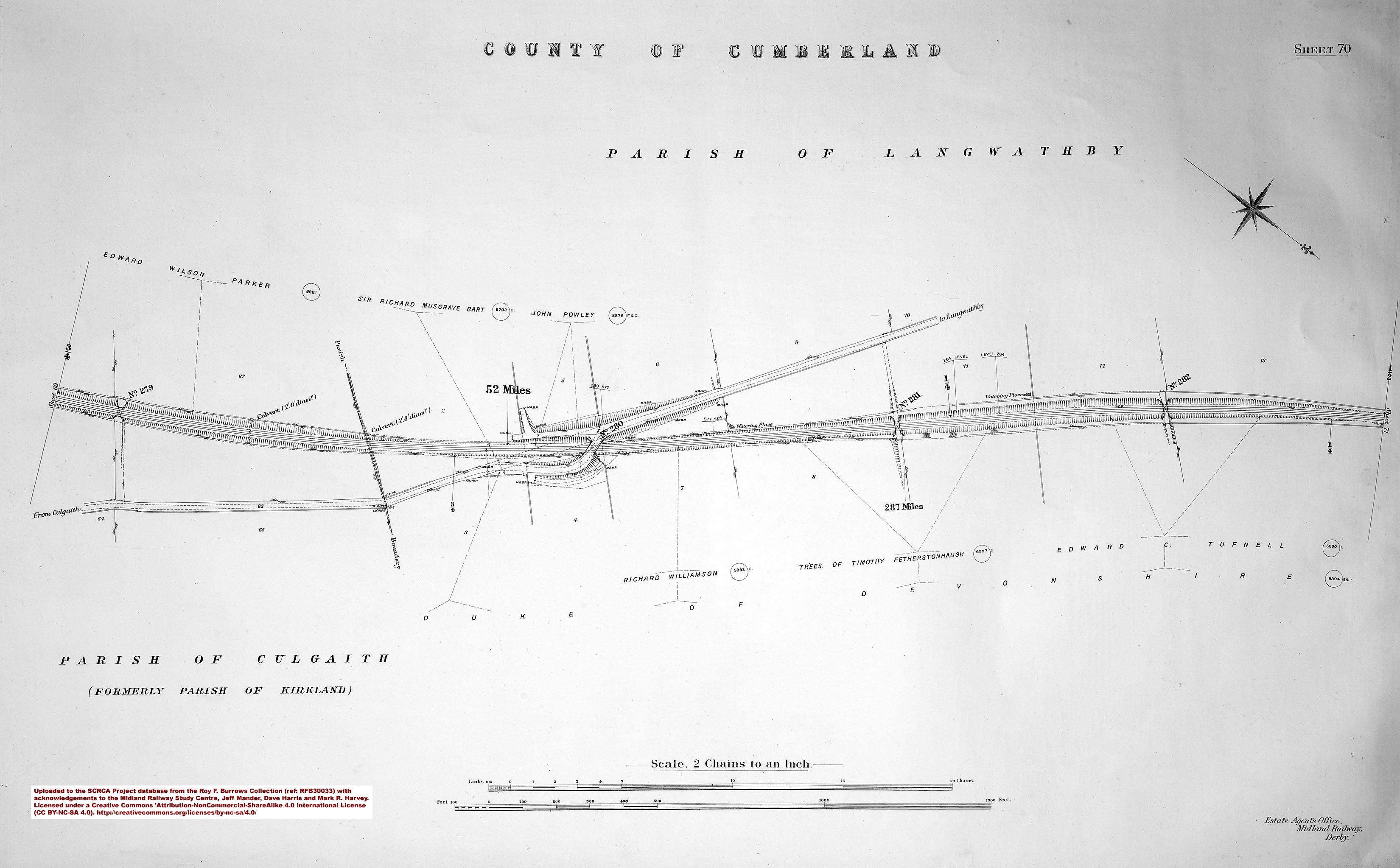
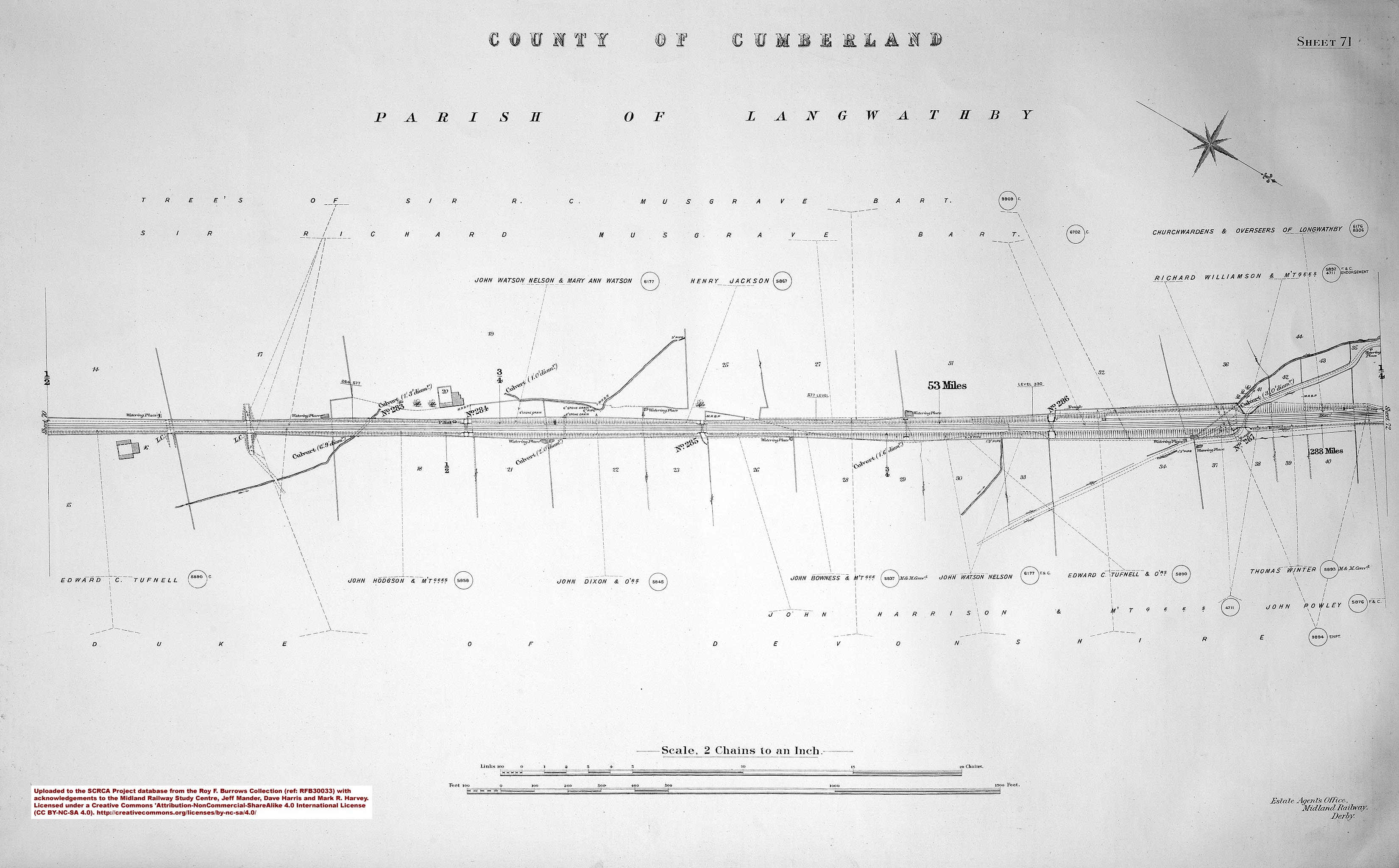
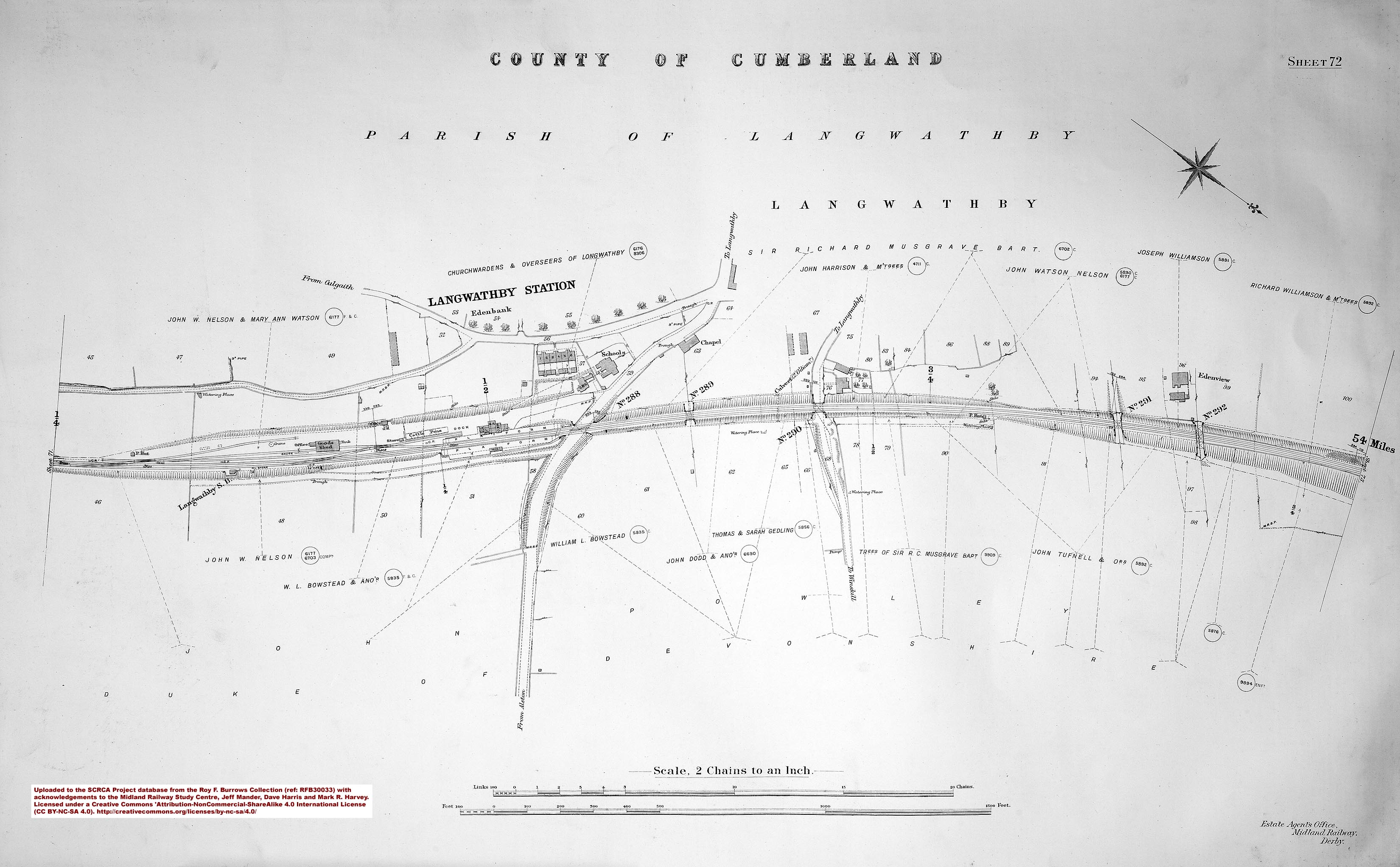
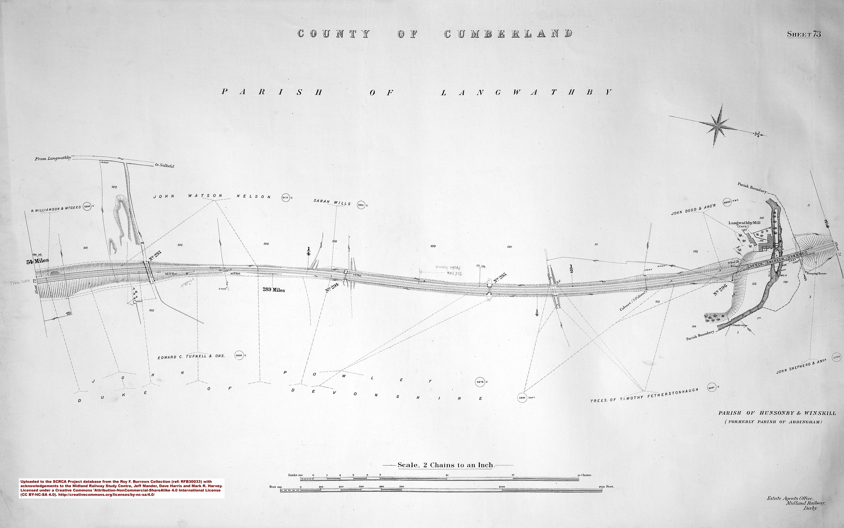
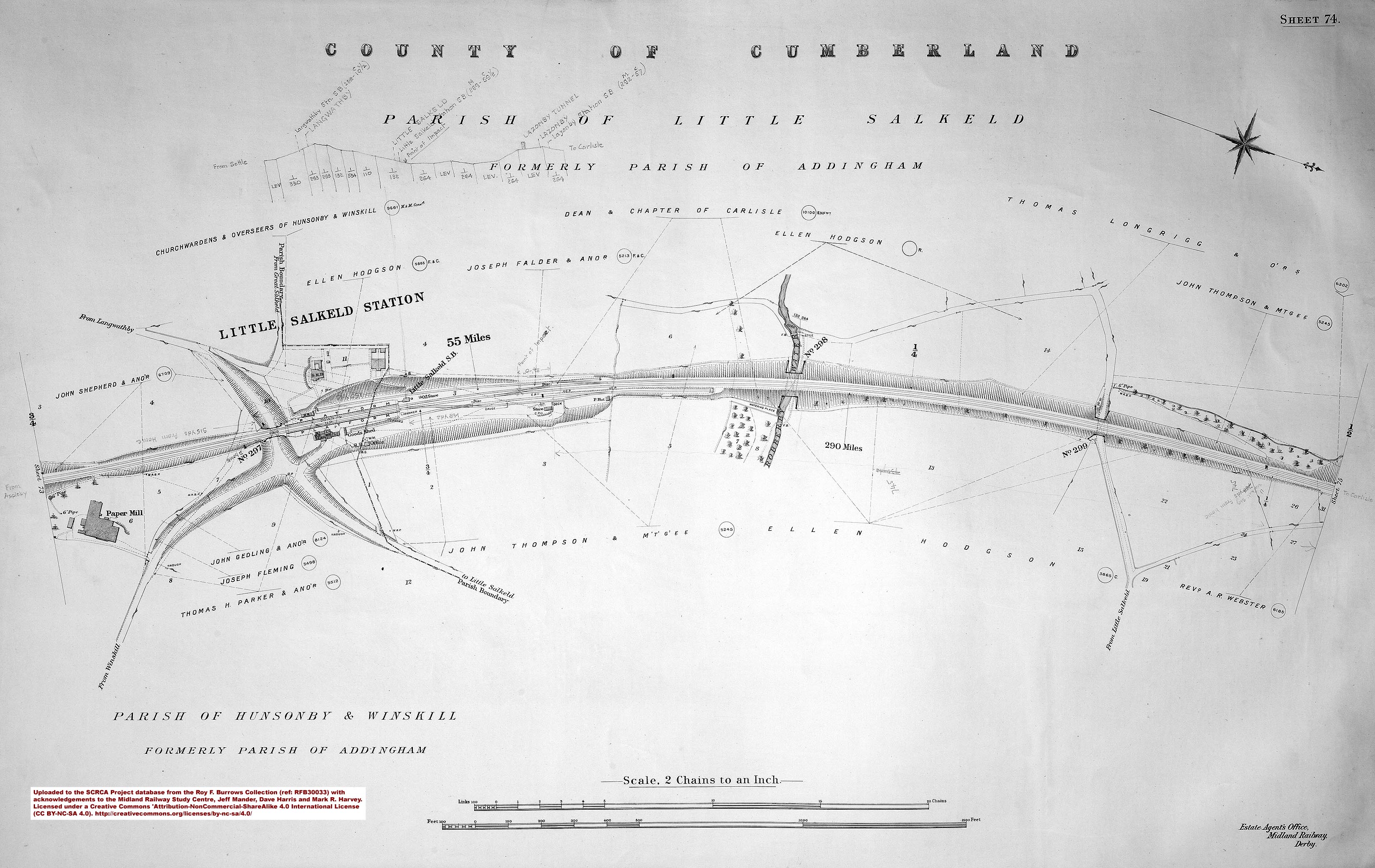
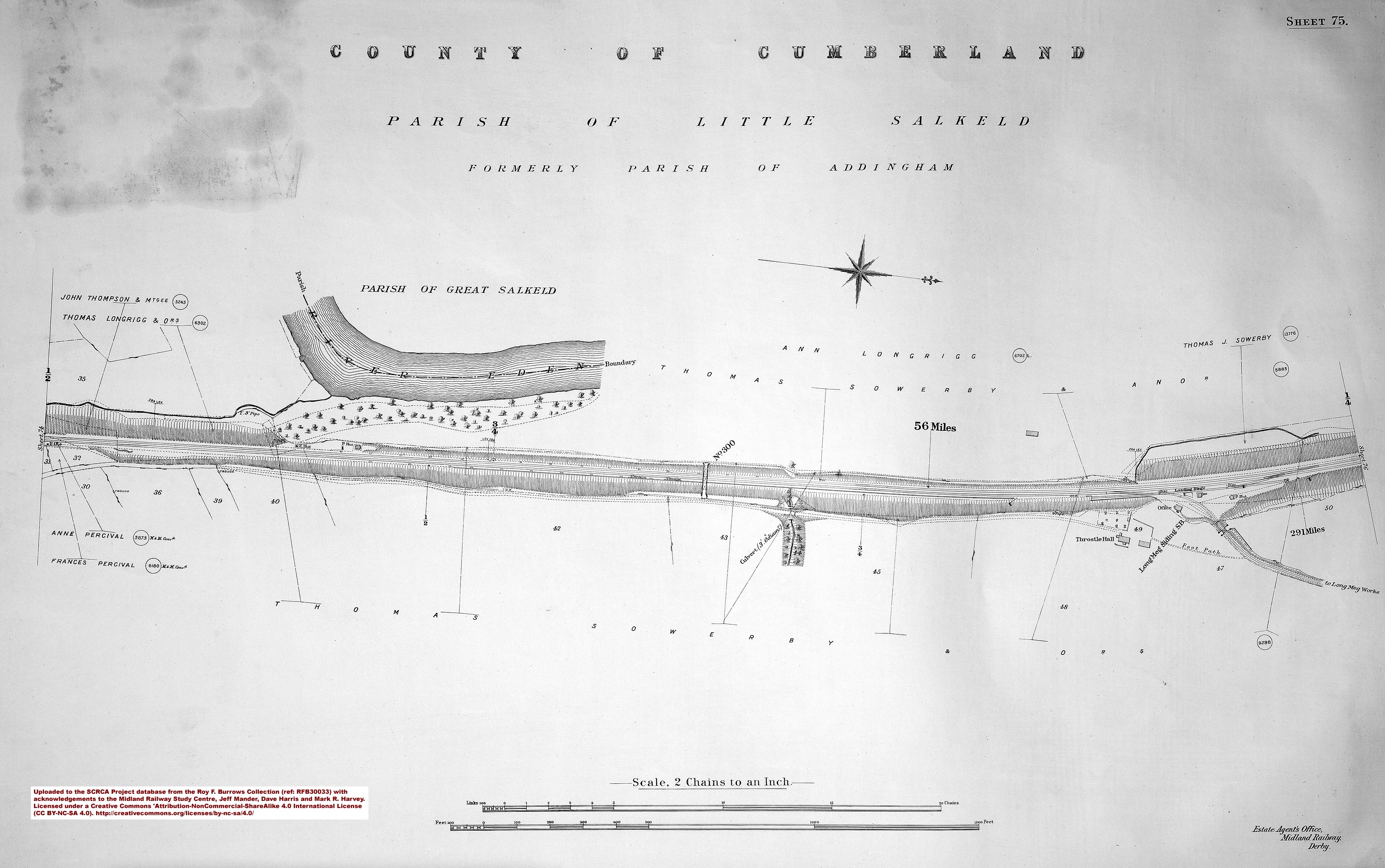
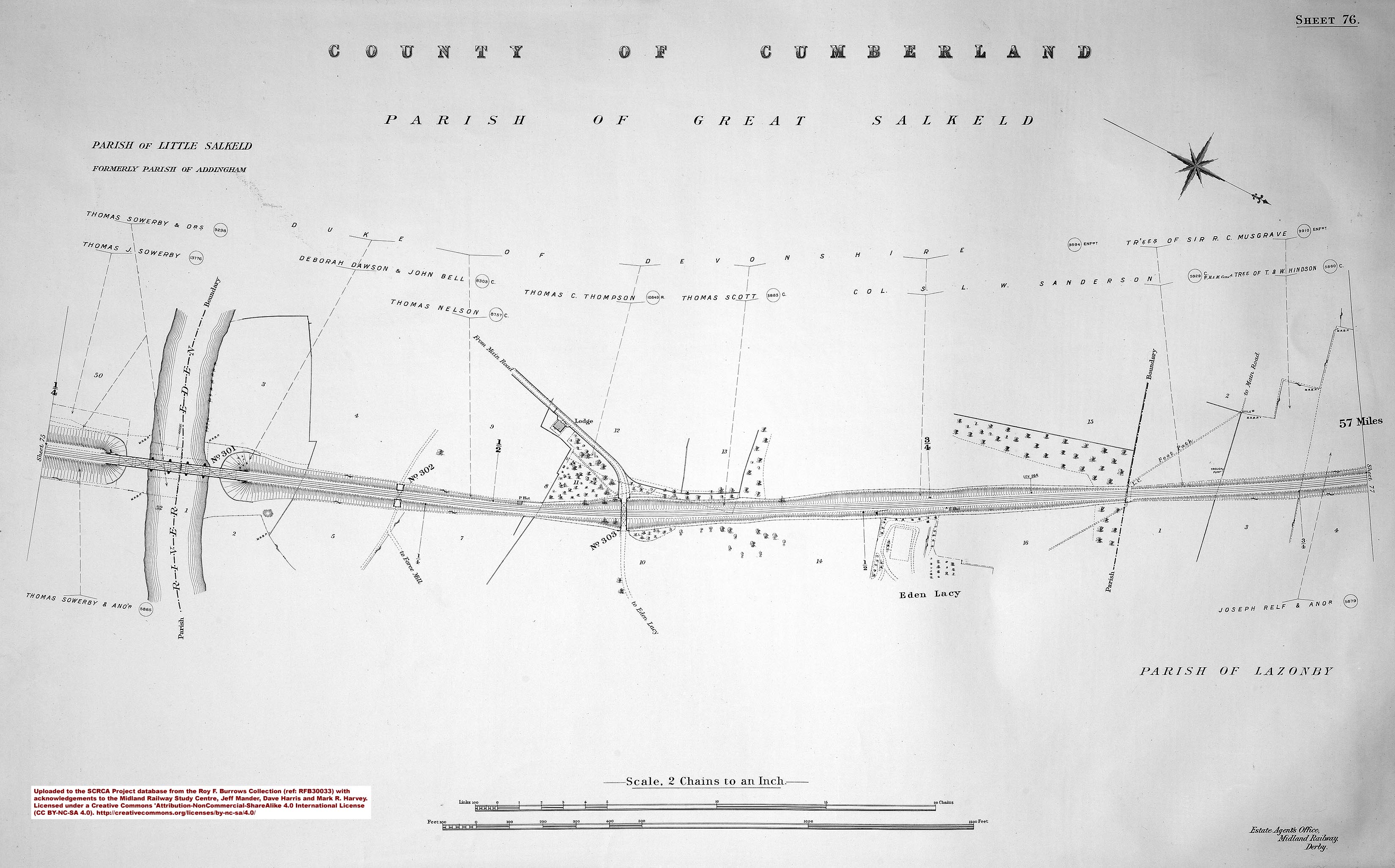
Reference RFB30033 - Culgaith to Carlisle (published in 1912):
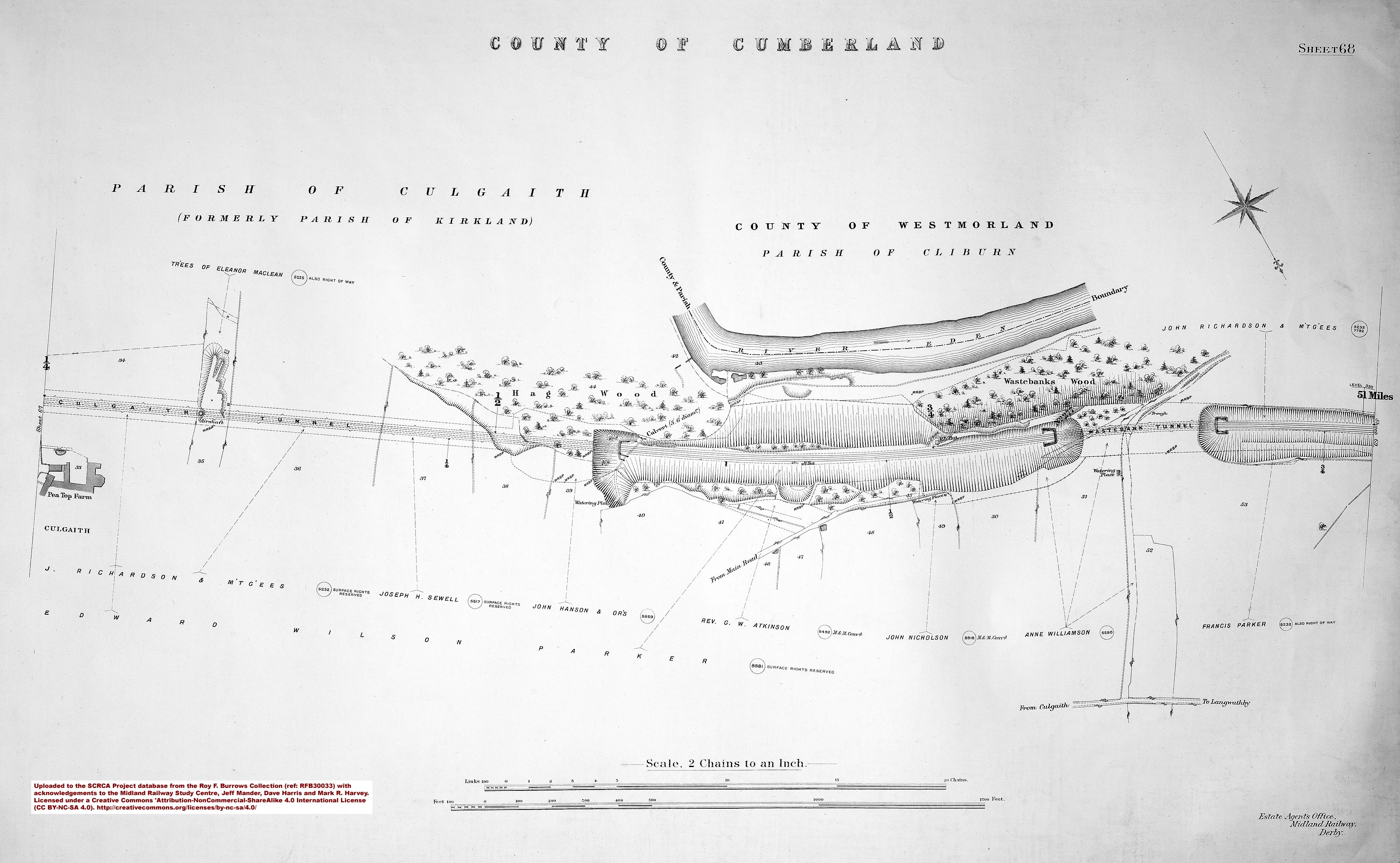
- sac-68-1912 = Sheet 68.
- sac-69-1912 = Sheet 69 - 286 miles.
- sac-70-1912 = Sheet 70 - 287 miles.
- sac-71-1912 = Sheet 71 - 288 miles.
- sac-72-1912 = Sheet 72 - Langwathby Station.
- sac-73-1912 = Sheet 73 - 289 miles.
- sac-74-1912 = Sheet 74 - 290 miles and Little Salkeld Station.
- sac-75-1912 = Sheet 75 - 291 miles.
- sac-76-1912 = Sheet 76.
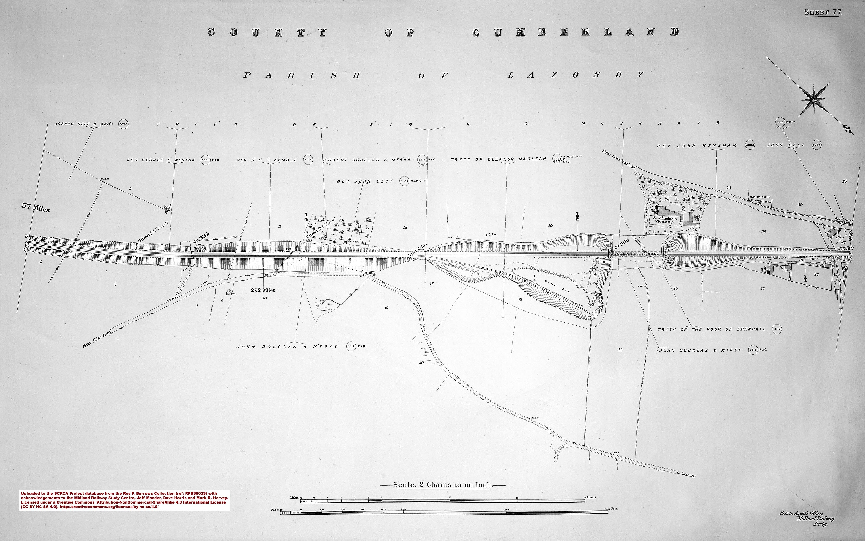
- sac-77-1912 = Sheet 77 - 292 miles.
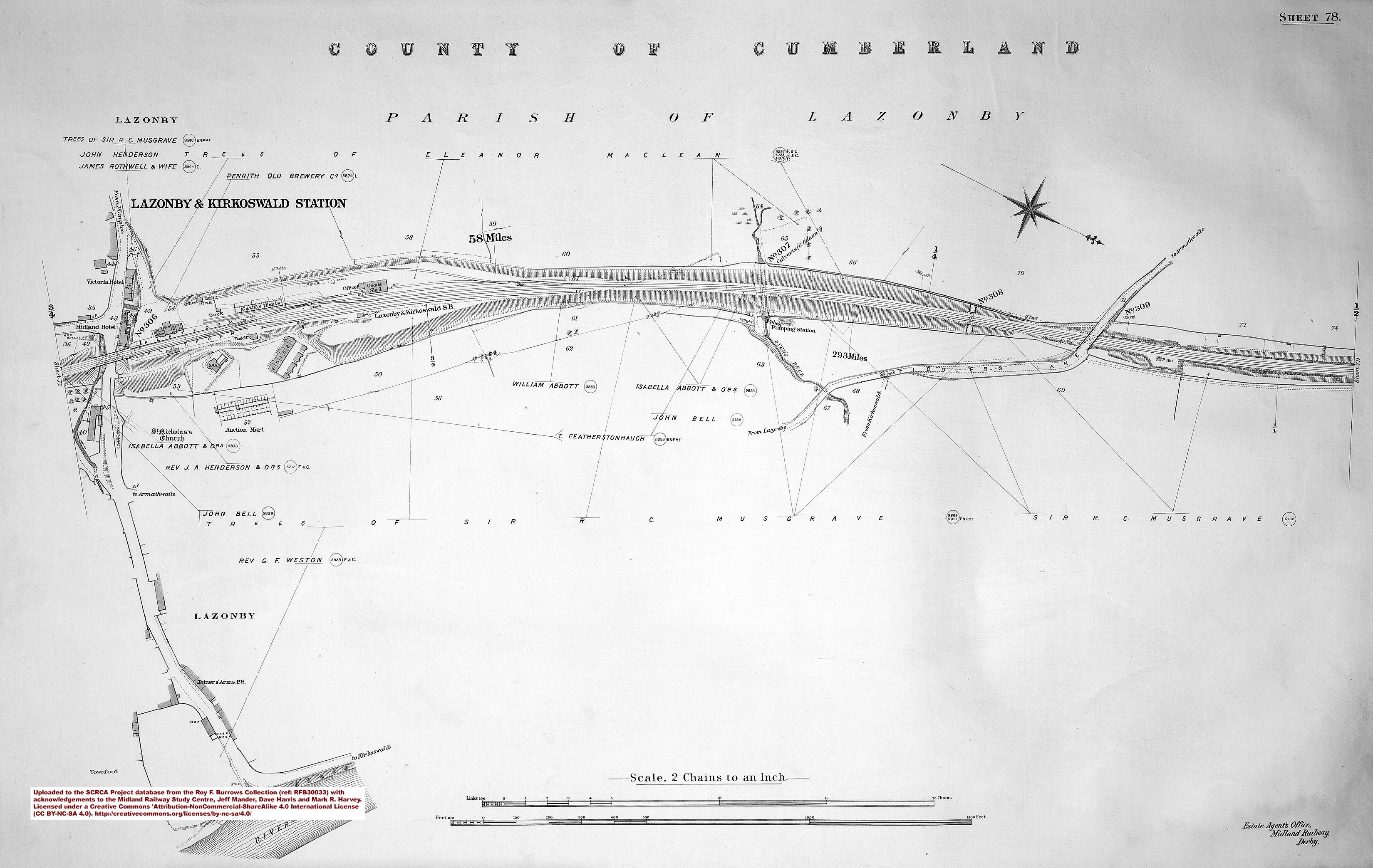
- sac-78-1912 = Sheet 78 - 293 miles and Lazonby & Kirkoswald Station.
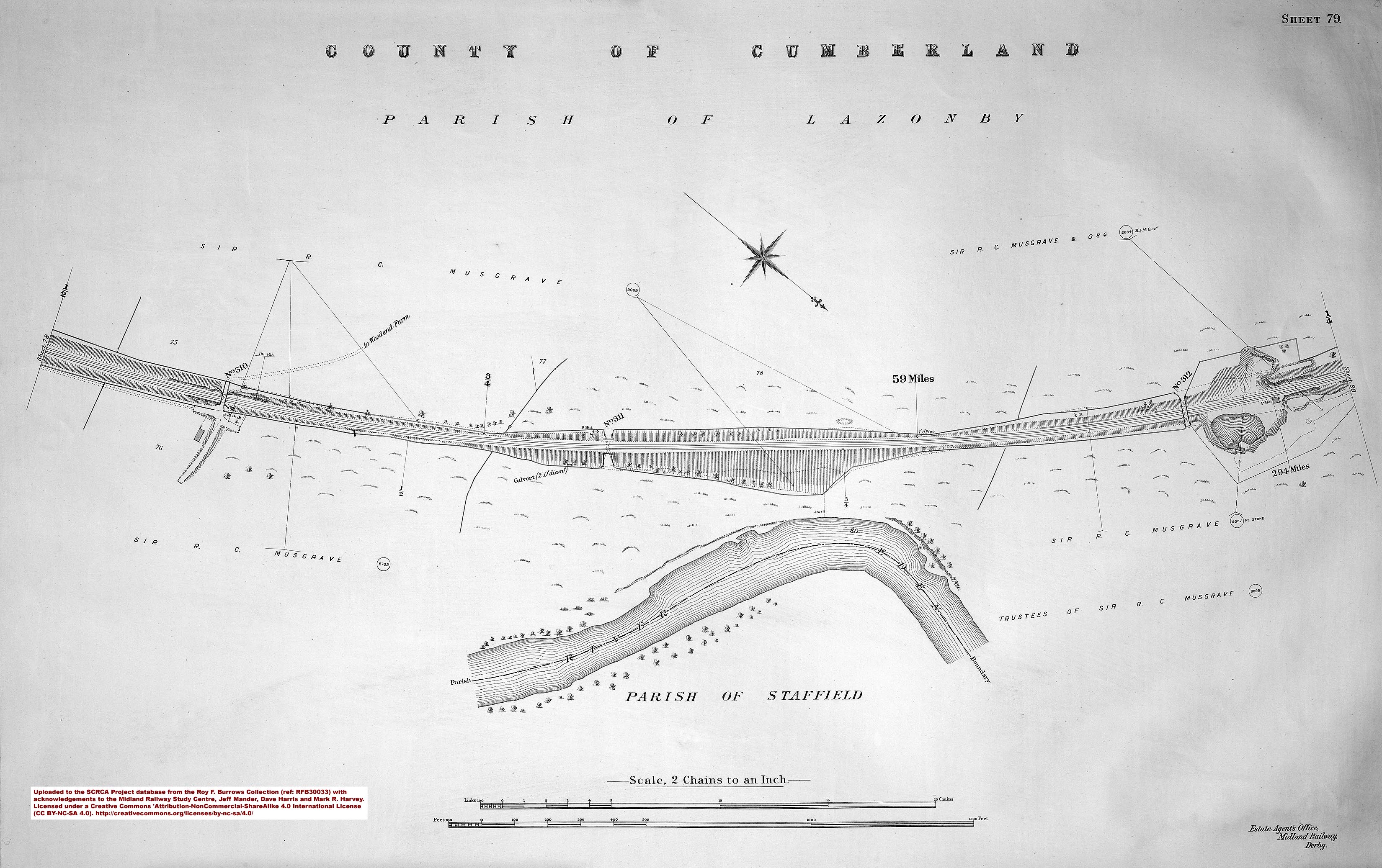
- sac-79-1912 = Sheet 79 - 294 miles.
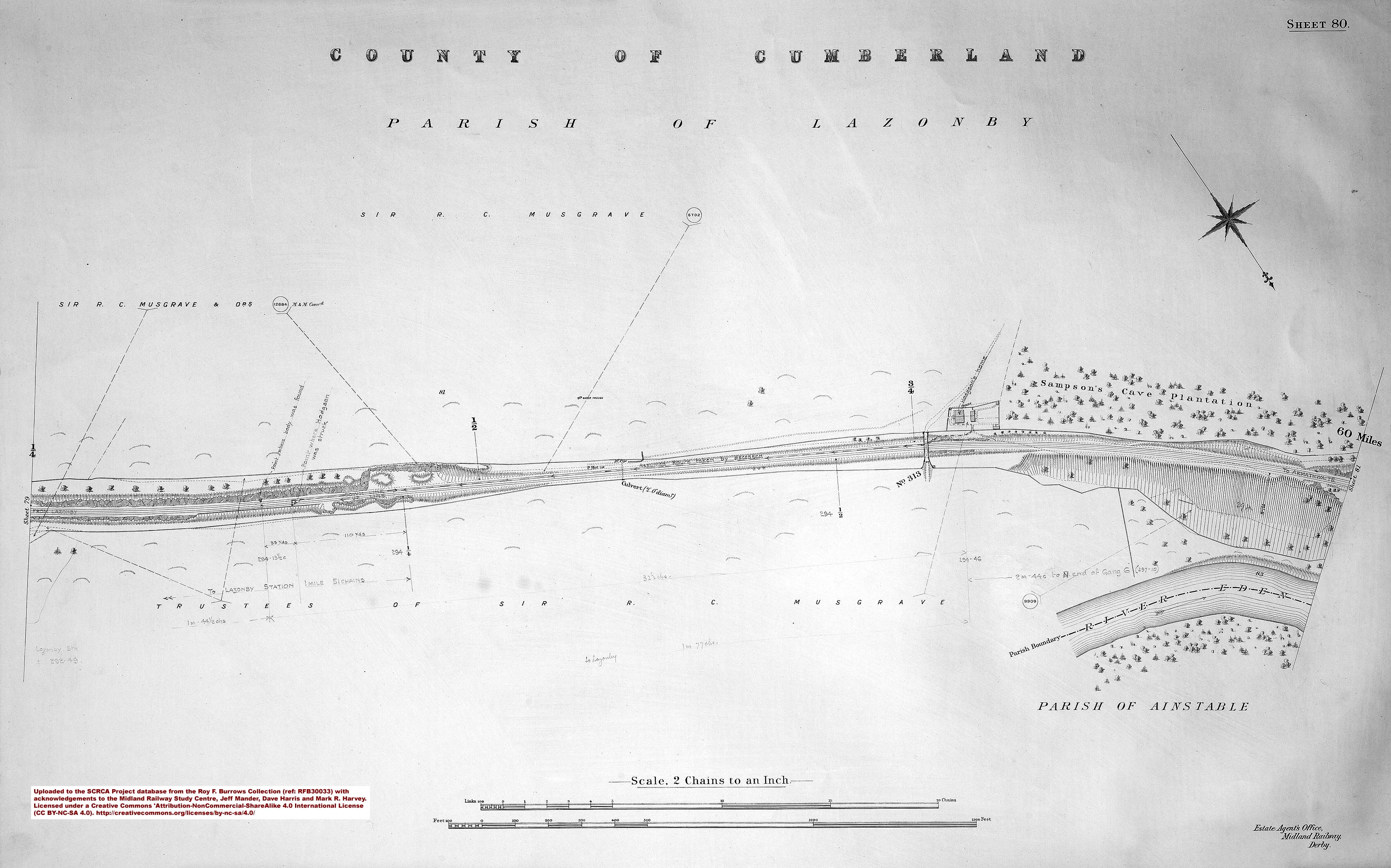
- sac-80-1912 = Sheet 80.
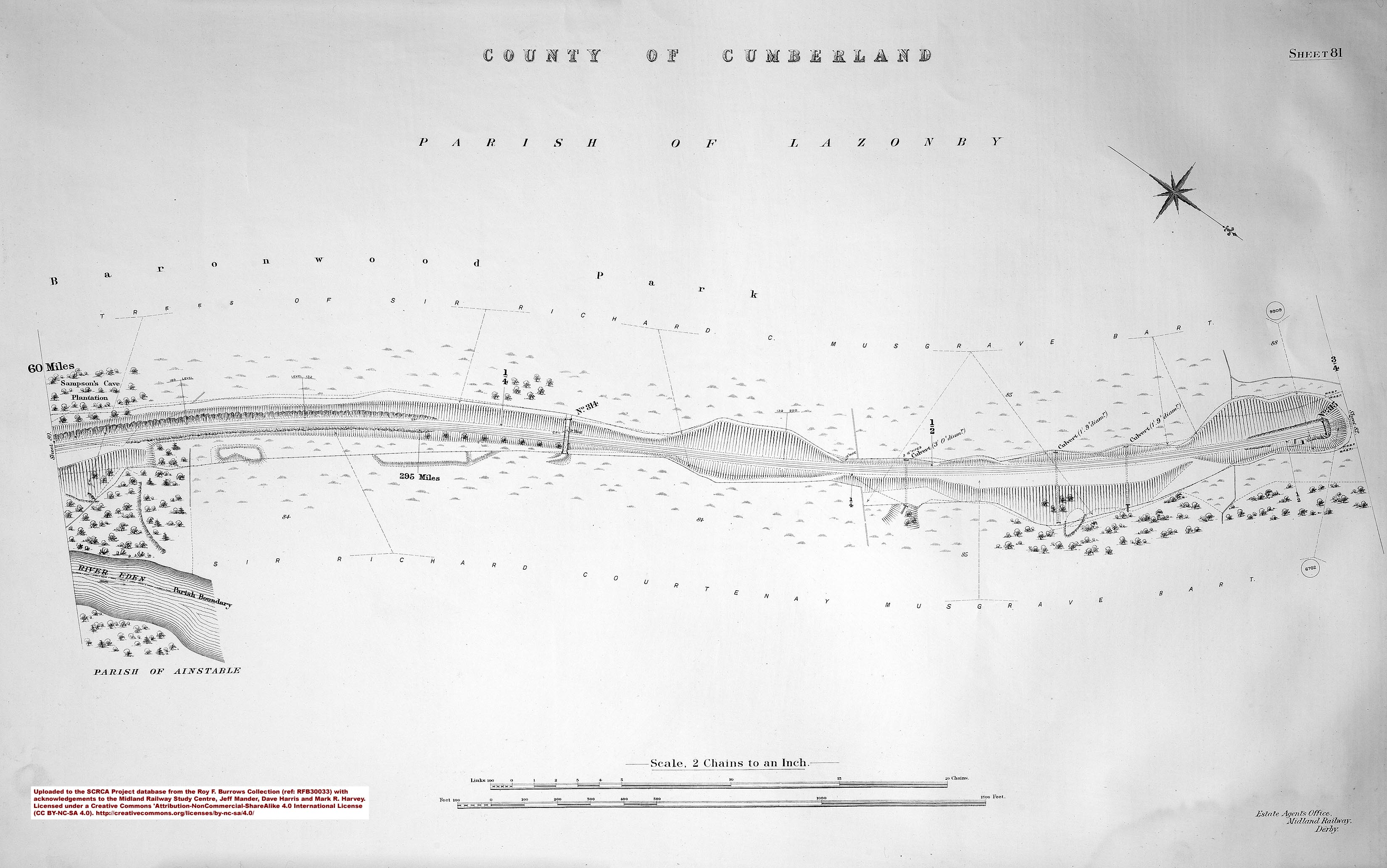
- sac-81-1912 = Sheet 81 - 295 miles.
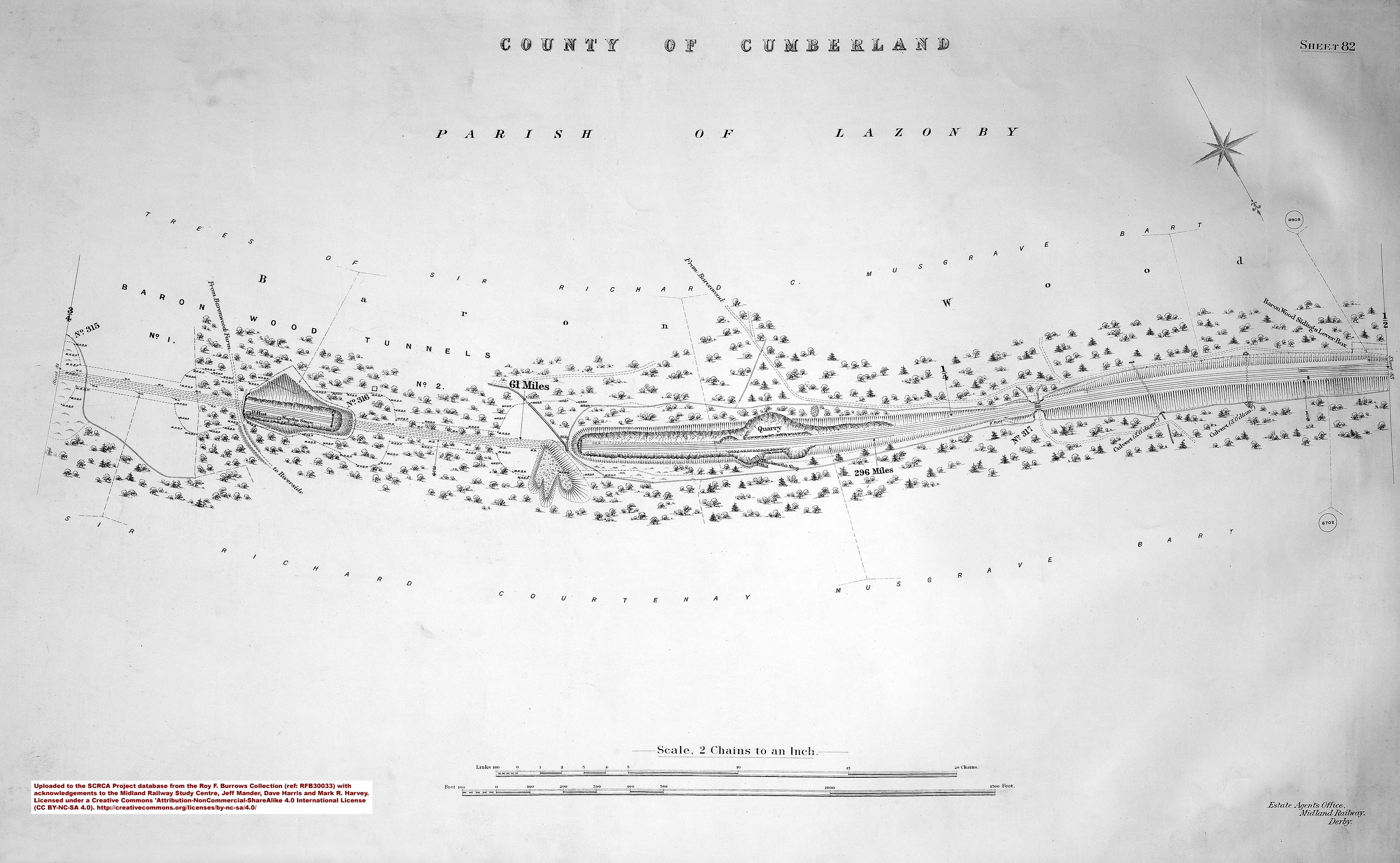
- sac-82-1912 = Sheet 82 - 296 miles.
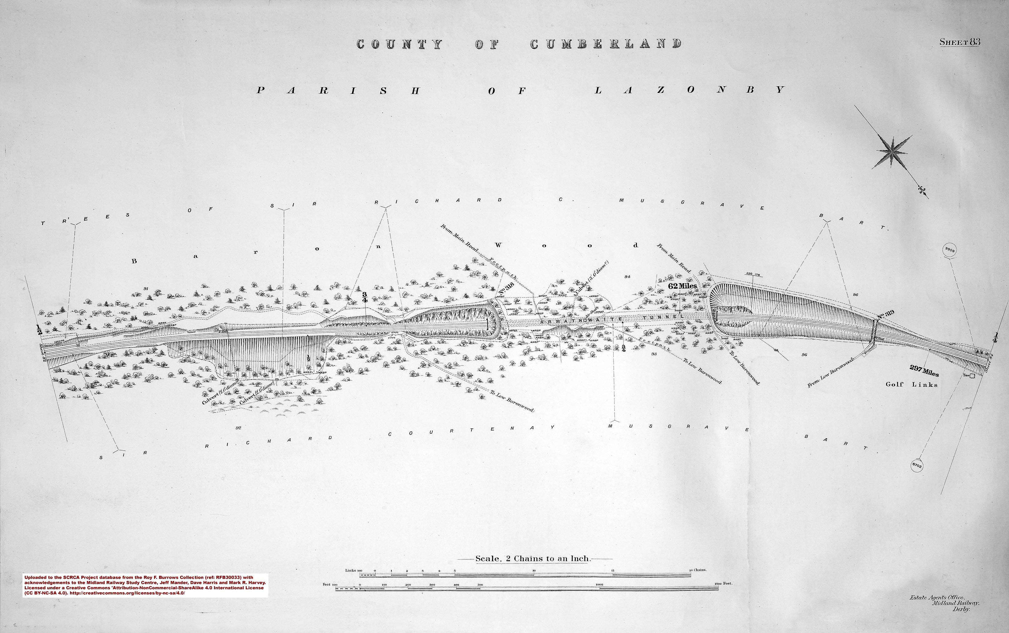
- sac-83-1912 = Sheet 83 - 297 miles.
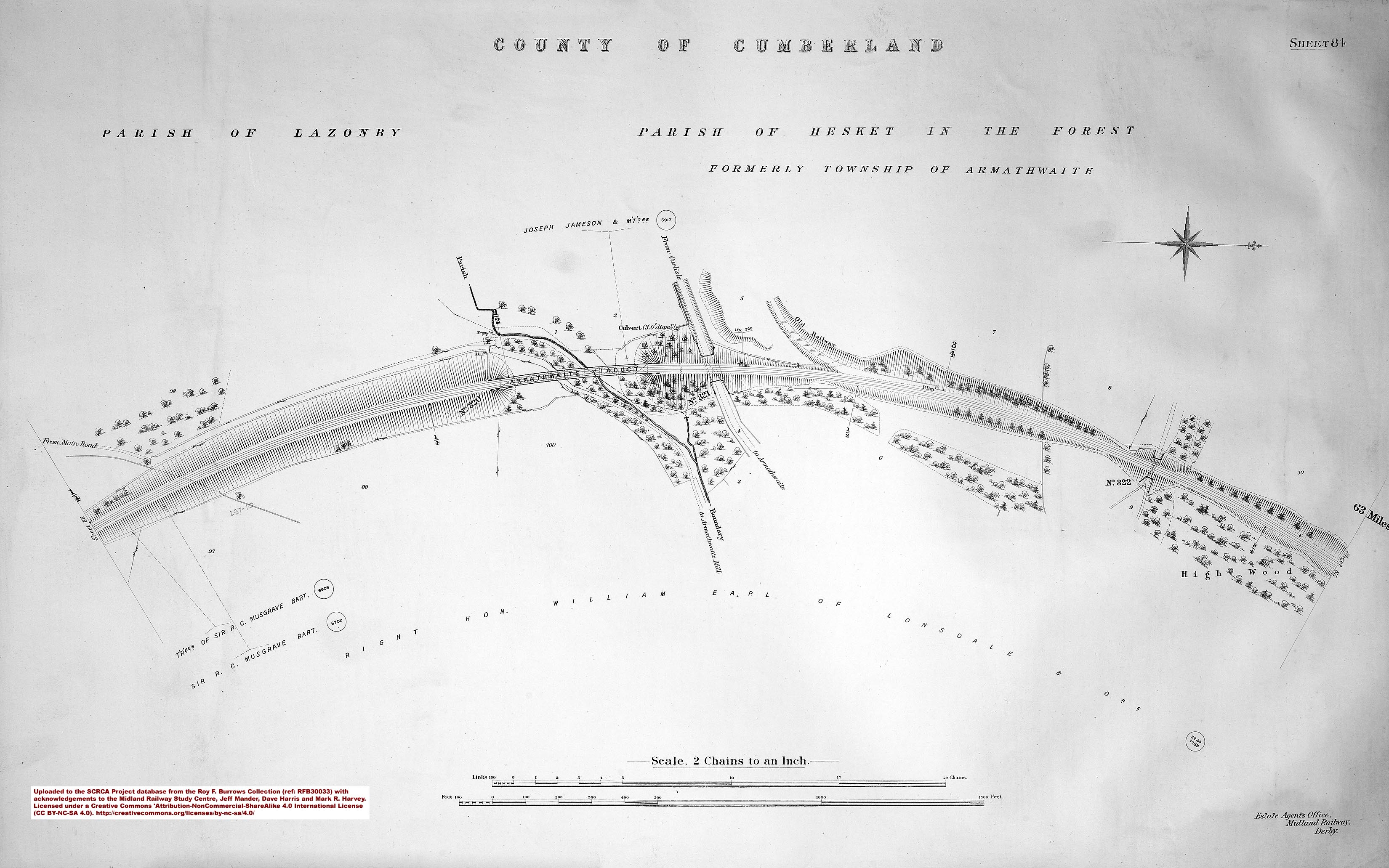
- sac-84-1912 = Sheet 84.
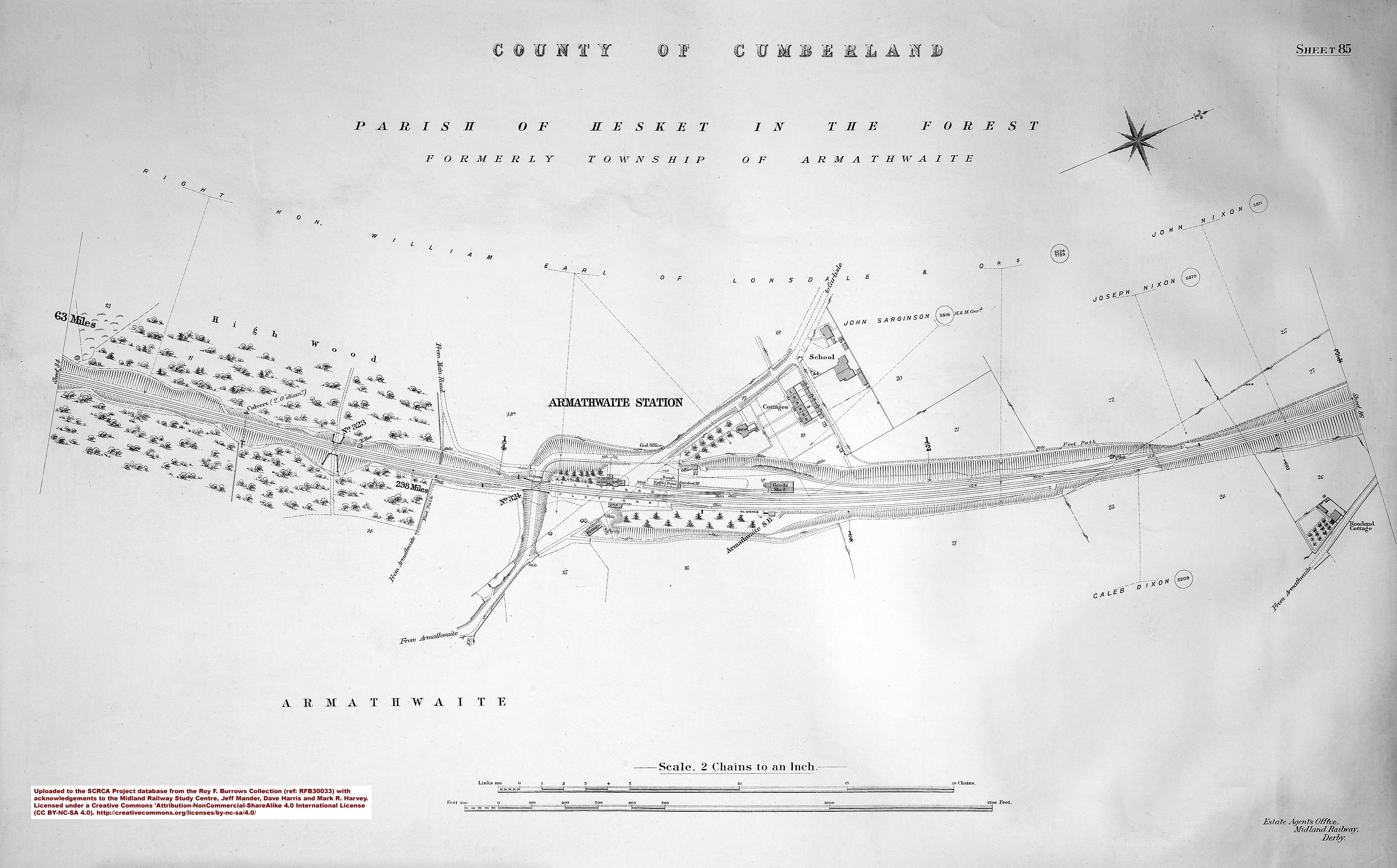
- sac-85-1912 = Sheet 85 - 298 miles and Armathwaite Station.
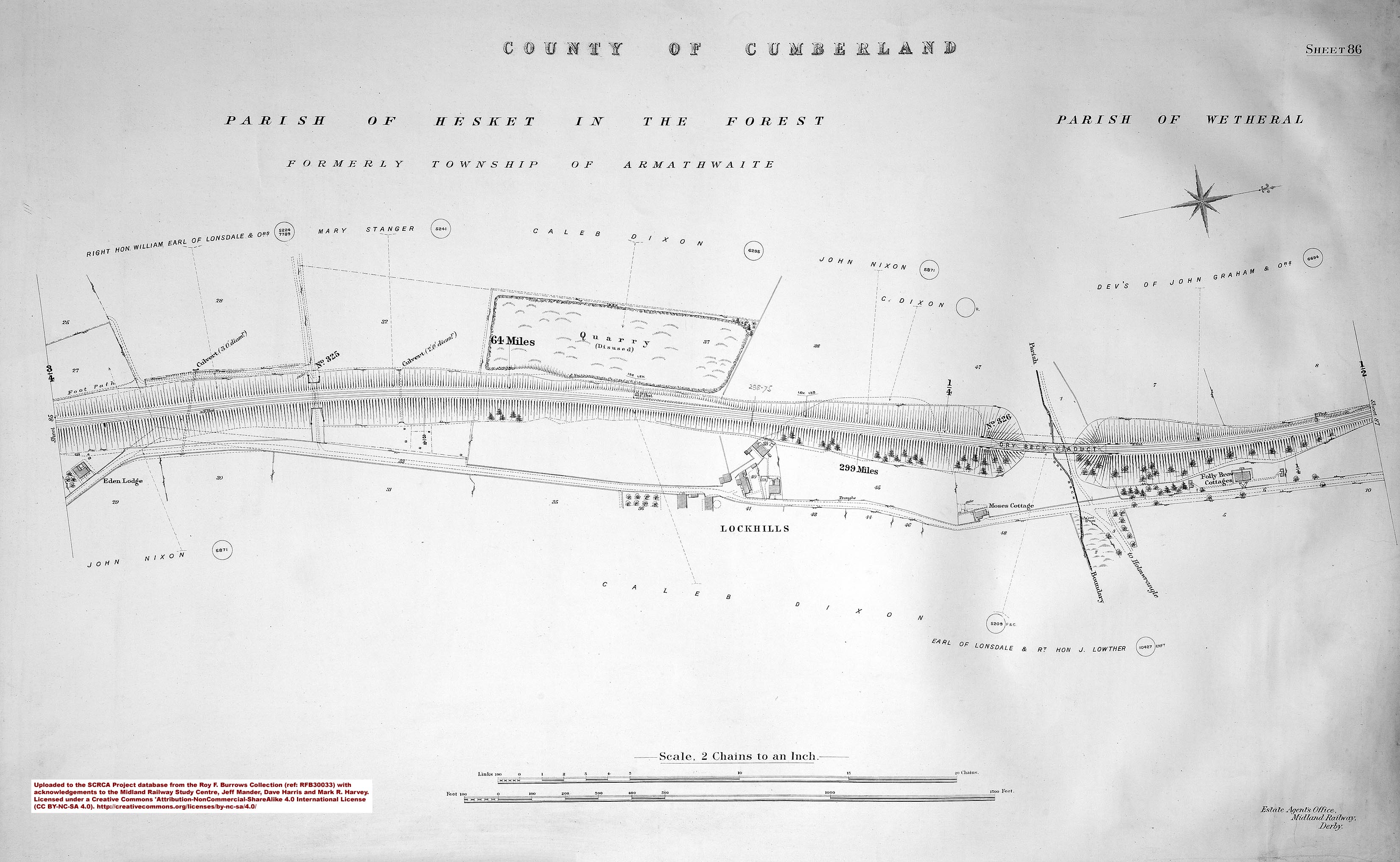
- sac-86-1912 = Sheet 86 - 299 miles.
- sac-87-1912 = Sheet 87 - 300 miles.
- sac-88-1912 = Sheet 88.
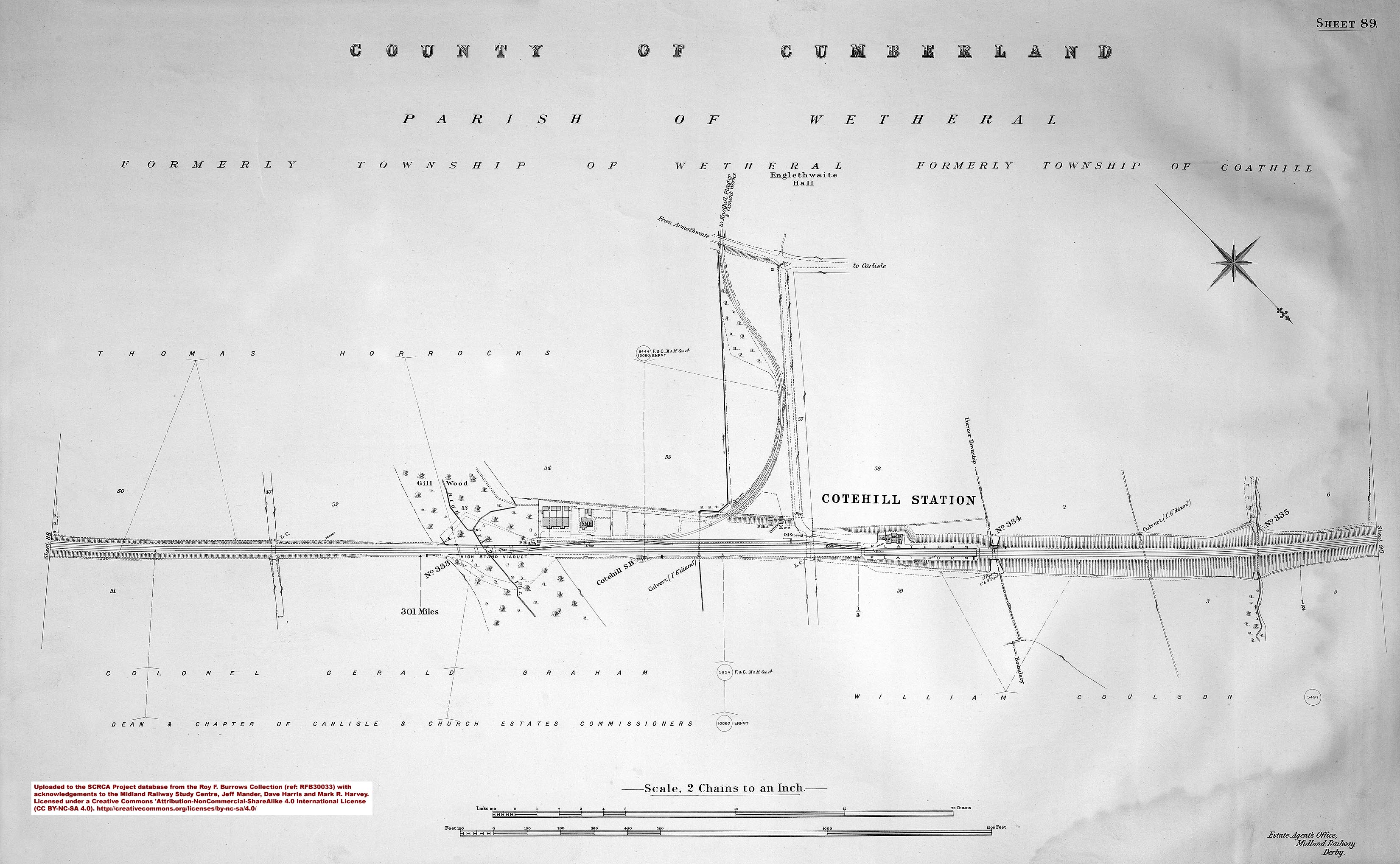
- sac-89-1912 = Sheet 89 - 301 miles and Cotehill Station.
- sac-90-1912 = Sheet 90 - 302 miles.
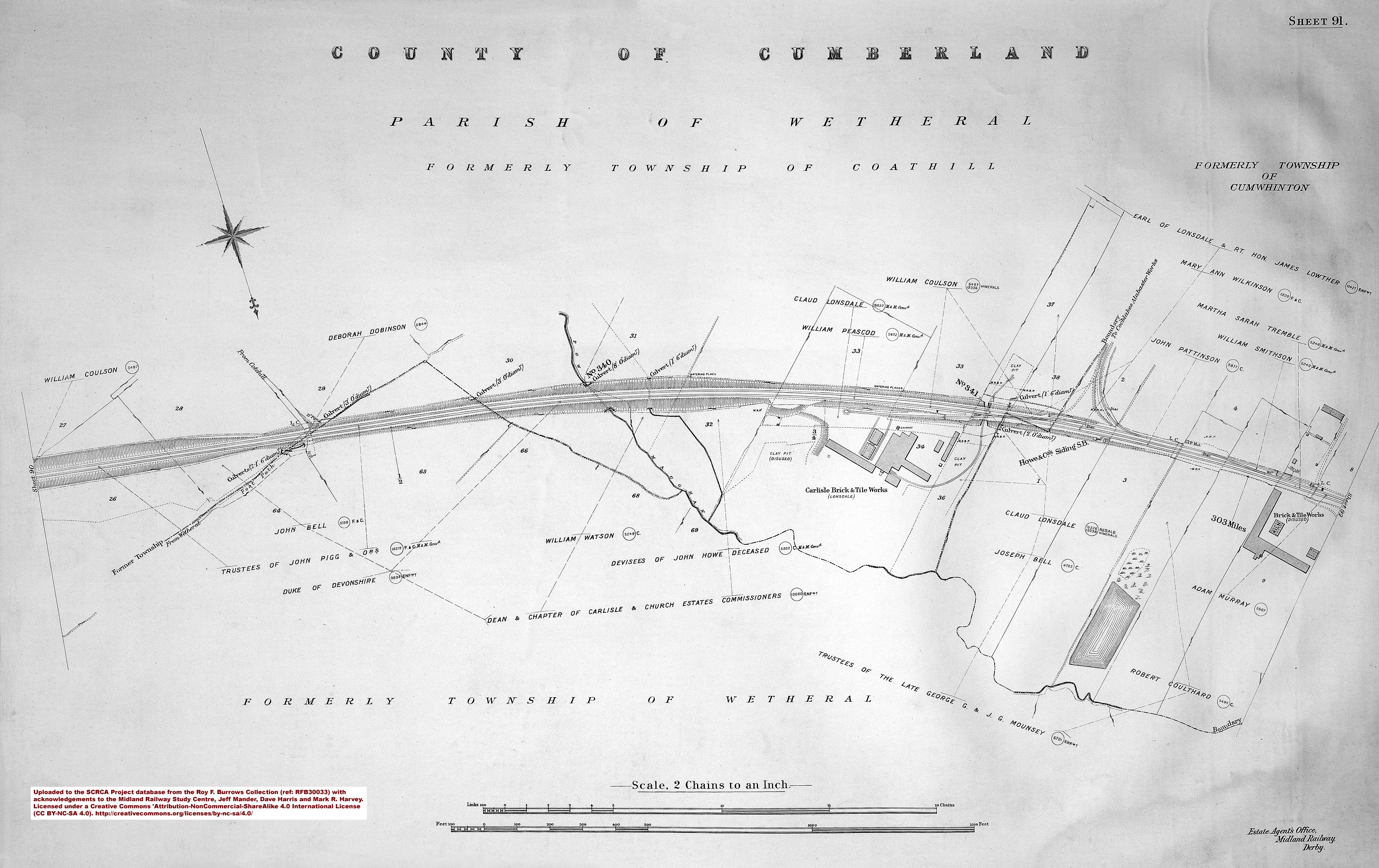
- sac-91-1912 = Sheet 91 - 303 miles.
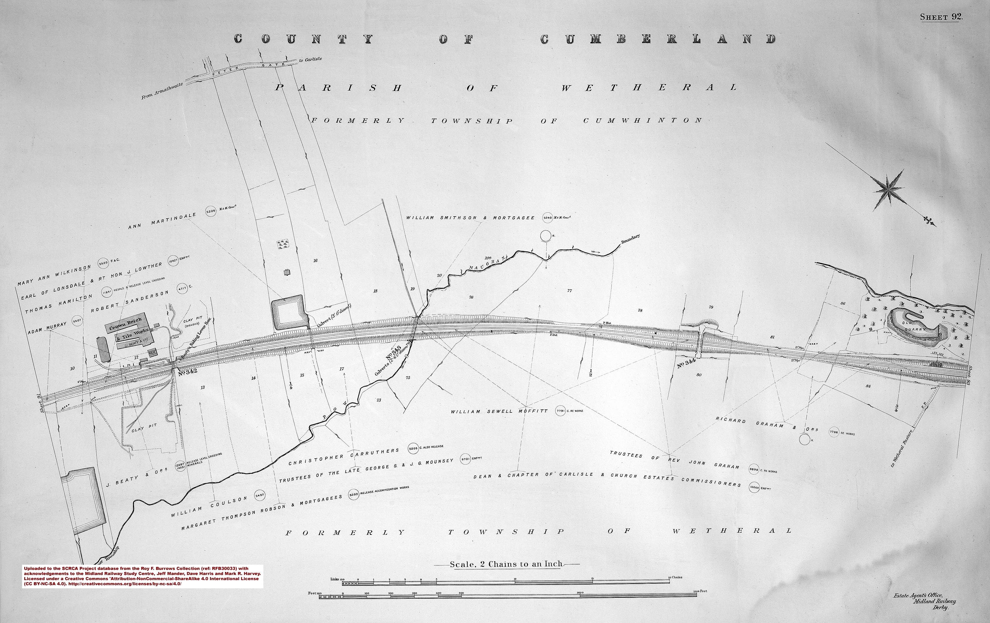
- sac-92-1912 = Sheet 92.
- sac-93-1912 = Sheet 93 - 304 miles and Cumwhinton Station.
- sac-94-1912 = Sheet 94 - 305 miles.
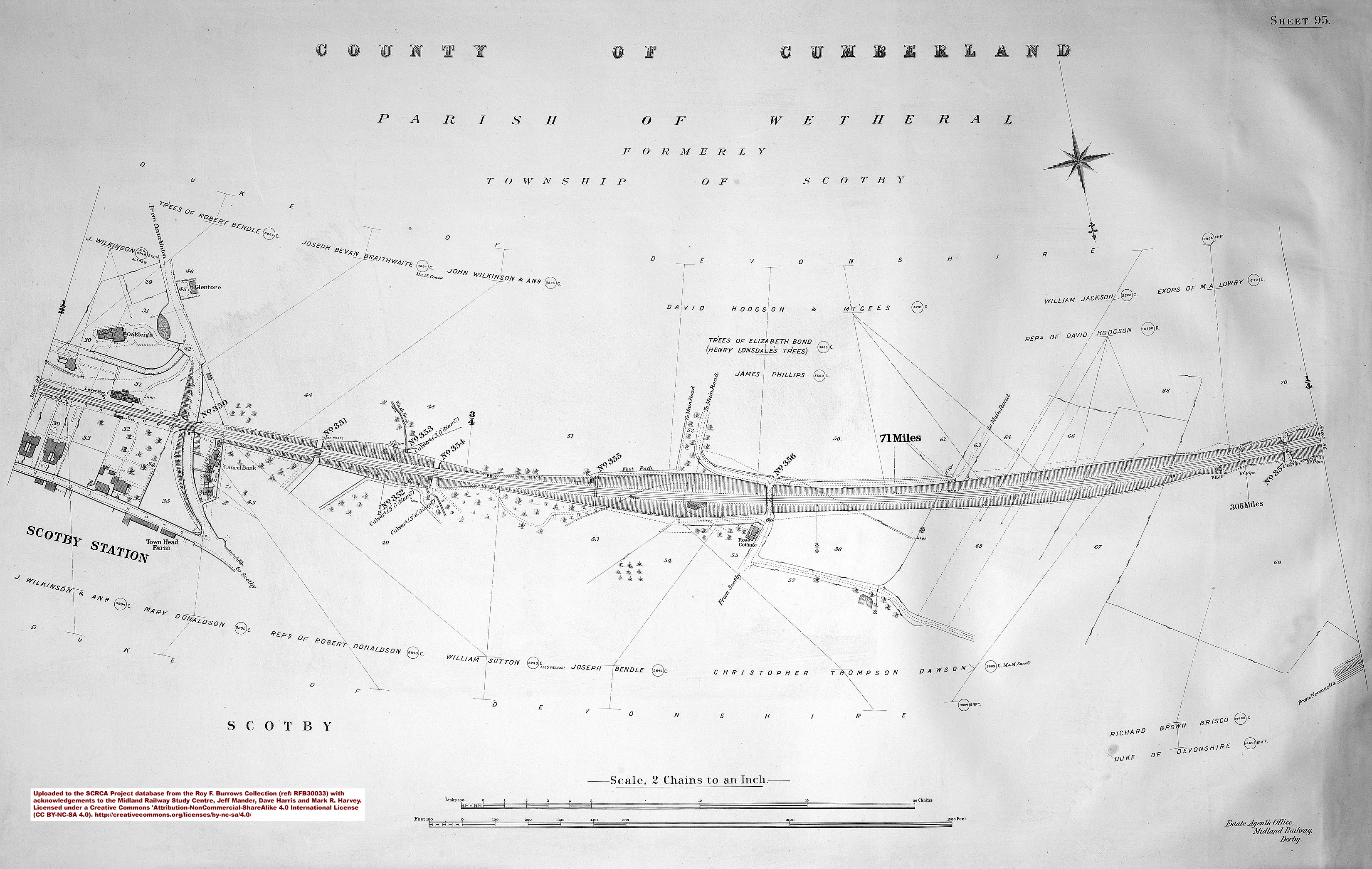
- sac-95-1912 = Sheet 95 - 306 miles and Scotby Station.
- sac-96-1912 = Sheet 96.
- sac-97-1912 = Sheet 97 - 307 miles and Petteril Bridge Junction (near Carlisle).
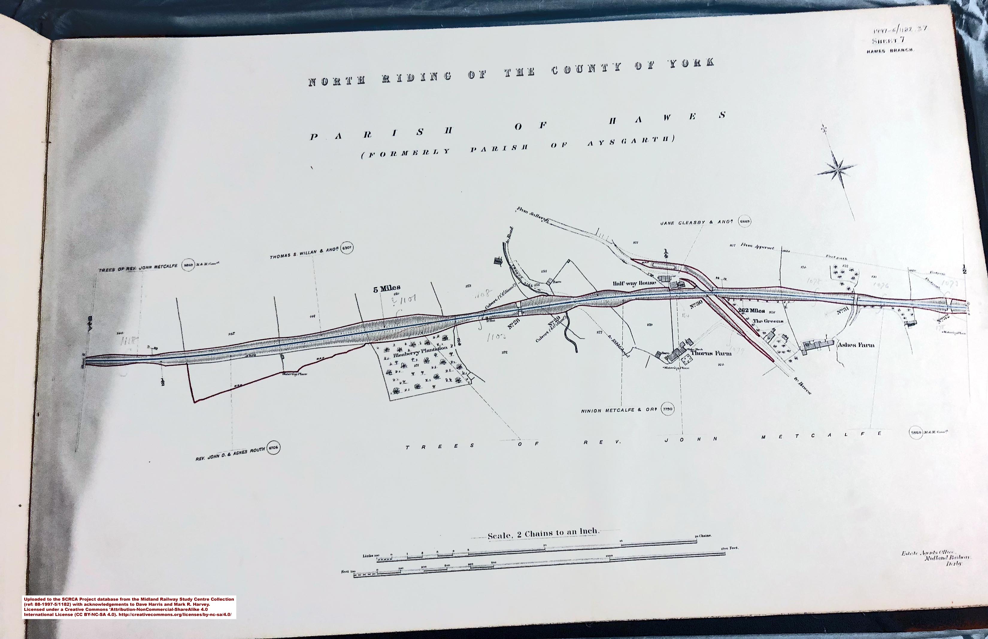
Set 2: Hawes Branch land plans from the Midland Railway Study Centre Collection
This set covers Hawes Junction & Garsdale Station, Hawes Station and the branch line in between. It was photographed quickly under difficult circumstances using a hand-held camera, but the results are perfectly adequate for research purposes. The individual sheets can be downloaded in jpg format from the SCRCA Project database using the links provided on all relevant location summary pages and via the links provided in the sheet index below. Please note that these land plans are licensed for personal use only and are subject to the Creative Commons Attribution-NonCommercial-ShareAlike 4.0 International License. ![]()
Reference 88-1997-5_1182 - The Hawes Branch (publication date unknown) [3]:
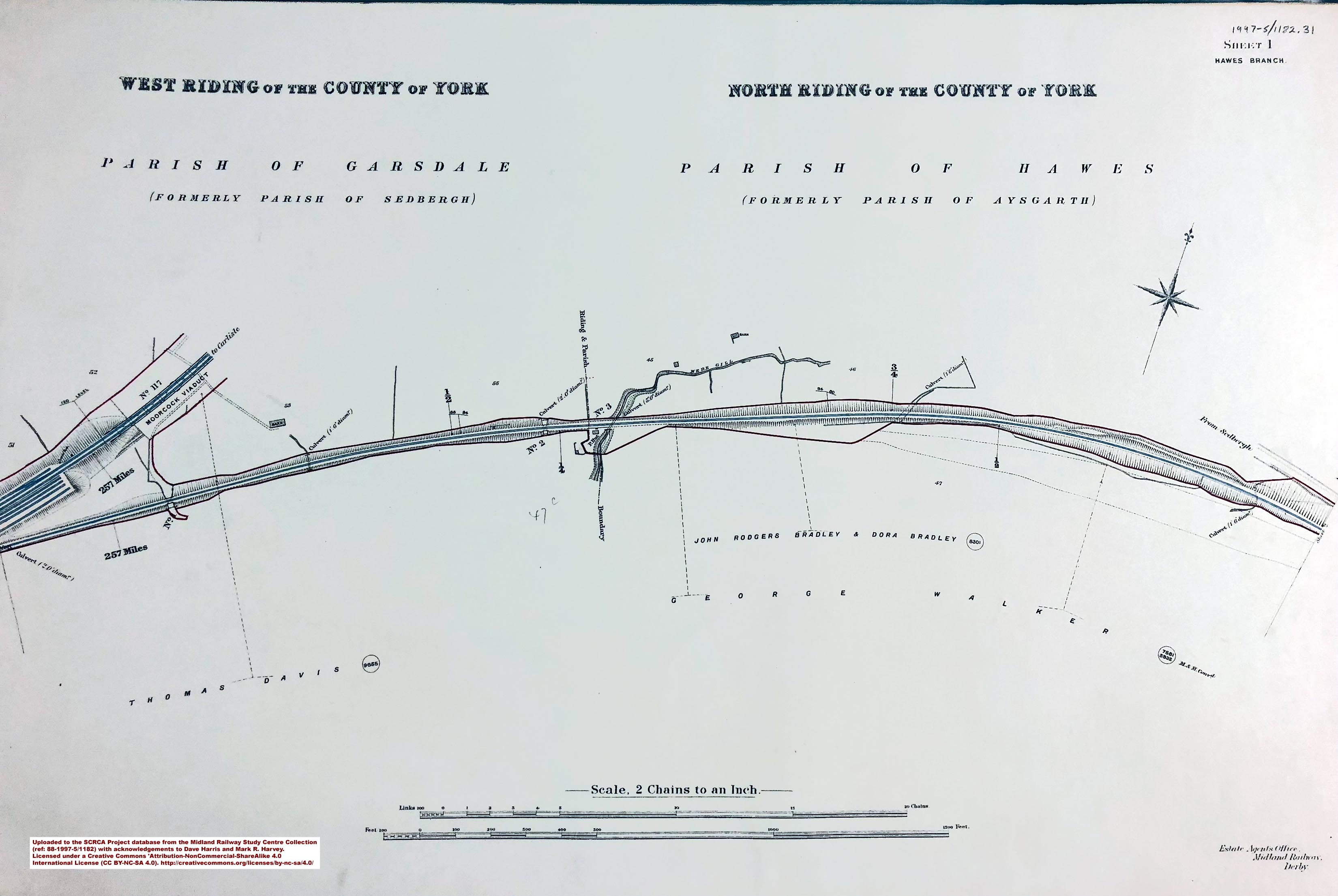
- sac-hb0-19xx = Sheet 0 - 256¾ miles and Hawes Junction & Garsdale Station.
- sac-hb1-19xx = Sheet 1.
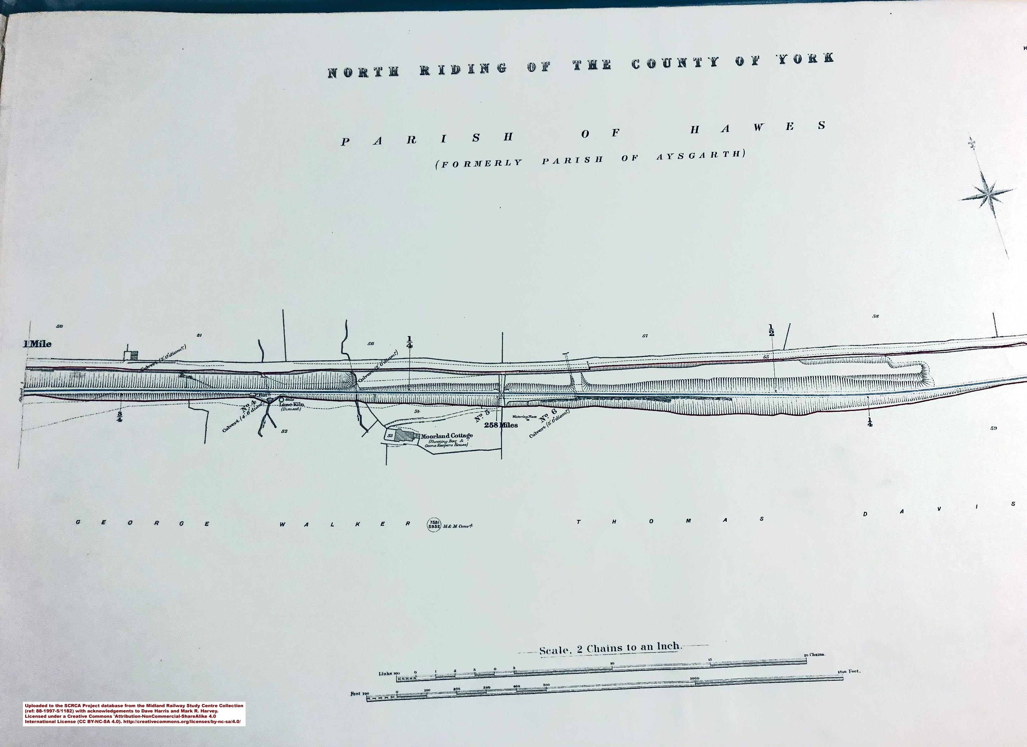
- sac-hb2-19xx = Sheet 2 - 258 miles.
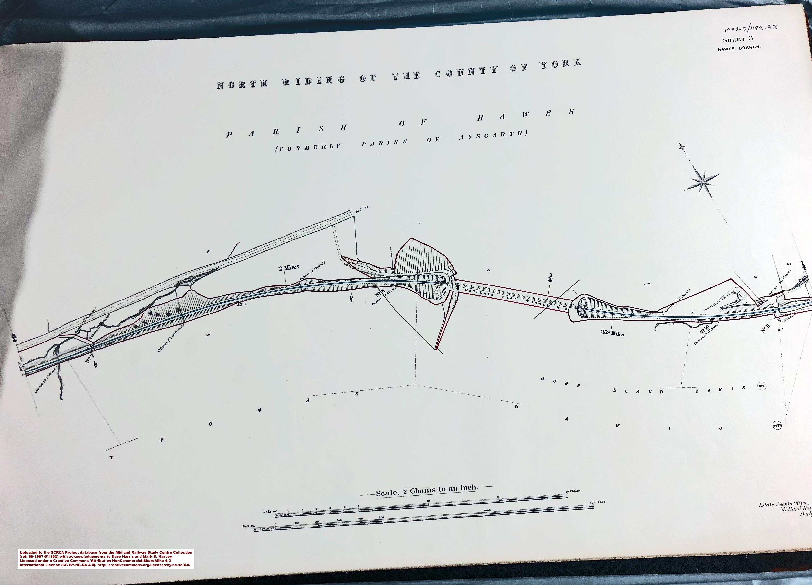
- sac-hb3-19xx = Sheet 3 - 259 miles.
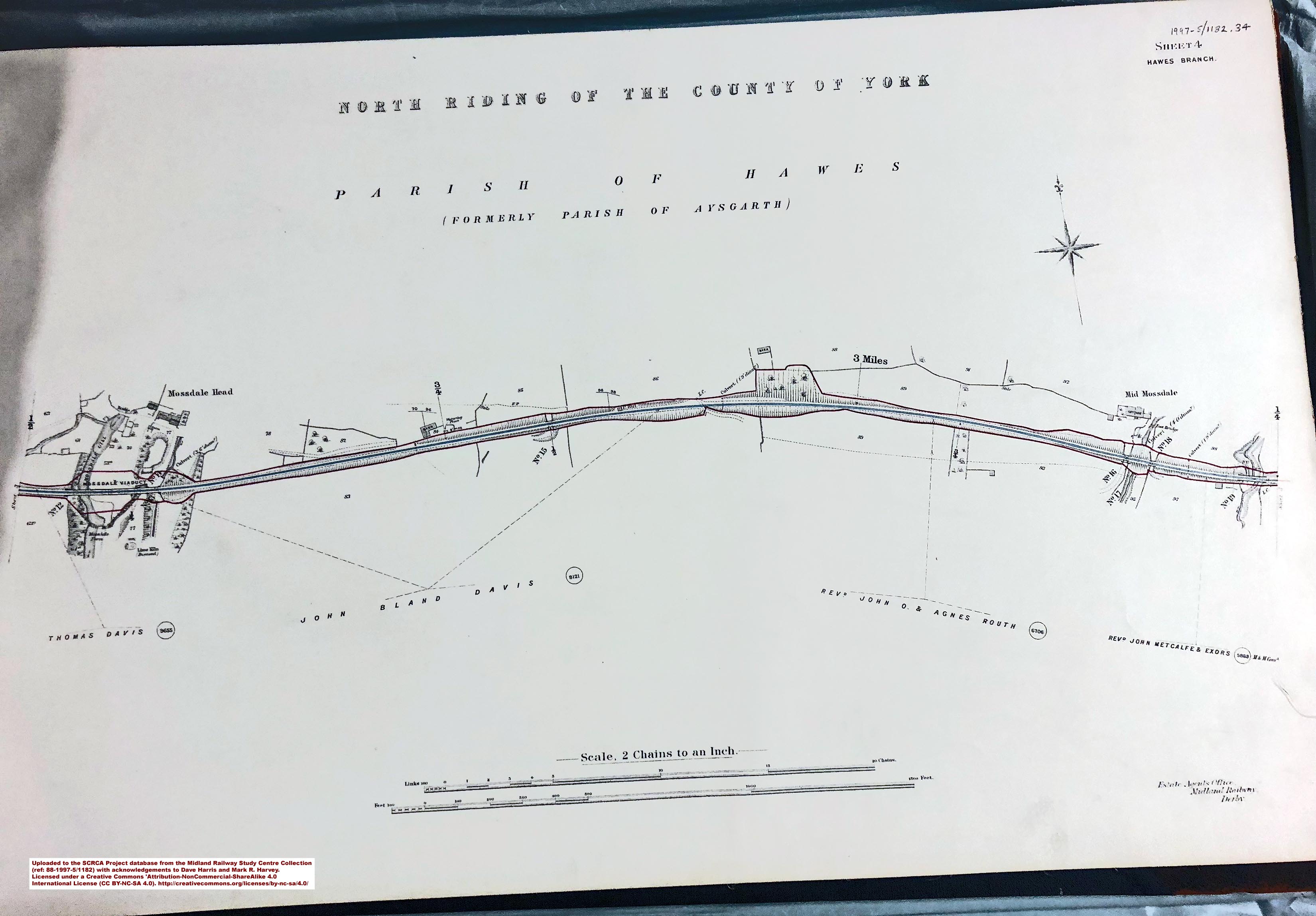
- sac-hb4-19xx = Sheet 4 - 257 miles.
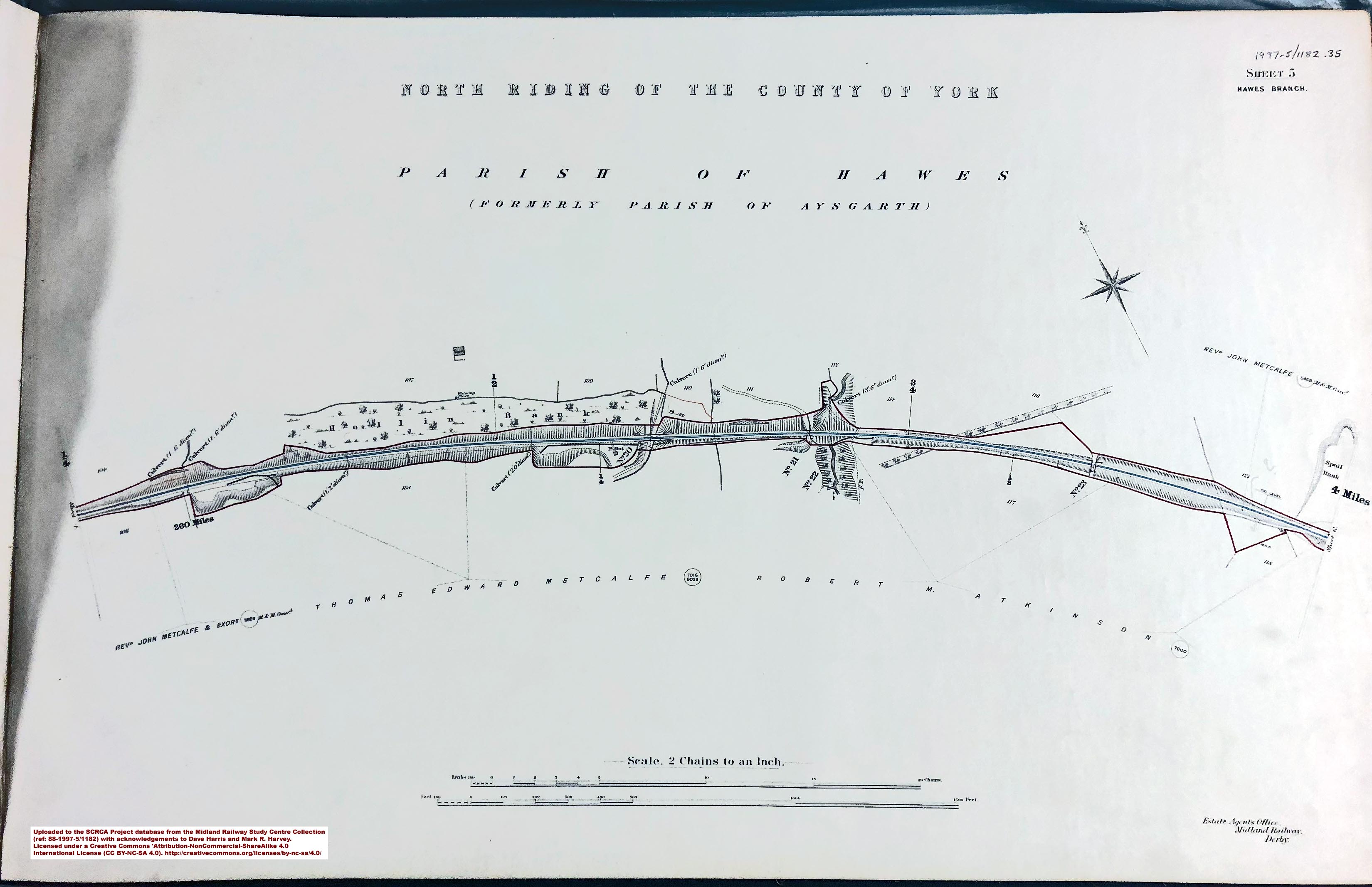
- sac-hb5-19xx = Sheet 5 - 260 miles.
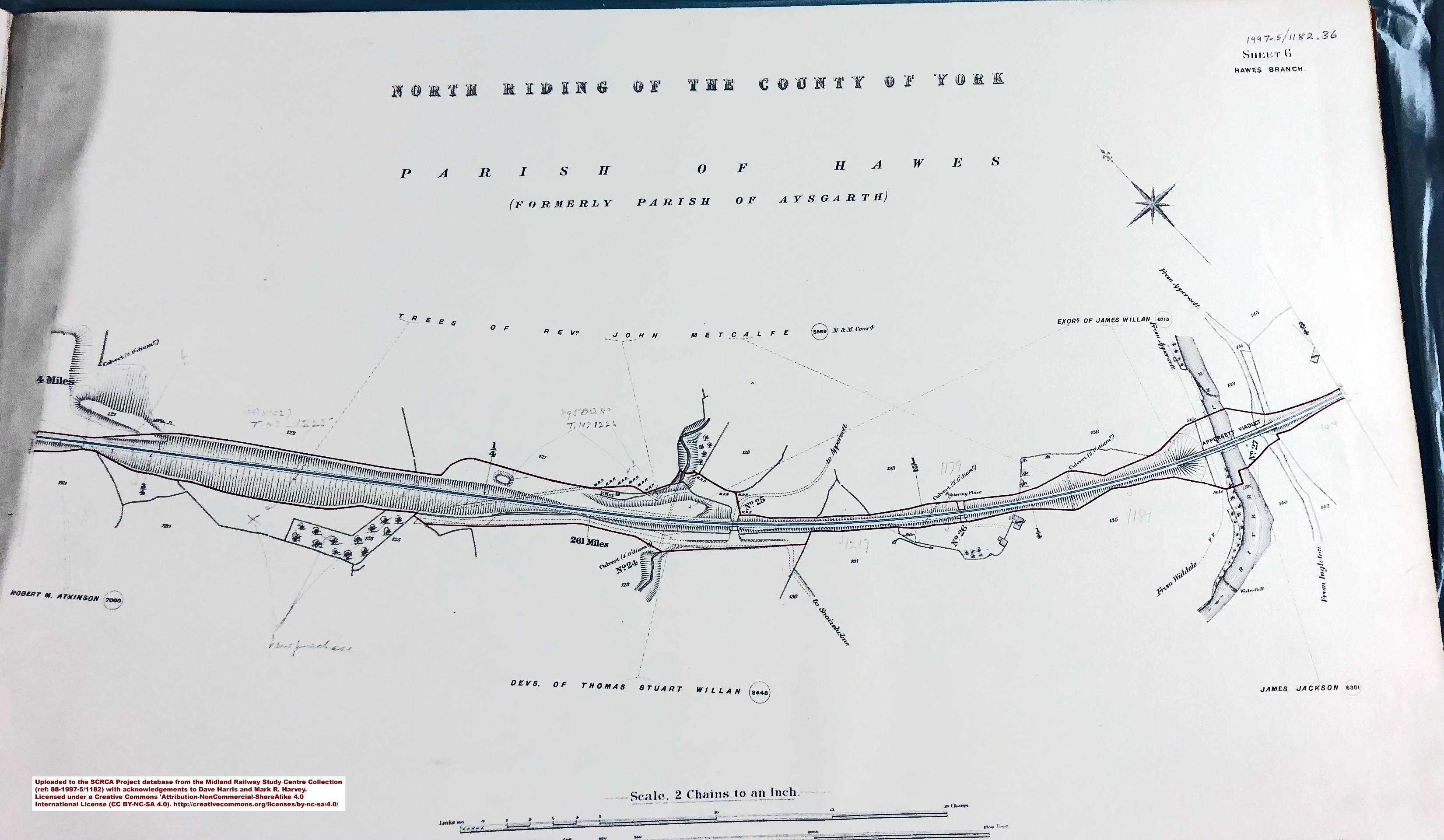
- sac-hb6-19xx = Sheet 6 - 261 miles.
- sac-hb7-19xx = Sheet 7 - 262 miles.
- sac-hb8-19xx = Sheet 8 - 262¾ miles and Hawes Station.
Acknowledgements
- Research and text by Mark R. Harvey (© Mark R. Harvey, 2019).
- This set of land plans has been made available for public viewing and / or public download as a result of the generosity of Roy F. Burrows, Jeff Mander, Dave Harris, the Midland Railway Society and the Midland Railway Study Centre. The author gratefully acknowledges the contribution made by these individuals and organisations. Further information about the Roy F. Burrows Collection, the Midland Railway Society and the Midland Railway Study Centre is available at (or via links from):
http://www.midlandrailwaystudycentre.org.uk/. - This set of land plans has been made available for public viewing and / or public download as a result of the generosity of Dave Harris and the Midland Railway Study Centre. The author gratefully acknowledges the contribution made by both parties. Further information about the Midland Railway Study Centre is available via the link provided for #2 above.