SCRCA structure 247360: Memorials to SCR Construction Workers at St Leonards' Church, Chapel-le-Dale

SCRCA Location Introduction

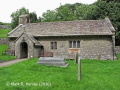
St Leonards' Church in Chapel-le-Dale lies well outside the boundary of the Settle-Carlisle Railway Conservation Area (SCRCA). However, it has a direct and important association with the SCRCA through the graves of - and the memorials to - the hundreds of people who lost their lives during the construction of the railway in this area.

The church / churchyard is the site of:

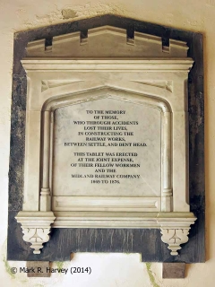
  • a wall-mounted memorial tablet to the construction workers,
  • the millenium memorial,
  • the marked graves of:
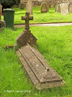
    • Job Hirst (the sub-contractor responsible for all the bridges and masonry between Batty Moss Viaduct and the south entrance to Bleamoor Tunnel),
    • James Mather (proprietor of the Welcome Home - a hostelry popular with railway navvies - who died on 29 April 1872 aged 45 years following an accident at Ingleton with a horse and cart),
    • John Thomson (a navvy killed inside Blea Moor tunnel while using a brazier to dry wet dynamite) and
  • the unmarked graves for an unknown number of railway workers and locals killed between 1869 and 1876 as a result of accidents and the smallpox outbreak.

The grave of Job Hirst is capped by a large ornately carved tombstone.

The grave of James Mathers is marked by a headstone, which includes the following inscription:

When I was in the prime of life it was through a fall I lost my life.
No man in this world need boast of his might, he is alive in the morning and dead at night.

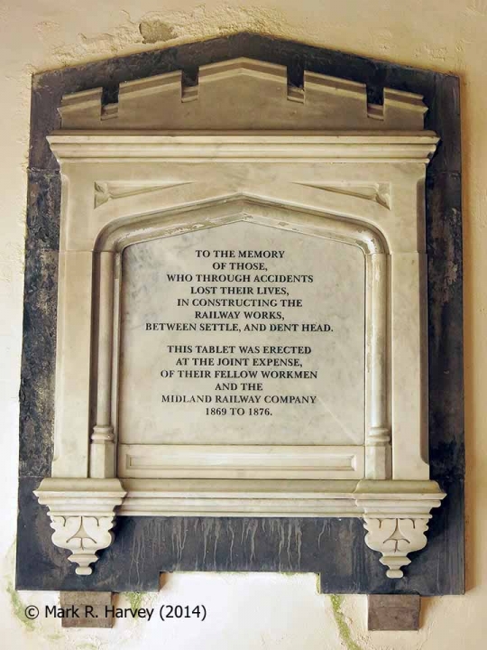
Memorial to Settle-Carlisle Railway construction workers in St Leonards' Church.

Key details from the Location Record

Location Type
Monument / Memorial
Location Variant
Memorial Type - Other
Assessment status
Assessed
Current Use(s)
Memorial
Shown on a land plan?
No 
Construction / installation period
2: MR construction phase (1869 to 31st Dec 1876)
Distance from London St.Pancras
247 miles (chains not estimated)
Position relative to running lines
Remote
Visibility
This location IS visible from nearby publicly accessible land.
Accessibility (ease of access)
Easy
Protection Category
Listed, Grade II
Geographic Location
  View this location on mapping. or on aerial imagery.

List Entry Extract(s)

The information quoted below has been extracted from the relevant List Entries in 'The National Heritage List for England (NHLE) (https://historicengland.org.uk/listing/the-list/).

Tip: To open the full extract, click / tap on the List Entry Number in the left hand column.

List Entry Number (LEN) List Entry District List Entry Name
1213046 Craven CHURCH OF ST LEONARD

Image Gallery

Tips: To view a larger version of an image, click on its thumbnail (i.e. the small image). To view the acknowledgements and notes associated with an image, click / tap on the image title.

Further Reading (Snippets)

The following 'snippets' contain additional information relating to this location.

Tip: To view a snippet, click / tap on its title.


Errors and omissions
Reasonable efforts are being made to ensure the accuracy of the information obtained and uploaded as part of the SCRCA Project. However, it is possible that a few errors will have crept-in. If you notice any such errors, we would be grateful if you would bring them to our attention using the SCRCA Project Contact Form. The Friends of the Settle-Carlisle Line and the members of the SCRCA Project Team do NOT guarantee the accuracy of the information contained in this database. If you intend to use and / or act upon any of this information, you are advised to verify its accuracy BEFORE doing so.