SCRCA Structure 234590: Settle Junction

SCRCA Location Introduction

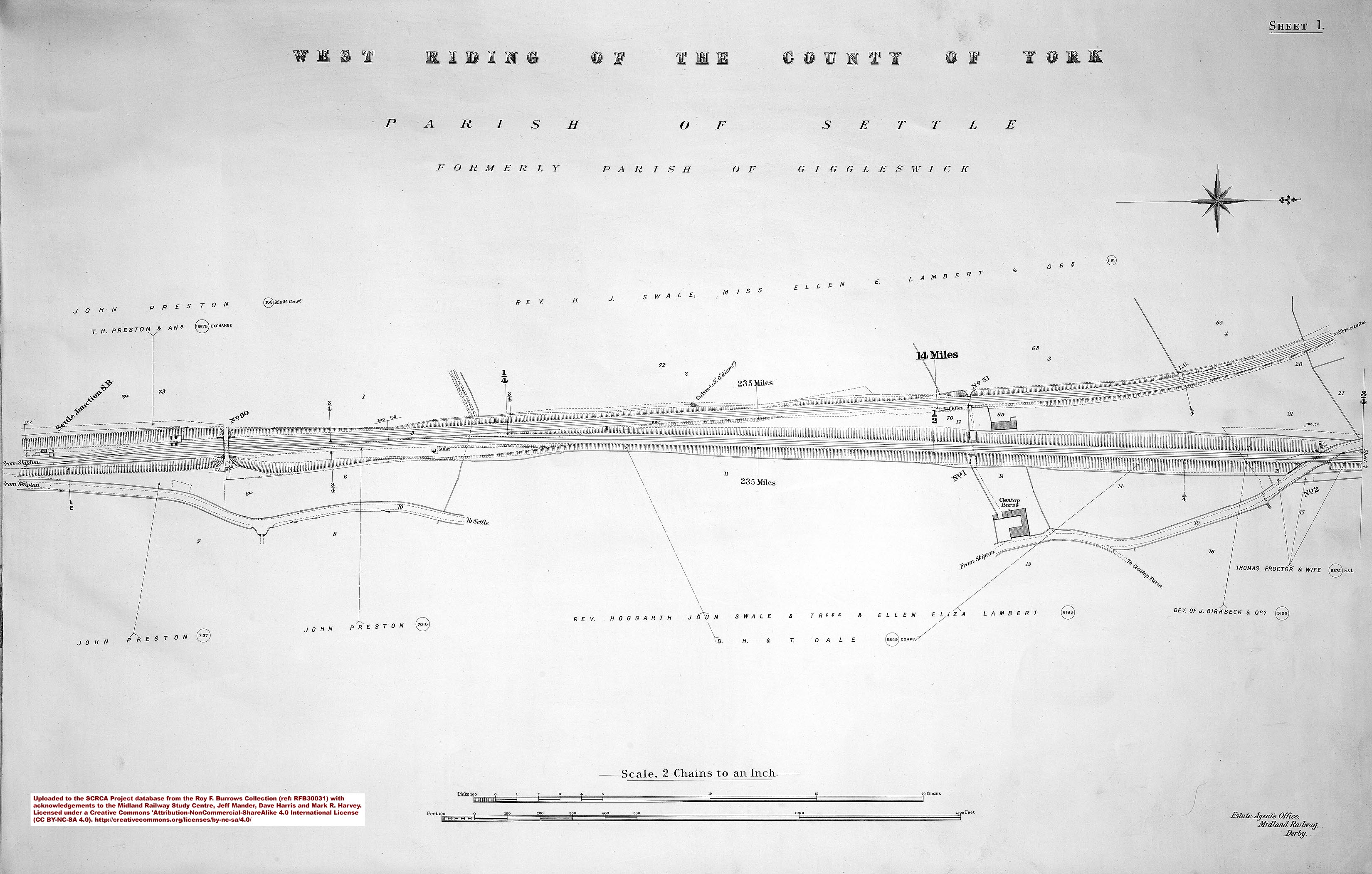
At Settle Junction, the Midland Railway Company's Settle & Carlisle Railway (S&CR) diverges from the route of the (Little) North Western Railway (NWR) linking Skipton with Low Gill and Lancaster.

Immediately beyond the junction, the trackbed of the NWR route is level, but the S&CR route transitions through 1-in-300 to 1-in-100 and this marks the start of ‘The Long Drag': an almost continuous 1-in-100, 15¼ mile climb to the south end of Blea Moor Tunnel.

Settle Junction: Northern elevation view

Key details from the Location Record

Location Type
Junction
Location Variant
Not Applicable
Assessment status
Assessed
Current Use(s)
Railway ops
Shown on a land plan?
Yes 
Construction / installation period
2: MR construction phase (1869 to 31st Dec 1876)
Distance from London St.Pancras
234 miles and 41 chains
Position relative to running lines
Down
Visibility
This location IS visible from nearby publicly accessible land.
Accessibility (ease of access)
Easy
Protection Category
Conservation Area Only
Geographic Location
  View this location on mapping. or on aerial imagery.
 

Errors and omissions
Reasonable efforts are being made to ensure the accuracy of the information obtained and uploaded as part of the SCRCA Project. However, it is possible that a few errors will have crept-in. If you notice any such errors, we would be grateful if you would bring them to our attention using the SCRCA Project Contact Form. The Friends of the Settle-Carlisle Line and the members of the SCRCA Project Team do NOT guarantee the accuracy of the information contained in this database. If you intend to use and / or act upon any of this information, you are advised to verify its accuracy BEFORE doing so.