The annotated photograph below shows the relative locations of four of the five main quarries on the western side of Ribblesdale in the Helwith Bridge area (Dry Rigg, Combs, Foredale and Arcow). The fifth (Helwith Bridge) is out of shot, approximately half a mile to the left of the photographer's location.
These quarries exploit(ed) two very different rock-types:
1: Siltstone: 445-420 million years old; typically 'cleaved' (split) to form flagstones, roofing slates, water troughs & cisterns, etc., or crushed for use as ballast, aggregate & roadstone.
2: Limestone: 350 - 335 million years old; typically crushed for use as ballast, or burnt to produce lime for land improvement and the chemical industry.
In general, the limestones are bedded horizontally, but the siltstones are heavily folded & faulted. There is a distinct near-horizontal boundary between the top of the siltstones and the base of the limestones. In geological terms, this boundary is referred to as an 'unconformity' and it represents a gap in the geological record of approximately 70 million years.
All five quarries can be seen from passing trains.
Helwith Bridge Quarry had a dedicated siding beside the Settle & Carlisle Railway on the eastern side of the River Ribble (Location ID 240310). Stone from the quarry was transported across the river via an overhead conveyor. The ground frame that controlled the siding was taken out of service on 17th September 1969.
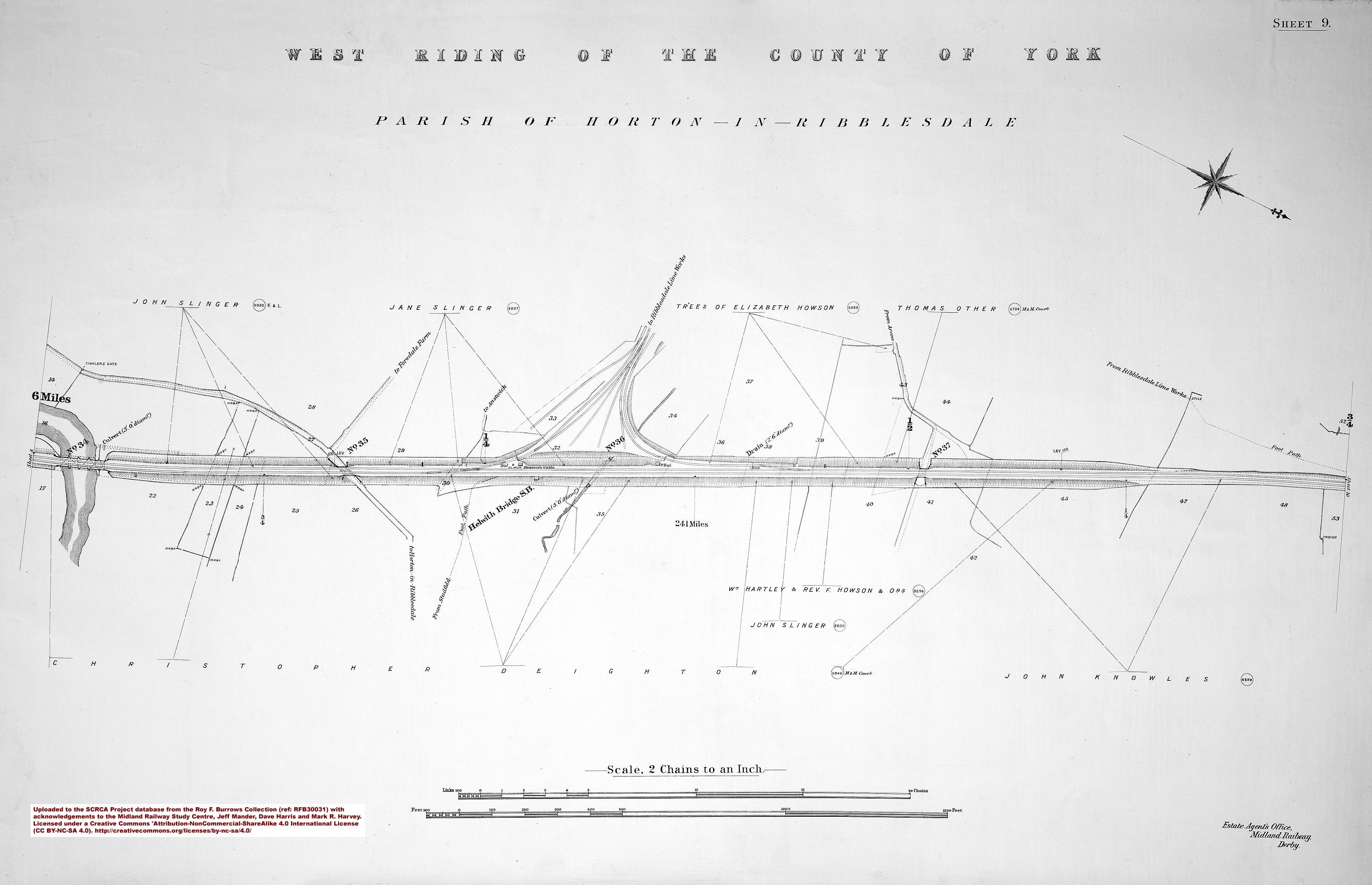
Foredale Quarry was connected to the Settle-Carlisle Railway via the Ribblesdale Lime Works Sidings (Location ID 240980) and an inclined-plane rope-hauled tramway (the trackbed of which is still visible on the hillside between Dry Rigg and Arcow Quarries). The sidings were accessed from the main line via a triangular junction, which was controlled from Helwith Bridge Signal Box. The box closed on 7th September 1969 and the sidings & tramway were subsequently removed.
Stone from Arcow Quarry was originally despatched via the Ribblesdale Lime Works Sidings (Location ID 240980). However, a completely new rail connection has been constructed to serve both Dry Rigg and Arcow Quarries (Location ID 240950) and this became operational in Spring 2016.

.")
.")


")

 view of Foredale Quarry from the southwest.")


