At just 98 yards (90 metres) long, Moorcock Tunnel (a.k.a. Bridge SAC/119) is the shortest tunnel within the Settle Carlisle Railway Conservation Area (SCRCA). It was excavated through a ridge of boulder clay (deposited during the last ice age) and constructed between 1871 and 1875 by the Midland Railway Company (MRC) as part of Contract 2 for the Settle & Carlisle Railway. Work on the masonry for the two entrances (tunnel mouths) began on 29th January 1874 and was completed in July of the following year. The south portal is located 257 miles 38 chains from London St. Pancras.
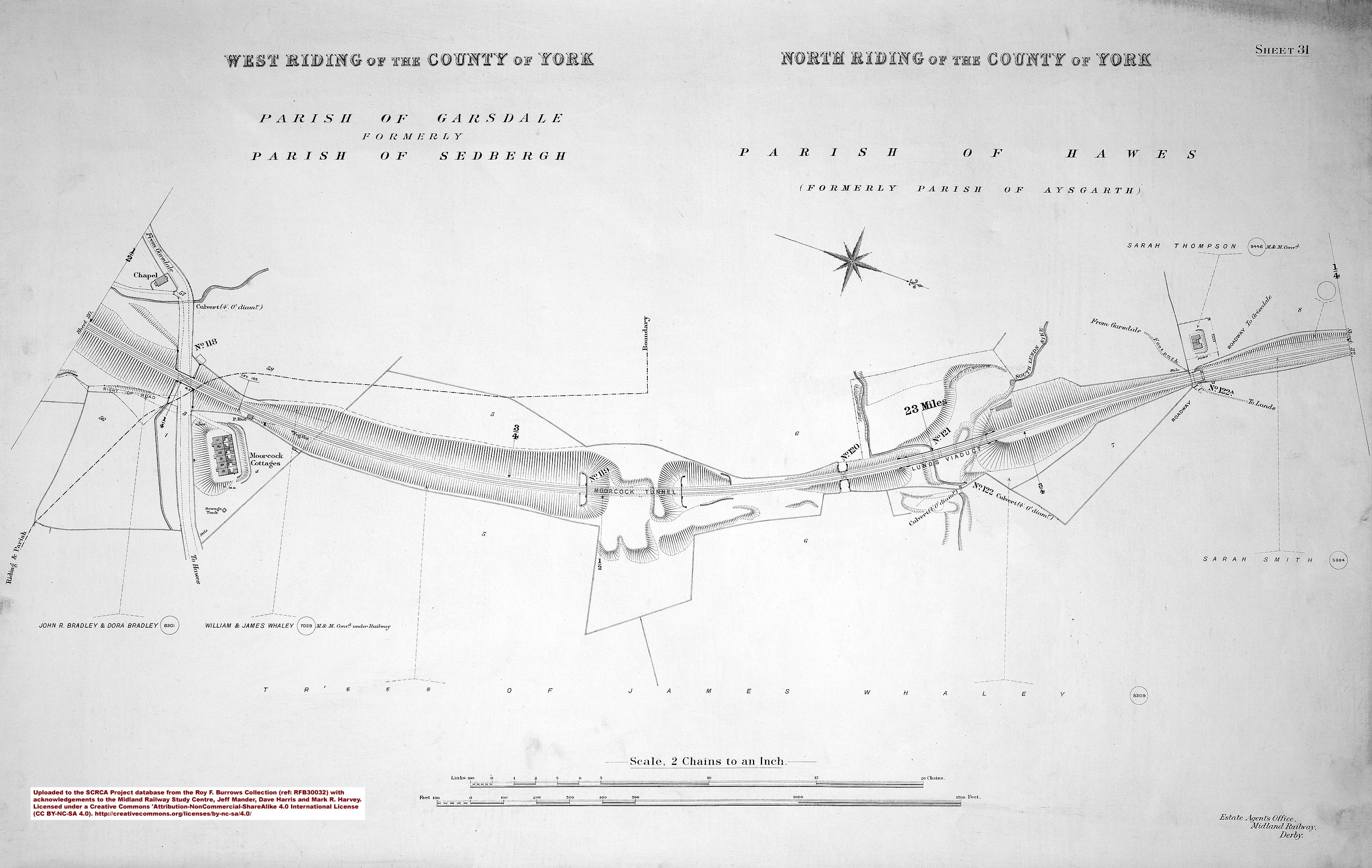
Compared with the length of the tunnel and its approach cuttings, there is an unusually large area of land enclosed within the railway boundary wall (see top photo and land plan extract). This is probably due to a combination of the following:
- the unstable nature of the ground conditions (boulder clay is prone to erosion & collapse, so a shallow slope angle is required in cuttings to minimise the risk of landslips);
- the tunnel's short length;
- its position on a relatively sharp radius curve;
- the disturbed nature of the ground surface (due to the construction process and associated tipping of spoil); and
- the low commercial value of 'rough grazing land' at that time.
The oddly-shaped area of railway land projecting eastwards (i.e. towards the right in the top photo and towards the bottom of the land plan extract) is also worthy of note. The land plan clearly depicts the railway boundary running all the way around this area and the drystone wall still follows that alignment today. The MRC probably purchased this additional land to provide space for tipping spoil from the tunnel excavations. Elsewhere, land like this would normally have been sold-off immediately after the completion of construction work. However, that does not appear to have been the case here (perhaps due to the relatively small size and low value). Recent high quality aerial imagery shows a fence across the western edge of this area of land and it is now being used for grazing. Compared to the amount of spoil that has been excavated for the tunnel and two approach cuttings, the extra area of land seems to contain very little spoil. This almost certainly reflects the amount of spoil that was needed for the nearby embankments, especially the one across Dandry Mire (which 'ate-up' a much larger amount of material than had originally been estimated).
This Location Record is for the underground section of the tunnel and the geolocation data (latitude & longitude) relates to the approximate mid-point between the two tunnel-mouths (see 'Associated Locations' below).

