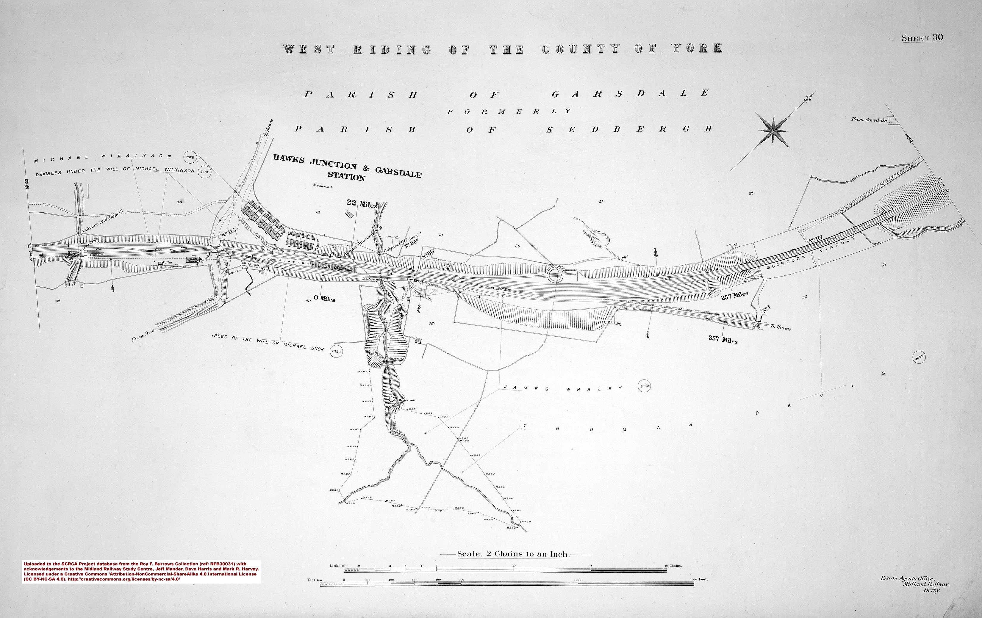
Dandrymire Viaduct is located at Garsdale Head, where the watershed between the Rivers Clough and Ure forms a relatively low-level pass between the valleys of Garsdale and Wensleydale. It is 227 yards (207 metres) long and has twelve arches, which vary in diameter from 44 feet 3 inches to 45 feet. For strength and resilience, the structure is split into three 4-arch sections and the piers between each section (pier numbers 4 & 8) are significantly thicker than the intermediate piers.
The vaults of the arches are turned in brick, but the rest of the structure is built from gritstone. The stone was obtained from a small quarry beside the north portal of Moorcock Tunnel. (The abandoned quarry is still visible from passing trains.) However, the bricks were transported by road from a temporary brickworks located on (or close to) the site of Kirkby Stephen station.
The viaduct and adjacent short embankments are aligned on a gentle curve and they carry the Settle & Carlisle Railway across a relatively small area of peatland known as Dandry Mire. The original plan was for the railway to cross over the trans-Pennine road via a single skew arched bridge (Moorcock Bridge), then to cross the mire via a continuous embankment. The latter was to be constructed using the spoil excavated from nearby Moorcock Tunnel and its approach cuttings, so this was expected to be a relatively cheap and efficient use of both materials and labour. However, the reality was somewhat different to the plan. Every day for two years, the contractors used 100 tip wagons to move rock & earth from the cutting to the site of the embankment, but the mire had a voracious appetite and it consumed almost everything that was tipped into it. The situation is vividly described by the contemporary author F.S. Williams[1]:
But the peat yielded to the weight placed upon it, and rose on each side in a bank, in some places fifteen feet high. After more than 250,000 cubic yards had been tipped, it was decided that a viaduct of twelve arches over the deepest part of the works must be made. The work thus erected is some fifty feet high, and for nearly the whole length it had to be sunk an additional fifteen feet through the peat before a firm foundation could be obtained.
Construction work on the viaduct began on 9th May 1873 and, by September 1874, the piers & abutments had reached springing level. The (relatively short) embankments on either side were complete by May the following year, but occasional remedial work was needed for a considerable period after that to address settlement issues. By September 1875, the parapet walls were also complete.
Since its construction, the viaduct has been stabilised on several occasions by the insertion of a series of rock bolts and spandrel ties. In addition, two of the piers (towards the north end) have been strengthened with concrete & steel 'jackets'. In more recent times, a set of guard rails have been added along the top of the parapet walls (to protect railway workers from a potentially fatal fall).
The viaduct was listed (Grade II) on 14th June 1984.
: Elevation view from the southeast")
 & Bridge SAC/117(Dandrymire Viaduct, right) from the west.")
 & Moorcock Cottages, context from the south.")
, context view from the north east.")
 from the SW, with Bridge SAC/118 in the distance.")
: Context view from the North.")


, elevation view from the south west.")
: Elevation view from the northwest")
: Elevation view from the southeast")


, north east abutment.")
, north west datestone.")
, piers from the south east (1).")
, piers from the south east (2).")
, piers from the south east (3).")
, piers from the south west.")


")