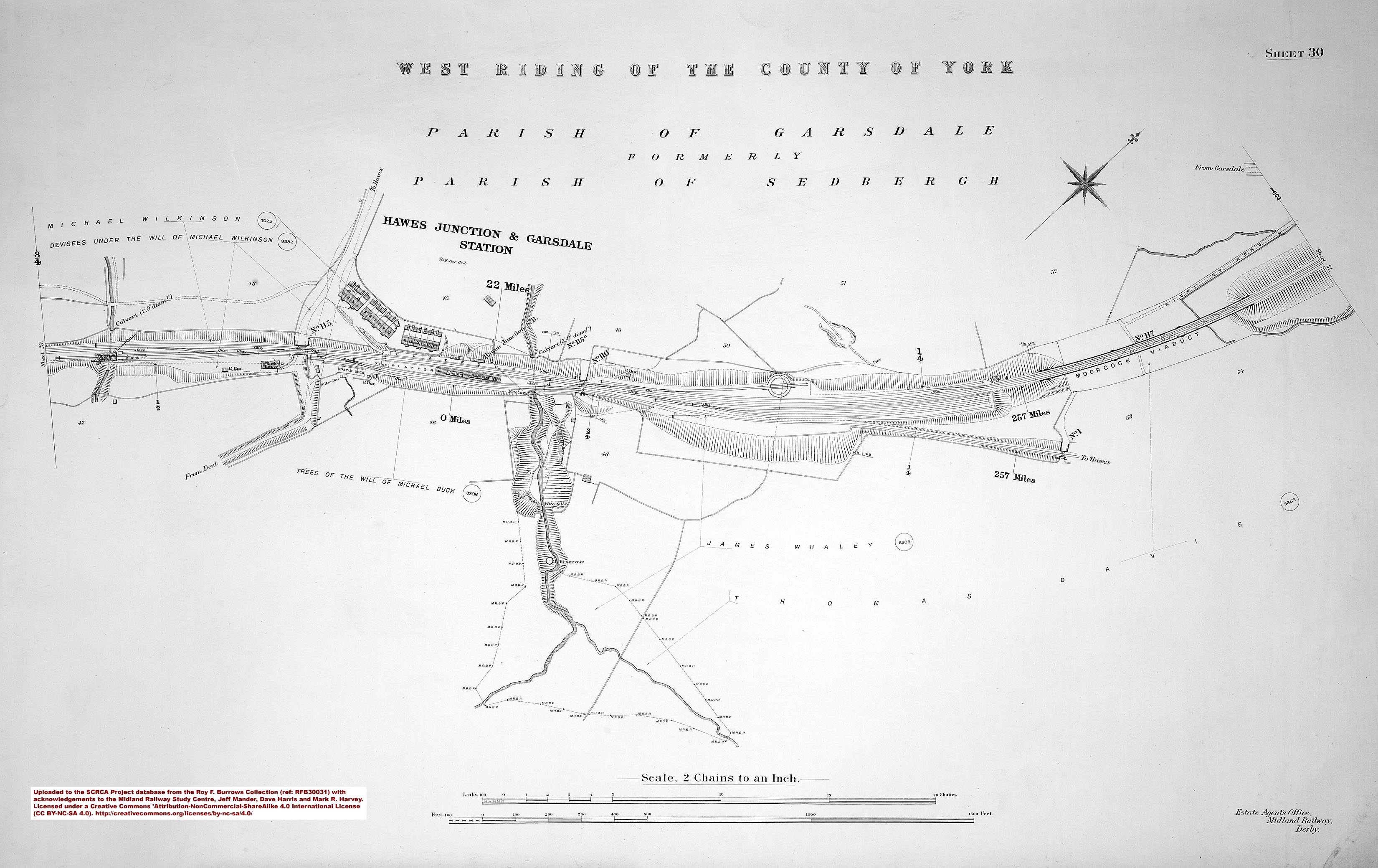
For the purposes of the SCRCA Project, 'Hawes Junction' is the point where the former branch line to Hawes and stations to Northallerton officially begins.
Trains to / from the branch line used the platform face to the right of the island platform (see right-centre in the large image below).
The former trackbed is now used as a driveway and parking area. The official 'zero point' for the branch line was located beside (to the right of) the booking office (i.e. the nearest building visible on the island platform - see Structure 256660). However, the trailing junction from the main Settle-Carlisle line was behind and to the left of the photographer's position.
The map-marker for the junction has been placed at the approximate location of the official 'zero point' for the Hawes Branch rail mileages.

