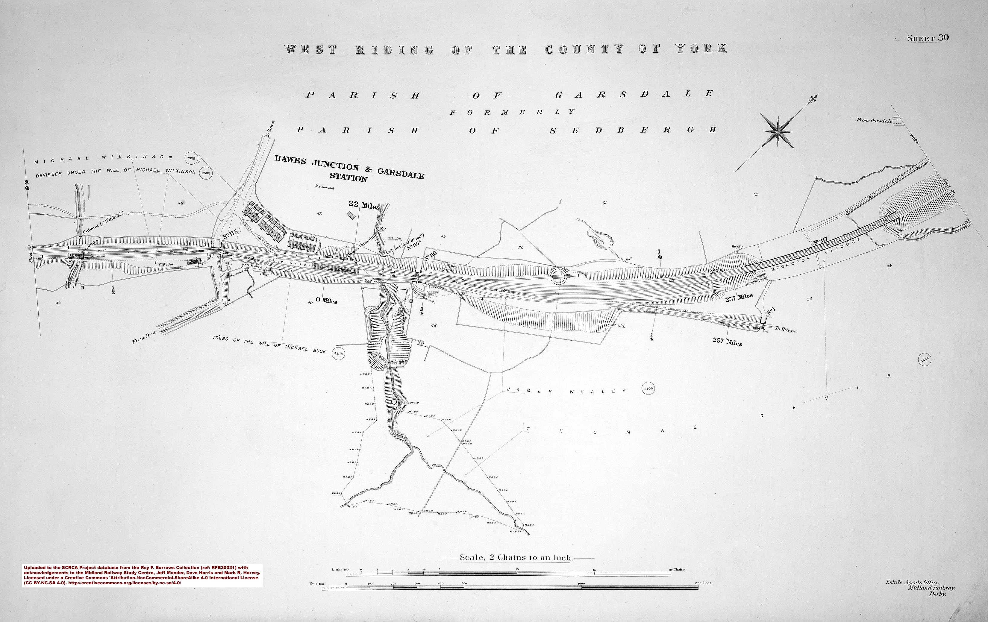
The turntable at Garsdale Head was installed primarily to turn the Midland Railway Company's 'banking' and 'pilot' engines.
During the steam era, these extra locomotives were attached to heavy freight and passenger trains to help them climb the steep gradients on either side of the summit at Ais Gill (approximately three miles north of Garsdale Station).
The turntable was operated by muscle power alone and adverse weather conditions could make it difficult to use. In winter, drifting snow would regularly clog-up the turntable pit, while strong winds at any time of year could significantly increase the amount of effort needed to turn a heavy locomotive. Those same winds could also make it nigh-on impossible to stop the turntable with any degree of accuracy. In a bid to minimise these problems, a protective fence / stockade was constructed around the turntable at some point in history and this is visible in some of the photographs below. There is a frequently told tale that, on at least one occasion, exceptionally strong winds made a locomotive spin around and around (completely out of control) for several hours and that it was only brought to a stop by shovelling sand, ash, earth or ballast into the turntable pit. This may be a true story, or it may have originated as a joke or 'wind-up' (pun intended). The jury is still out as to which it is, but it's an interesting piece of railway folklore either way.
By the end of the 1960s, the turntable had became redundant due to the demise of regular steam-hauled services. Its key components (including the table and locking mechanisms) were removed on 26th February, 1989 (a Sunday) and transported to the Keighley and Worth Valley Railway (K&WVR). After renovation and repair, they were installed in the existing turntable pit at Keighley, where they have been in regular use since 1990.


