Horton Quarry is barely noticeable from passing trains, but it dominates the western side of the upper Ribble Valley near Horton-in-Ribblesdale station. The quarry covers almost 80 hectares (198 acres) and it has more than 40 million tonnes of 'consented reserves' of limestone in a series of layers with a total thickness of more than 90 metres (295 feet).
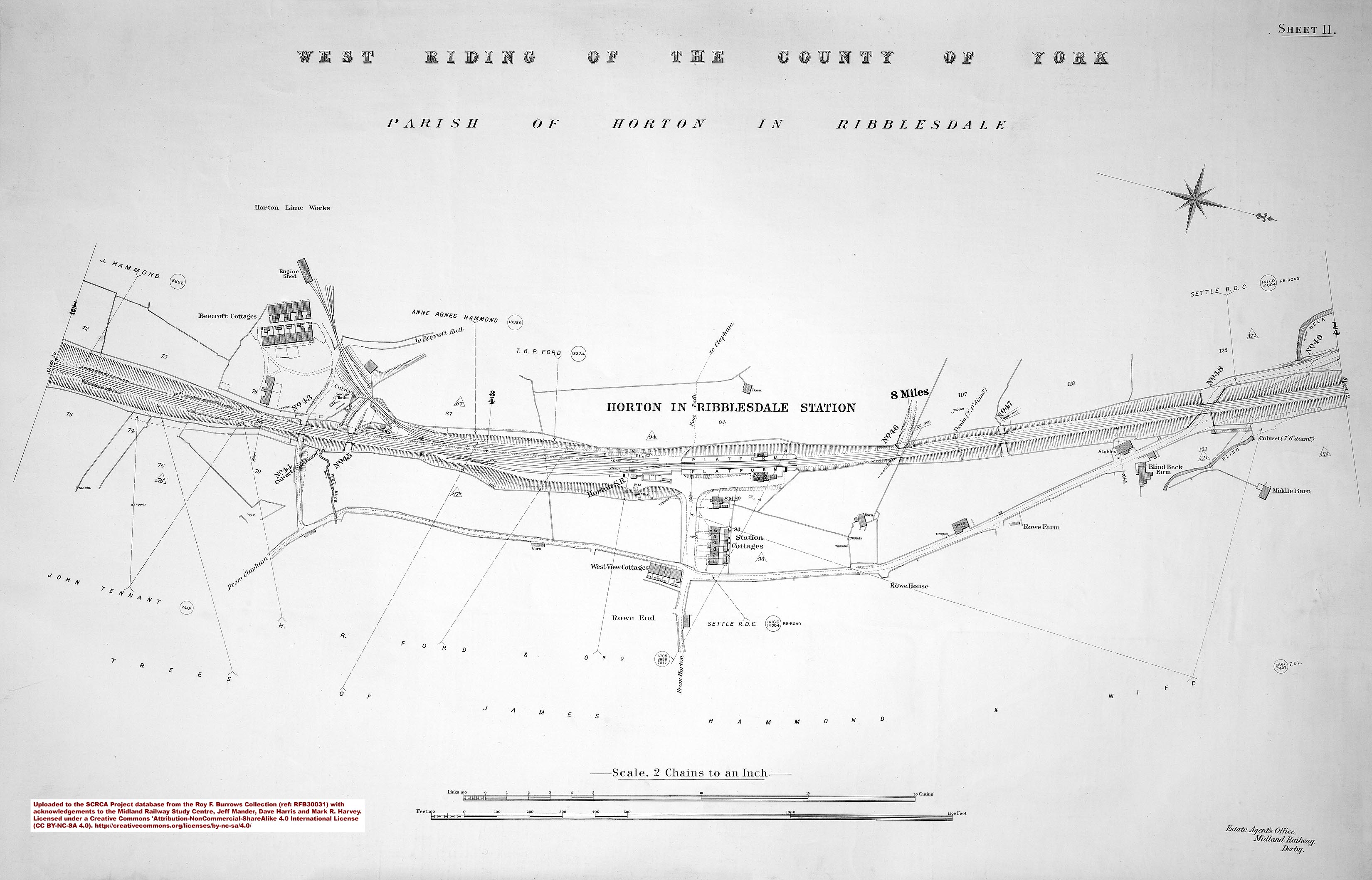
Industrial scale limestone quarrying commenced on this site in 1888, when John Delaney negotiated a lease with the owner of Beecroft's Farm. Delaney had seen the potential of the Settle & Carlisle Railway for bringing-in a cheap and reliable supply of high quality coal (to fuel the lime-burning process) and for despatching the limestone and lime to customers far & wide. The quarry had its own internal railway network (complete with engine shed) and its own fleet of private owner wagons and industrial steam locomotives. Sadly, the rail connection was severed in February 1965 and, apart from a few trains to & from the adjacent 'down' lie-by siding and truncated quarry spur, all of the quarry's supplies and products were subsequently transported by road.
Ownership of the quarry has changed several times over the years. In 1939, Delaney's merged with the Ribblesdale Lime Company (owners of Langcliffe Quarry and Lime Works) to form Settle Limes Limited. The quarry subsequently passed through the hands of Imperial Chemical Industries (aka ICI, 1961), Tarmac (1980), and Hanson (2000). In 2007, Hanson was acquired by Heidelberg Cement (which became Heidelberg Materials in 2023).
At its peak, Horton Quarry directly employed more than a hundred local people. While that number has reduced significantly, the quarry still employees "9 people all from the local area"[1].
As can be seen from some of the photographs below, the limestone is worked via a series of steps known as 'benches'. These create reasonably safe working conditions, while maximising the quantity of material that can be profitably extracted from a given land area.
The limestone is underlain by a series of heavily folder and faulted gritstones, some of which are highly valued for their hardness and skid-resistance. These were originally quarried from a pit to the east of the limestone quarry (closer to the railway), but the pit was abandoned and allowed to naturally fill with water. This quickly became an interesting feature in the landscape due to its bright azure/turquoise colour (depending on the light). which gave it the appearance of a tropical atoll.
The quarry is licenced to extract Carboniferous Limestone and skid-resistant 'high PSV' gritstone until 2042.
In 1996, the Yorkshire Dales National Park Authority (YDNPA) granted conditional approval for the reinstatement of the rail connection. Subsequent progress was slow but, in January 2024. work finally commenced with the clearance of vegetation from the alignment of the old 'down' lie-by siding and the adjacent spur to the original quarry siding. The project included the in-filling of the old gritstone quarry pit and significant alterations and enhancements to the crushing and loading equipment within the quarry. A vital pre-requisite for the new rail connection was the replacement of the busy (and dangerous) foot crossing at Horton-in-Ribblesdale station with a footbridge. The new footbridge was constructed during the second half of 2024 and it opened on 2nd December of that year. The first loaded test train departed from the new rail link on Tuesday 17th 2025.
[1] This quote was sourced on 20th Aug 2025 from the following page on the Heidelberg Materials website: https://www.communities.heidelbergmaterials.co.uk/en/sites/horton-quarry-community-page. However, due to the recent expansion of the quarry's facilities and output, this figure is likely to have increased since the webpage was last updated.
.")


.")
.")
.")
.")
.")
.")
.")

.")